The Addison Vista Loop at Pinnacle State Park in Addison, New York is a moderate 1.7-mile loop hike that features views of Addison and the surrounding mountains, views facing northeast, and an abandoned car hidden in the woods.
Trails
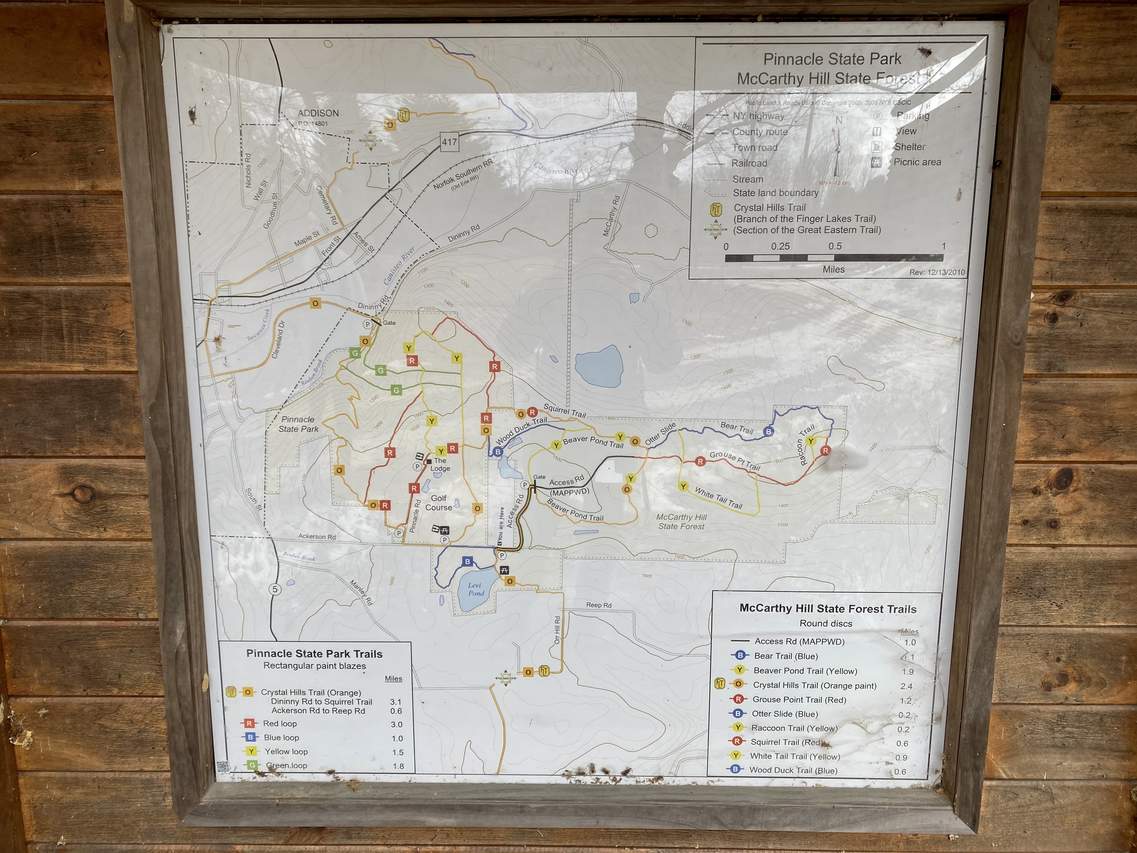
This hike follows several named trails and roads in the following counter-clockwise order: Crystal Hills Trail (orange blazes) / Finger Lakes Trail system, Yellow Loop, Red Loop (Pinnacle Road), Ackerson Road. Please see this map for more details.
Hike Description
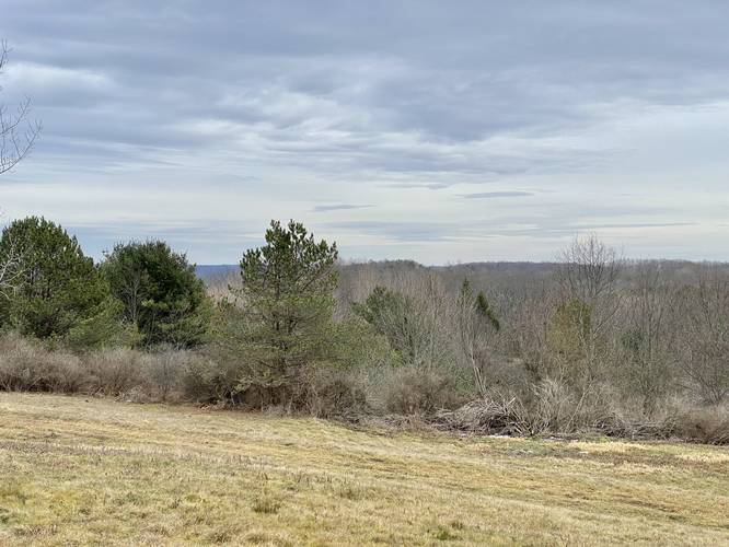
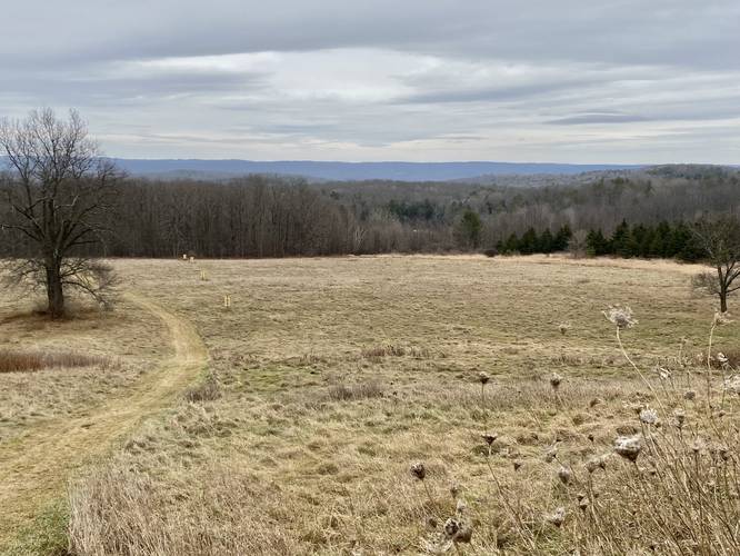
This hike begins at the Crystal Hills Trail trailhead located just off of Ackerson Road, east of Pinnacle Road in Addison, New York and follows the orange blazes of the Crystal Hills Trail as it heads north through the park. Note that the Crystal Hills Trail is also part of the Finger Lakes Trail system (FLT). At the parking lot, hikers will have a nice "view" of the rolling field as it begins to slope downhill toward a mountainous view in the distance. Across the dirt service road is where the trailhead is located.
Overlook - Mile 0.08
At mile 0.08, hikers will reach a small "overlook" that sits above a large power generator. While it's not the nicest view on this hike, it provides an interesting change of landscape.
Wetland / Soggy Feet - Mile 0.08 to 0.6
After passing the first "overlook", hikers will be meandering along the Crystal Hills Trail as it passes through lowland flood plains from the hills above. The ground becomes very soggy and there are many small creeks and streams that run down the mountain, passing this trail along the way, which lasts for about a half-mile total.
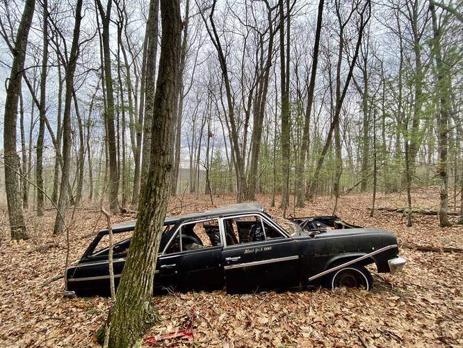
Abandoned 1963 AMC Rambler Wagon - Mile 0.25
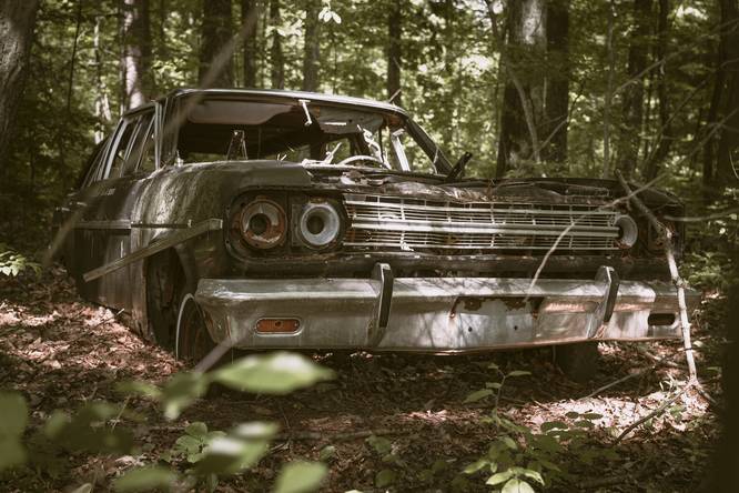
Around mile 0.25, keen-eyed hikers (thanks to my wife) may notice an abandoned vehicle tucked away off-trail in the woods, which is located around mile 0.3 off-trail. According to my dad, this is a 1963 AMC Rambler Wagon. A neat find for a random New York woods hike!
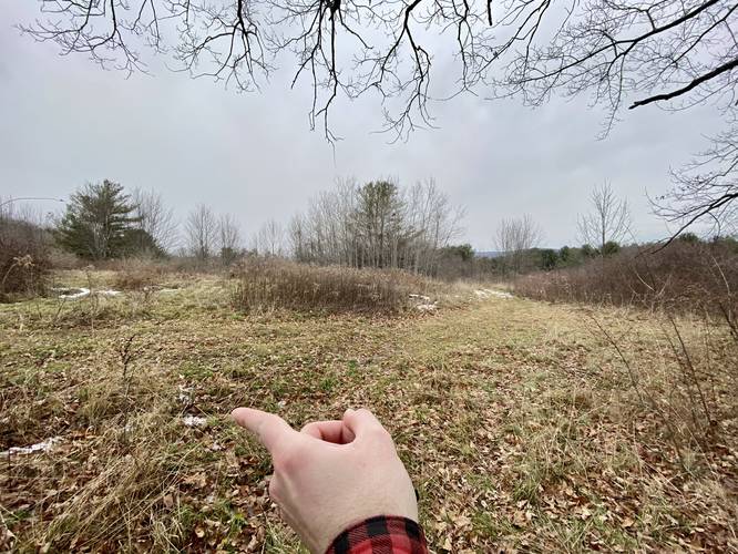
Left-Hand Turn - Mile 0.7
After hiking the Crystal Hills Trail for about 1-mile, hikers will take a sharp left-hand turn at a grassy knoll at mile 0.7 (mile included assumes you bushwhacked to the abandoned car). This turn is easy to find because it's noted by the old lodge located at the top of the hill.
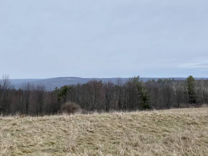
Hillside Views - Mile 0.8 to 0.9
On the hike up toward the now-abandoned lodge, hikers can turn around to get nice views of the surrounding mountains in the distance.
Abandoned Lodge - Mile 0.9
Around mile 0.9, hikers will reach the top of the hill where a now-abandoned lodge sits. While this used to be a golf course and is now apparently a hiking park, this old building still stands. During windy days, hikers can sometimes here the rusty squeaking of the vent pipes atop of the building - which would make for an excellent creepy Halloween hike!
Addison Overlook - Mile 1
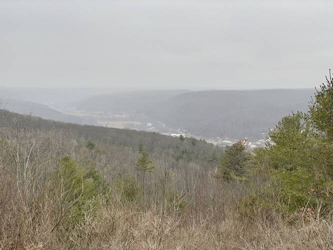
Just behind the abandoned lodge is a beautiful view of Addison, New York below in the mountain valley, located around mile 1.
Abandoned Golf Hut
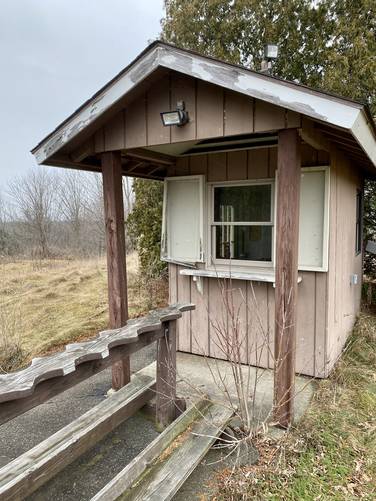
Between the lodge and the view is a small hut that appears to be where golfers would make a pit-stop. Inside are very old sodas and mail from ~2017 - maybe this is when the golf club closed, though that's our own speculation.
Pinnacle Road to Ackerson Rd - Mile 1.05 to 1.5
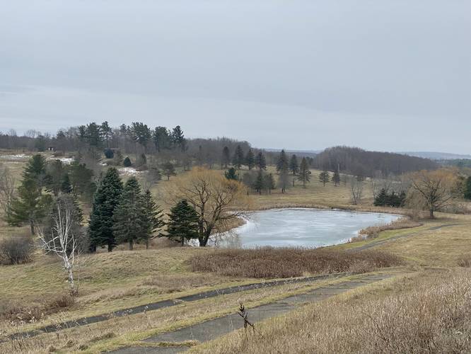
After visiting the abandoned lodge, view, and hut, hikers will follow the red blazes along Pinnacle Road. Along the way are decent views above the old golf course with ponds below.
Ackerson Road to Parking - Mile 1.5 to 1.8
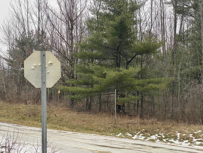
Once on Ackerson Road, take a left-hand turn to head back up the hill to the parking lot. One of the last couple of things to note (as of December, 2022) is the old baseball field catcher's fence near the parking lot and the bullet-laden Stop sign. Take a left-hand turn to reach the parking lot for a 1.8-mile hike.
Parking
Hikers will find a large parking lot by the coordinates provided. Drive up the dirt service road off of Ackerson Road to find the parking lot on your left-hand side.
Pets
Dogs are allowed if leashed and their waste should be carried out by the hiker.
Biking
Note that biking is not permitted along the Finger Lakes Trail system, hence, no biking along the Crystal Hills Trail. Biking is permitted along both roads.
Abandoned Golf Course
Please note that the golf course and associated buildings at Pinnacle State Park appear to have been shut down and "abandoned" years ago. According to mail we found by looking through some windows, it seems maybe the golf facility was shut down around 2017. Since its closure, the State Park sign at the entrance road has been removed, but the trail kiosks located around the property still have all of the trails labeled. The blazes of the trails seem to be maintained by locals, but that doesn't mean all of the trails are maintained or passable. If you plan to visit these abandoned buildings please leave no trace and only take pictures.
Trails
This hike follows several named trails and roads in the following counter-clockwise order: Crystal Hills Trail (orange blazes) / Finger Lakes Trail system, Yellow Loop, Red Loop (Pinnacle Road), Ackerson Road. Please see this map for more details.
Hike Description
This hike begins at the Crystal Hills Trail trailhead located just off of Ackerson Road, east of Pinnacle Road in Addison, New York and follows the orange blazes of the Crystal Hills Trail as it heads north through the park. Note that the Crystal Hills Trail is also part of the Finger Lakes Trail system (FLT). At the parking lot, hikers will have a nice "view" of the rolling field as it begins to slope downhill toward a mountainous view in the distance. Across the dirt service road is where the trailhead is located.
Overlook - Mile 0.08
At mile 0.08, hikers will reach a small "overlook" that sits above a large power generator. While it's not the nicest view on this hike, it provides an interesting change of landscape.
Wetland / Soggy Feet - Mile 0.08 to 0.6
After passing the first "overlook", hikers will be meandering along the Crystal Hills Trail as it passes through lowland flood plains from the hills above. The ground becomes very soggy and there are many small creeks and streams that run down the mountain, passing this trail along the way, which lasts for about a half-mile total.
Abandoned 1963 AMC Rambler Wagon - Mile 0.25
Around mile 0.25, keen-eyed hikers (thanks to my wife) may notice an abandoned vehicle tucked away off-trail in the woods, which is located around mile 0.3 off-trail. According to my dad, this is a 1963 AMC Rambler Wagon. A neat find for a random New York woods hike!
Left-Hand Turn - Mile 0.7
After hiking the Crystal Hills Trail for about 1-mile, hikers will take a sharp left-hand turn at a grassy knoll at mile 0.7 (mile included assumes you bushwhacked to the abandoned car). This turn is easy to find because it's noted by the old lodge located at the top of the hill.
Hillside Views - Mile 0.8 to 0.9
On the hike up toward the now-abandoned lodge, hikers can turn around to get nice views of the surrounding mountains in the distance.
Abandoned Lodge - Mile 0.9
Around mile 0.9, hikers will reach the top of the hill where a now-abandoned lodge sits. While this used to be a golf course and is now apparently a hiking park, this old building still stands. During windy days, hikers can sometimes here the rusty squeaking of the vent pipes atop of the building - which would make for an excellent creepy Halloween hike!
Addison Overlook - Mile 1
Just behind the abandoned lodge is a beautiful view of Addison, New York below in the mountain valley, located around mile 1.
Abandoned Golf Hut
Between the lodge and the view is a small hut that appears to be where golfers would make a pit-stop. Inside are very old sodas and mail from ~2017 - maybe this is when the golf club closed, though that's our own speculation.
Pinnacle Road to Ackerson Rd - Mile 1.05 to 1.5
After visiting the abandoned lodge, view, and hut, hikers will follow the red blazes along Pinnacle Road. Along the way are decent views above the old golf course with ponds below.
Ackerson Road to Parking - Mile 1.5 to 1.8
Once on Ackerson Road, take a left-hand turn to head back up the hill to the parking lot. One of the last couple of things to note (as of December, 2022) is the old baseball field catcher's fence near the parking lot and the bullet-laden Stop sign. Take a left-hand turn to reach the parking lot for a 1.8-mile hike.
Parking
Hikers will find a large parking lot by the coordinates provided. Drive up the dirt service road off of Ackerson Road to find the parking lot on your left-hand side.
Pets
Dogs are allowed if leashed and their waste should be carried out by the hiker.
Biking
Note that biking is not permitted along the Finger Lakes Trail system, hence, no biking along the Crystal Hills Trail. Biking is permitted along both roads.
Abandoned Golf Course
Please note that the golf course and associated buildings at Pinnacle State Park appear to have been shut down and "abandoned" years ago. According to mail we found by looking through some windows, it seems maybe the golf facility was shut down around 2017. Since its closure, the State Park sign at the entrance road has been removed, but the trail kiosks located around the property still have all of the trails labeled. The blazes of the trails seem to be maintained by locals, but that doesn't mean all of the trails are maintained or passable. If you plan to visit these abandoned buildings please leave no trace and only take pictures.


