Loading...

Distance:
0.6 Miles / 1.0 km
Type:
Out-and-Back
Difficulty:
Easy
Time to Hike:
~18 minutes
Features:
Surface Type:
Dirt
Park:
Tonto National Forest
Town:
Fort McDowell, Arizona
Directions:
33.546946, -111.656692
Added:
January 08, 2019
Updated:
January 08, 2019

The Phon D Sutton Lookout Trail at Tonto National Forest in Fort McDowell, Arizona is an easy 0.6 mile out-and-back hike that leads out to a lookout point above the Salt River.

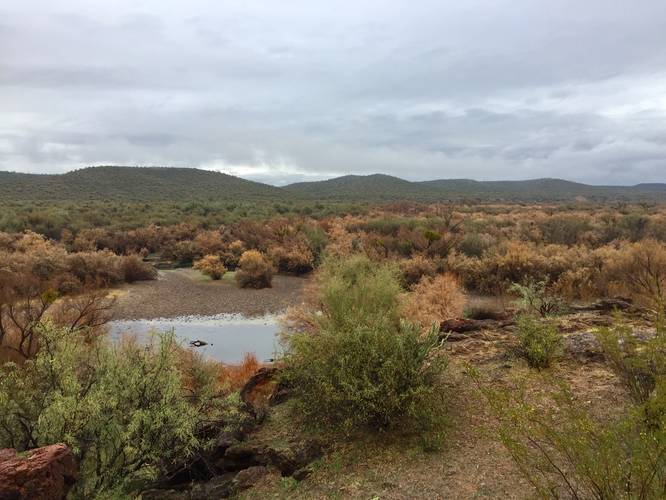
The trailhead can be found at the staircase at the very end of Phon D Sutton Road. Take the staircase down and then take a right-hand turn. Follow the trail along the water until it starts to stray from the river. The trail will skirt past a large bluff before heading uphill to get a view of the area.

Wild horses: This trail can also be used to search for wild horses as the horses use this trail to drink from the river; however, it's not guaranteed you'll see a wild horse. The best time of day to see them is within the first couple of hours after sunrise or the first couple of hours before sunset.

Explore 11 trails near Fort McDowell, AZ
  1. Parking

    33.546946, -111.656692
  2. Main Trailhead

    33.547259, -111.65672
  3. View of the surrounding mountain range

    33.548119, -111.652047
    View of the surrounding mountain range
Explore other trail routes for this hike, added by the MyHikes Community via Trip Reports.
No community routes found. To add your own route as a Community Route for this Trail guide, please leave a Trip Report with a GPX file on this Trail.

Hazards

Snakes

Seasons

All
Loading...
Loading...
47 '

Total Change
55 '

Ascent
55 '

Descent

Photo Albums

2 Trip Reports

No Star-Ratings
Write-up by:
Admin user profile picture
0.6 miles / 1.0 km
Trail added
January 08, 2019
Hiked on
January 05, 2019
Updated on
January 08, 2019
0.6 miles / 1.0 km
January 06, 2019
Hiking

Weather Forecast

In Fort McDowell, AZ

Explore Hiking Trails

New Hikes

Jamestown Falls
0.5 Miles
0.8 km
Easy
Out-and-Back
Coquina Loop (Old Levi Mill Waterfall)
1.7 Miles
2.7 km
Moderate
Loop
Congaree Boardwalk Loop
2.5 Miles
4 km
Easy
Loop
Almond-Hornell Overlook
0 Miles
0 km
Easy
Out-and-Back

Before you leave...

MyHikes is an indie web platform aimed to make exploring public trails easier for everyone. The site has no investors and is owned and operated by one person, Dave Miller (Founder & Admin). As the Founder, main contributor, and doer-of-all-things for MyHikes, I share my trips with over-detailed write-ups for fun on a volunteer basis and I believe that public trail information should be available to everyone.

It takes a lot of time 🕦, money 💰, and effort (including espresso shots ☕) to run MyHikes, including hiking , mapping , writing , and publishing new trails with high-quality content... along with building new features, moderating, site maintainance, and app development for iOS and Android . I simply ask that if you find MyHikes' trail guides helpful to please consider becoming a Supporter to help keep the site, iOS, and Android apps available to everyone.

Supporters unlock website and in-app perks with a one-time payment of $25 (you renew) 😎👍. Or you can simply make a Donation of your choice without a MyHikes user account. Otherwise, telling your friends about MyHikes is the next-best thing - both quick and free 🎉

Thanks for visiting MyHikes and have a great hike!️

Admin user profile picture

Dave Miller
MyHikes Founder & Admin