The Pendleton Trace Trail, which leads over to the Falls of Pendleton, at Blackwater Falls State Park in Davis, West Virginia is an easy 1.4 mile out-and-back hike. This trail is easy and mostly flat, aside from the last uphill climb back to parking, but the uphill is fairly gradual.
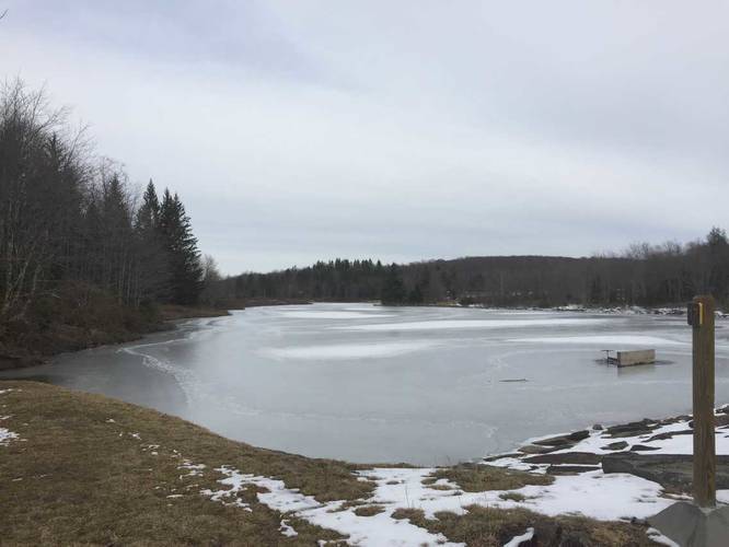
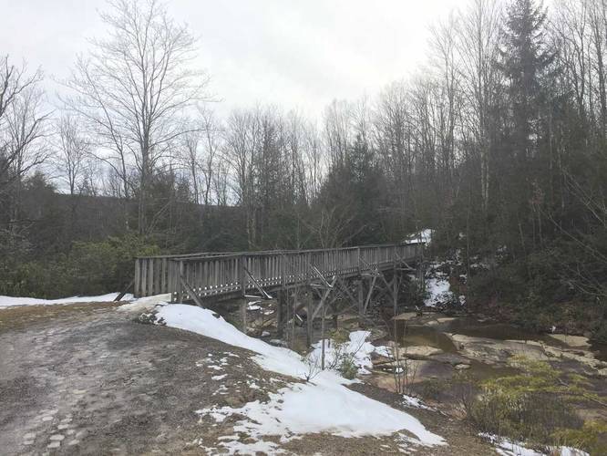
The hike starts out at the main parking lot by the Pendleton Overlook and heads downhill toward Pendleton Lake. When you reach the first trail junction, take the immediate left-hand turn to head towards Pendleton Lake. On the other side of the lake you'll find a sign labeled "17" - this is technically a different trail and appears to be named the Dobbin House Trail on OpenTopoMaps. Follow this trail across the bridge, where the initial cascade of the Falls of Pendleton start.
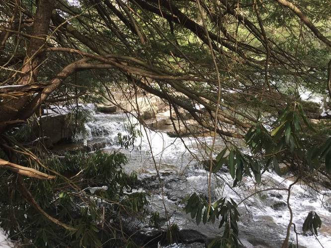
This initial bridge crossing is likely the only place where you'll safely see any parts of the Falls of Pendleton unless you're daring enough to traverse Blackwater Gorge to find the main cascade - please read the note at the bottom. Shortly after the bridge crossing, you'll notice a skinny deer trail on your left-hand side - you can use this to traverse down to Pendleton Run to see other parts of the upper cascade. It's also possible to follow the creek further to the main cascade, but I did not go further than where I found the creek and a small cascade.
After crossing the bridge and passing the small deer trail that leads to Pendleton Run, the trail stays relatively flat throughout the rest of the hike. Follow the blue blazes, but do not confuse the looped blazes with the this route. If you follow the looped blazes, it will return you back onto this route, but further west - please consult the park map to make more sense of this.
After following the trail for quite some time, you'll eventually hit a trail junction (not mapped out here) and the trail continues on to a lookout point (also not mapped out here). For more details, please consult the park map for more options.
Please read: The Falls of Pendleton is very difficult to get to and is not recommended that you try to get to the main cascade. The traverse to the falls requires you to hike and scramble down Blackwater Gorge, which is steep and there are no maintained paths down. Additionally, if you slip and fall into Pendleton Run (the fast flowing creek), you could get seriously injured or die due to drowning. Also note that due to the steepness of the gorge and the lack of trails to the main falls, I was not able to find the main cascade of Pendleton Falls - I was only able to find some smaller portions of the falls, likely above the main cascade. If you're interested to see what the actual cascade looks like, please follow this link. If I'm able to find the main cascade at a later date, I will update the trail data to include that spur trail along with a picture and more details on how to reach it.
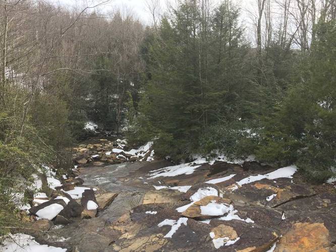
The hike starts out at the main parking lot by the Pendleton Overlook and heads downhill toward Pendleton Lake. When you reach the first trail junction, take the immediate left-hand turn to head towards Pendleton Lake. On the other side of the lake you'll find a sign labeled "17" - this is technically a different trail and appears to be named the Dobbin House Trail on OpenTopoMaps. Follow this trail across the bridge, where the initial cascade of the Falls of Pendleton start.
This initial bridge crossing is likely the only place where you'll safely see any parts of the Falls of Pendleton unless you're daring enough to traverse Blackwater Gorge to find the main cascade - please read the note at the bottom. Shortly after the bridge crossing, you'll notice a skinny deer trail on your left-hand side - you can use this to traverse down to Pendleton Run to see other parts of the upper cascade. It's also possible to follow the creek further to the main cascade, but I did not go further than where I found the creek and a small cascade.
After crossing the bridge and passing the small deer trail that leads to Pendleton Run, the trail stays relatively flat throughout the rest of the hike. Follow the blue blazes, but do not confuse the looped blazes with the this route. If you follow the looped blazes, it will return you back onto this route, but further west - please consult the park map to make more sense of this.
After following the trail for quite some time, you'll eventually hit a trail junction (not mapped out here) and the trail continues on to a lookout point (also not mapped out here). For more details, please consult the park map for more options.
Please read: The Falls of Pendleton is very difficult to get to and is not recommended that you try to get to the main cascade. The traverse to the falls requires you to hike and scramble down Blackwater Gorge, which is steep and there are no maintained paths down. Additionally, if you slip and fall into Pendleton Run (the fast flowing creek), you could get seriously injured or die due to drowning. Also note that due to the steepness of the gorge and the lack of trails to the main falls, I was not able to find the main cascade of Pendleton Falls - I was only able to find some smaller portions of the falls, likely above the main cascade. If you're interested to see what the actual cascade looks like, please follow this link. If I'm able to find the main cascade at a later date, I will update the trail data to include that spur trail along with a picture and more details on how to reach it.