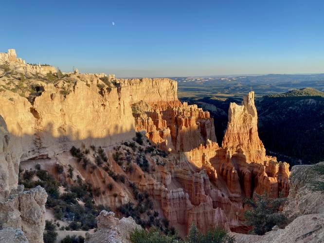
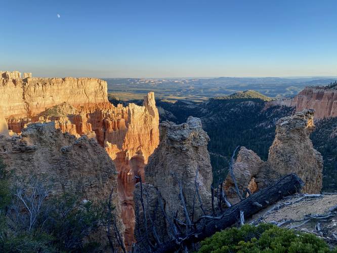
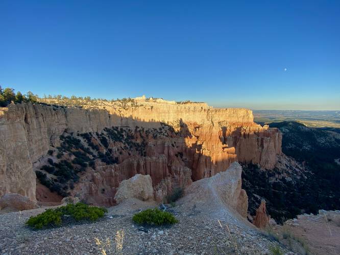
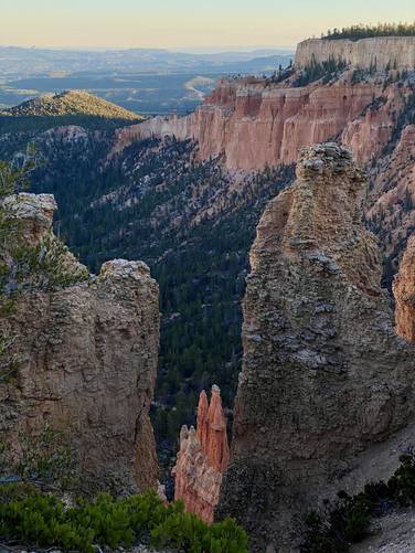
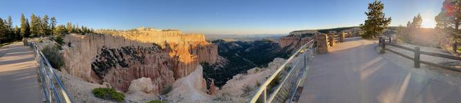
Paria View at Bryce Canyon National Park near Bryce Canyon City, Utah is an easy 0.4-mile out-and-back universally-accessible walk that features panoramic views of Bryce Canyon.
Hikers will begin at the main trailhead, which has three entrances along the parking lot, to make their way slowly downhill along the paved universally-accessible pathway to reach Paria View. From Paria View, hikers will get stunning panoramic views of Bryce Canyon with Yellow Creek just below your feet as it snakes its way through the canyonous terrain to reach the Paria River. This trail follows very steep sheer cliffs that plummet hundreds of feet into Bryce Canyon below, which adds to the dramatic views.
Universal Access
This trail includes a paved universal access pathway.
Fees
Bryce Canyon National Park has a $35/week entry fee as of September 2023. Visitors are highly encouraged to purchase an annual National Parks pass before their trip to reduce entry fees (especially if you're passing through multiple parks) and to also speed-up the very-long line that leads into the park.
Parking
Visitors will find a large parking lot at the coordinates provided.
Pets
Dogs are only allowed on paved surfaces at Bryce Canyon National Park like parking lots and fully paved trails, as of September 2023. Please read more about Bryce Canyon National Park's pet policy here.
Warning
Sheer cliffs: This trail follows alongside steep cliffs that plummet for hundreds of feet. There's fencing to keep hikers on-trail and back from the edge.