Oxbow Falls at Tioga State Forest near Cedar Run, Pennsylvania is an easy 0.1-mile out-and-back hike that leads to a small, and likely seasonal, waterfall named Oxbow Falls.
Hike Description
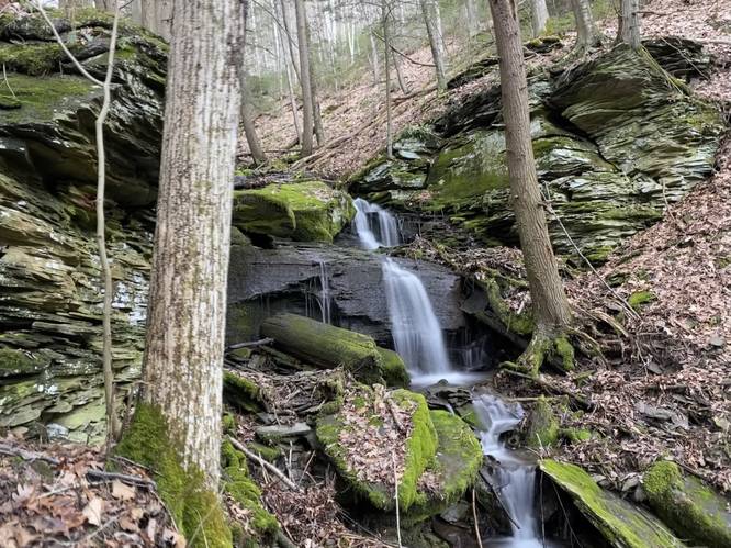
This off-trail hike begins at the sharp curve in Leetonia Road near the parking coordinates provided and follows a loosely-defined deer trail that leads up Oxbow Hollow to reach a small rock overhang where the creek cascades down, forming a waterfall during rainy seasons. This creek (Oxbow Run / Oxbow Creek) is not listed on any maps, hence, is likely a seasonal stream, so this waterfall will likely dry up by the time Summer rolls around.
Oxbow Falls - 8-feet tall
At the end of this GPS recording is the ~8-foot tall Oxbow Falls. To reach a decent view of the waterfall, up close, hikers must do some light scrambling to make their way up the hill. Be careful as some of this terrain is a bit steep. Once at the waterfall, hikers can enjoy a nice view of the falls before heading out.
Parking
Note that there's a tiny parking turnout by the coordinates provided along the bend in Leetonia Road. There's enough room for 1 or 2 cars maximum; however, your visit will be extremely short since the waterfall is visible from the road as well.
Pets
Dogs are allowed if leashed and their waste should be carried out by the hiker.
Hike Description
This off-trail hike begins at the sharp curve in Leetonia Road near the parking coordinates provided and follows a loosely-defined deer trail that leads up Oxbow Hollow to reach a small rock overhang where the creek cascades down, forming a waterfall during rainy seasons. This creek (Oxbow Run / Oxbow Creek) is not listed on any maps, hence, is likely a seasonal stream, so this waterfall will likely dry up by the time Summer rolls around.
Oxbow Falls - 8-feet tall
At the end of this GPS recording is the ~8-foot tall Oxbow Falls. To reach a decent view of the waterfall, up close, hikers must do some light scrambling to make their way up the hill. Be careful as some of this terrain is a bit steep. Once at the waterfall, hikers can enjoy a nice view of the falls before heading out.
Parking
Note that there's a tiny parking turnout by the coordinates provided along the bend in Leetonia Road. There's enough room for 1 or 2 cars maximum; however, your visit will be extremely short since the waterfall is visible from the road as well.
Pets
Dogs are allowed if leashed and their waste should be carried out by the hiker.