Loading...

🎉 Enjoy a Free 7-Day Supporter Trial and Unlock Exclusive Perks — No Credit Card Required. Learn more.

Orange Loop

Directions
Map
Pictures
Send to App
Distance:
0.8 Miles / 1.3 km
Type:
Loop
Difficulty:
Easy
Time to Hike:
~24 minutes
Features:
Surface Type:
Dirt
Park:
West Glenwood Preserve
Town:
Scotts Valley, California
Directions:
37.073007, -122.004814
Added:
May 31, 2022
Updated:
May 31, 2022
Copy Trail Link Hiking this trail? Send a friend or family member a link to this trail guide for your own safety. Hike at your own risk (disclaimer)
Loading...
Loading...
78'

Total Change
108'

Ascent
113'

Descent

Download the Trail Route for Offline Use

Supporters get exclusive access to download trail routes to the MyHikes app for offline use. Stay prepared on your adventure, even without an internet connection! Become a Supporter today to unlock this feature and hike with confidence.

Send to App

Orange Loop

The Orange Loop at the West Glenwood Preserve in Scotts Valley, California is an easy 0.8-mile loop trail that meanders through scrubland and features wildflowers and views of Scotts Valley.

Hike Description
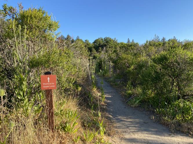
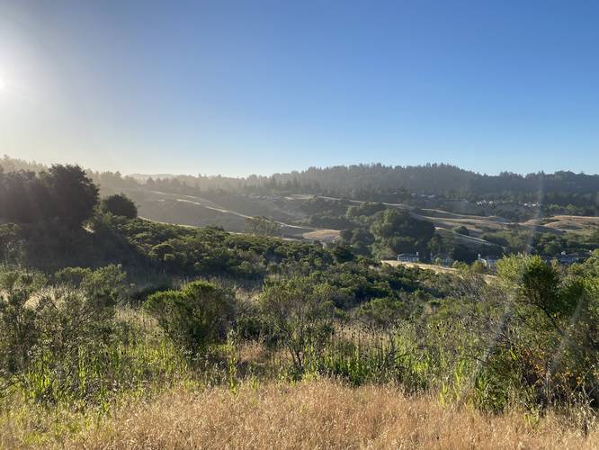
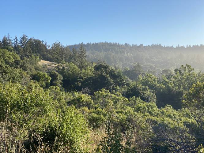
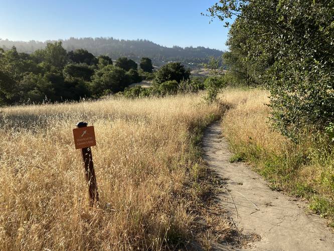
This trail has several trailhead locations, but this recording begins at the southern Blue Loop junction and heads in a clockwise direction. The trail mostly passes through low-growing trees and bushes, making this a somewhat anxiety-driven hike if solo, due to the potential presence of mountain lions; however, the wildflowers and views make up for the possibility of running into one of these big cats.

The trail connects to both the Blue Loop.

Parking
Hikers will find a small parking lot at the coordinates provided. It's large enough to fit about 6 vehicles.

Pets
Dogs are allowed if leashed and their waste must be carried out by the hiker.

Warnings
Rattlesnakes, mountain lion, wasps, poison oak, and ticks may all be found within this park.

Prohibited
No camping, no plant/animal/mineral collecting, no motorized vehicles or horses. No smoking, no alcohol.
Explore 20 trails near Scotts Valley, CA
  1. Parking

    37.073007, -122.004814
  2. Main Trailhead

    37.075088, -122.005064
  3. Bipass trail

    37.074858, -122.006378
    Bipass trail
  4. View / Overlook / Vista

    37.074783, -122.006386
    View / Overlook / Vista
  5. View / Overlook / Vista

    37.074836, -122.006897
    View / Overlook / Vista
  6. Bypass trail

    37.075653, -122.006889
    Bypass trail
No community routes found. To add your own hike as a Community Route for this Trail guide, leave a Trip Report with an attached GPX file.

Hazards

Ticks - Lyme Disease More Info (CDC)
Snakes
Poison Ivy/Oak

Seasons

All

Blaze Color

Orange

Trip Reports

Trail Guide By:
Admin user profile picture
0.8 miles / 1.3 km

Weather Forecast

In Scotts Valley, CA

Explore Hiking Trails

You May Also Like

Colorado's Million Dollar Highway - Plan a day's drive adventure along the iconic Million Dollar Highway in Colorado. Explore the best short trails, roadside stops, waterfalls, vistas, ghost towns, and hot springs within a ~6 hour road trip.
Explore

Colorado's Million Dollar Highway

Plan a day's drive adventure along the iconic Million Dollar Highway in Colorado. Explore the best short trails, roadside stops, waterfalls, vistas, ghost towns, and hot springs within a ~6 hour road trip.

Read
Glacier's Going-to-the-Sun Road - Discover the breathtaking beauty of Glacier National Park along the iconic Going-to-the-Sun Road. From stunning roadside stops to picturesque waterfalls and vistas, this engineering marvel offers endless opportunities for exploration.
Explore

Glacier's Going-to-the-Sun Road

Discover the breathtaking beauty of Glacier National Park along the iconic Going-to-the-Sun Road. From stunning roadside stops to picturesque waterfalls and vistas, this engineering marvel offers endless opportunities for exploration.

Read
New York's Best Waterfalls - Whether you're planning a day hike, roadside stop, or a leisurely short walk, this guide provides hikers, travelers, and locals alike with 63 different locations to over 100 scenic waterfalls to help plan your next adventure!
Explore

New York's Best Waterfalls

Whether you're planning a day hike, roadside stop, or a leisurely short walk, this guide provides hikers, travelers, and locals alike with 63 different locations to over 100 scenic waterfalls to help plan your next adventure!

Read

Before you boogie...

Find our trail guides useful? Consider becoming a Supporter to unlock perks!

MyHikes is an indie platform that makes exploring public trails easier for everyone. The platform has no investors, no ads, and is owned and operated by one person, Dave Miller. Dave has personally mapped and written over 1,800 trail guides on MyHikes for the public to explore. MyHikes has helped millions outdoor enthusiasts plan their next adventure.

But it takes a lot of time 🕦, money 💰, work, and espresso shots ☕ to run MyHikes, including hiking , mapping , writing , and publishing new trails with high-quality (accurate) information... along with software engineering (coding) the platform like building new features, website and mobile app development (iOS and Android), site maintainance . and much much more.

Supporters unlock website and mobile app perks with an annual one-time payment of $25 (you renew) 😎👍. Or you can simply make a Donation of your choice. Otherwise, you can support us by telling your friends about MyHikes - both quick and free 🎉

Admin user profile picture

Dave Miller
MyHikes Founder