Loading...

WINTER SALE! 50% OFF Supporter Accounts — now through January 31st. Learn More.

Blue Loop

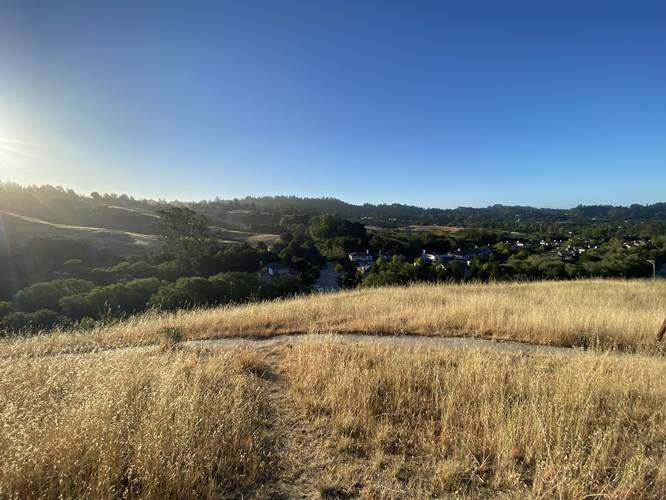
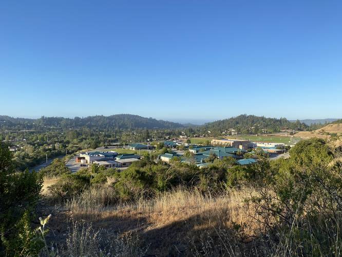
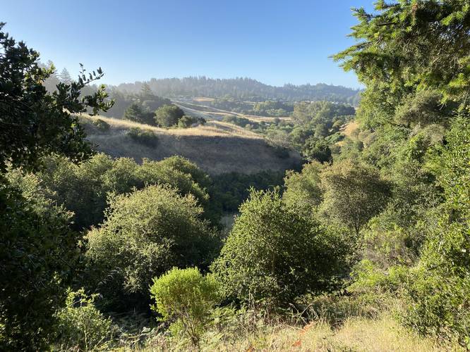
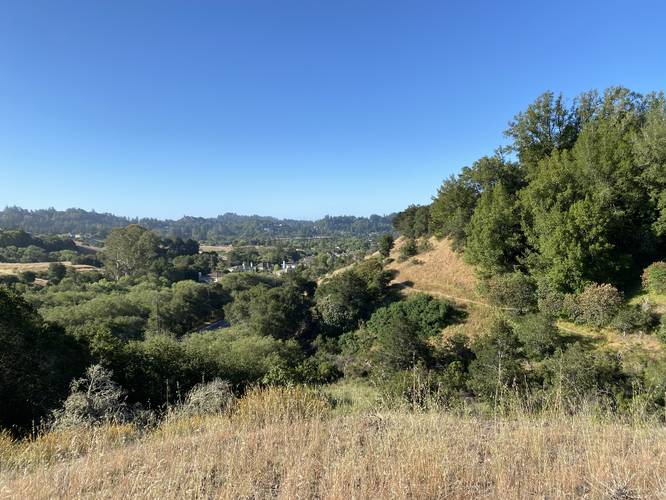
The Blue Loop at the West Glenwood Preserve in Scotts Valley, California is a moderate 0.7-mile loop trail that features views of the hills within the park along with some views of the Scotts Valley area.

Hike Description
The Blue Loop trailhead can be found at the end of the Entrance Trail. Here, this GPS recording heads in a clockwise direction. The Blue Loop has some exposed areas in the beginning and closer to the Green Loop junction, but for the most-part stays within the forest which provides hikers with shade.

This trail connects to the Orange Loop and Green Loop.

Parking
Hikers will find a small parking lot at the coordinates provided. It's large enough to fit about 6 vehicles.

Pets
Dogs are allowed if leashed and their waste must be carried out by the hiker.

Warnings
Rattlesnakes, mountain lion, wasps, poison oak, and ticks may all be found within this park.

Prohibited
No camping, no plant/animal/mineral collecting, no motorized vehicles or horses. No smoking, no alcohol.
Explore 20 trails near Scotts Valley, CA

Know Before You Go

  • The Blue Loop is a 0.7-0.8 mile moderate hiking trail in Scotts Valley, CA, offering views of the hills and some of the Scotts Valley area.
  • The trail is mostly shaded forest, connects to other loops (Orange and Green), and has a small parking lot available.
  • Hikers should be aware of potential hazards like rattlesnakes, mountain lions, wasps, poison oak, and ticks, and follow park rules regarding pets, prohibited activities, and preservation of the environment.
Interactive topographic map for Blue Loop located in Scotts Valley, CA. Click the "View Map" button to load GPS coordinates and trail markers.
Get directions
Distance
0.8 mi
Difficulty
Moderate
Type
Loop
Est. Time
24 min
Elev. Gain
187'
Rating
0.0
Added
May 31, 2022
Updated
May 31, 2022

Weather Forecast

Loading...
Total Change
143'
Ascent
187'
Descent
183'
Loading...

Download the GPX Data for Offline Use

Supporters get exclusive access to download trail routes to the MyHikes app for offline use. Stay prepared on your adventure, even without an internet connection! Become a Supporter today to unlock this feature and hike with confidence.

Download Blue Loop GPX Data to the MyHikes Mobile App

Features

Vista / Lookout Point
Dogs
Biking

Points of interest

  1. Parking

    37.073008, -122.004825
  2. Main Trailhead

    37.075169, -122.004455
  3. View / Overlook / Vista

    37.074403, -122.0047
    View / Overlook / Vista
  4. View / Overlook / Vista

    37.074483, -122.005347
    View / Overlook / Vista

Safety information

For your own safety: plan ahead, let someone know where you'll be, and hike at your own risk.

Hazards

Snakes (Rattlesnakes, Copperheads, others)
Poison Ivy or Poison Oak

Markers

Blaze Color

Blue

Availability

All seasons

Surface type

Dirt

Trip Reports (Reviews)

Your opinion matters! Be the first to rate this trail.

Ready to help fellow hikers? Add a trip report to share your experience and provide valuable insights for other hikers!

No community routes found. To add your own hike as a Community Route for this Trail guide, leave a Trip Report with an attached GPX file.

Popular categories

Scenic mountain view representing vista trails
Vista trails
Scenic gorge of cascades representing waterfall trails
Waterfall hikes
Rugged mountain terrain representing summit trails
Summit trails
Scenic mountain view representing dog-friendly trails
Dog-friendly
Scenic campsite with a view representing camping trails
Camping trails
Appalachian Trail logo representing A.T. hikes
A.T. hikes

You May Also Like

Colorado's Million Dollar Highway - Plan a day's drive adventure along the iconic Million Dollar Highway in Colorado. Explore the best short trails, roadside stops, waterfalls, vistas, ghost towns, and hot springs within a ~6 hour road trip.
Explore

Colorado's Million Dollar Highway

Plan a day's drive adventure along the iconic Million Dollar Highway in Colorado. Explore the best short trails, roadside stops, waterfalls, vistas, ghost towns, and hot springs within a ~6 hour road trip.

Read
Glacier's Going-to-the-Sun Road - Discover the breathtaking beauty of Glacier National Park along the iconic Going-to-the-Sun Road. From stunning roadside stops to picturesque waterfalls and vistas, this engineering marvel offers endless opportunities for exploration.
Explore

Glacier's Going-to-the-Sun Road

Discover the breathtaking beauty of Glacier National Park along the iconic Going-to-the-Sun Road. From stunning roadside stops to picturesque waterfalls and vistas, this engineering marvel offers endless opportunities for exploration.

Read
🍪 We use cookies to learn about site usage and to serve map tiles. You may block cookies manually in the browser. By continuing you agree. Learn more