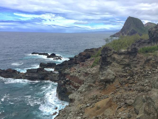
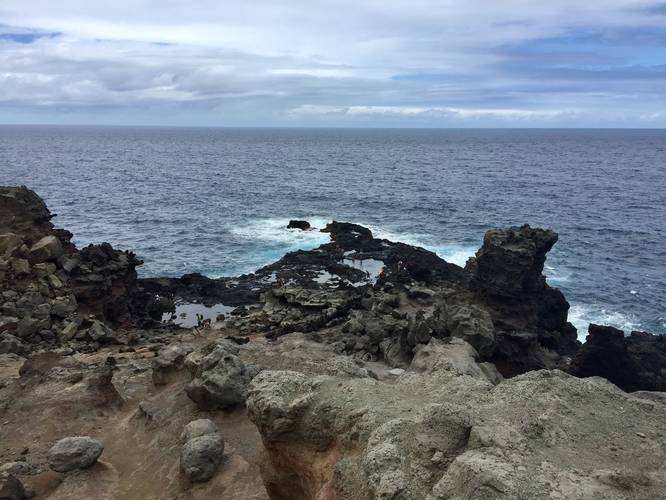
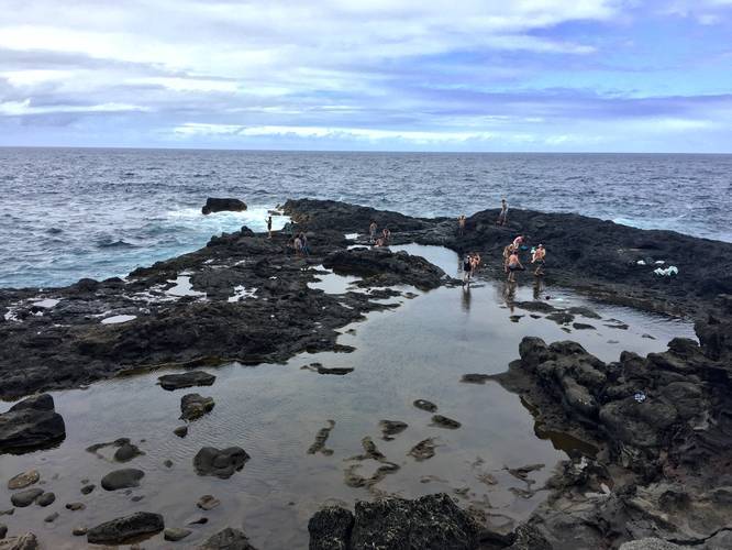
The Olivine Pools Trail along Kahekili Highway, Maui is a moderate 0.4 mile out-and-back hike down to the Olivine Pools. The Olivine Pools are natural tide pools that sit next to Maui's battered northern coast. The pools replenish their water when the surf and winds are strong enough to push water over the rocks.
The pools are a very popular spot for swimmers, snorkelers, and hikers, but they lie in a rugged area of the island. Plan for a moderate hike back up the cliff side - sneakers or hiking boots are recommended, but many people do this hike in flip-flops and sandals along the jagged rocky trail.
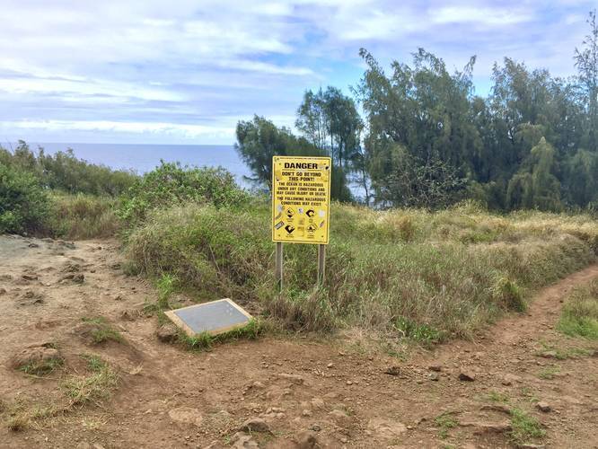
When you first hit the trail, you'll find a fork with a danger sign encouraging hikers to head back to parking. People have died in the Olivine Pools, due to strong currents and being swept out to sea - in fact, there was a death here March 2018 and one in 2017. While the pools may look inviting, if you decide to swim here, you're swimming at your own risk.
If you make it to the fork in the trail and still want to see the pools or swim in the pools, take either a right or left-hand turn. The right-hand turn will head down the hill to the pools - just continue following the cliffside slightly north from when you reach the cliffs to find the trail down to the pools. If you take a left-hand turn, walk for a few paces before you find another trail on your right - take this trail to the cliff edge and then head slightly north (just a few feet) to follow the trail down to the pools.
Respecting the Land
Hawaiian land is considered sacred to native Hawaiians and many locals, so please stay on-trail, take nothing but photos, and leave nothing but footprints. Respect the locals - don't stay for long and have a backup hike planned in case the parking lot is full.
The pools are a very popular spot for swimmers, snorkelers, and hikers, but they lie in a rugged area of the island. Plan for a moderate hike back up the cliff side - sneakers or hiking boots are recommended, but many people do this hike in flip-flops and sandals along the jagged rocky trail.
When you first hit the trail, you'll find a fork with a danger sign encouraging hikers to head back to parking. People have died in the Olivine Pools, due to strong currents and being swept out to sea - in fact, there was a death here March 2018 and one in 2017. While the pools may look inviting, if you decide to swim here, you're swimming at your own risk.
If you make it to the fork in the trail and still want to see the pools or swim in the pools, take either a right or left-hand turn. The right-hand turn will head down the hill to the pools - just continue following the cliffside slightly north from when you reach the cliffs to find the trail down to the pools. If you take a left-hand turn, walk for a few paces before you find another trail on your right - take this trail to the cliff edge and then head slightly north (just a few feet) to follow the trail down to the pools.
Respecting the Land
Hawaiian land is considered sacred to native Hawaiians and many locals, so please stay on-trail, take nothing but photos, and leave nothing but footprints. Respect the locals - don't stay for long and have a backup hike planned in case the parking lot is full.