McCune Trail
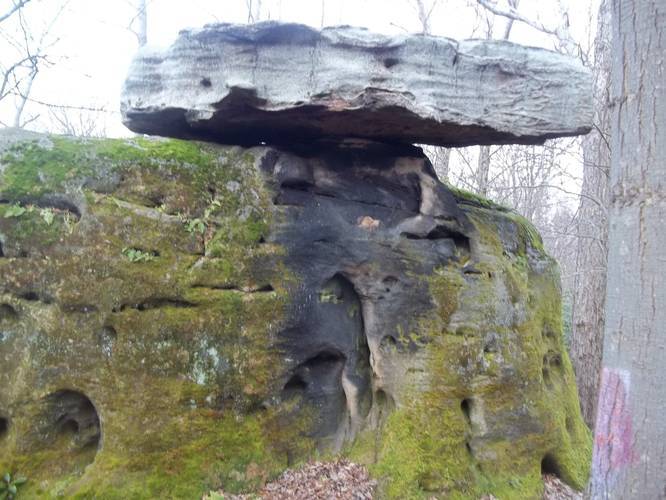
The trail is mostly flat with a couple of lookout points, wildflower meadows, and large rock outcroppings in the woods. Please note that there is one main uphill section on the hike between mile 1.5 and mile 2.1 - the elevation gain is about 450 feet.
This is one of the best hiking trails at Ohiopyle State Park. Dogs and biking are both allowed on this trail.
Know Before You Go
Interactive topographic map for McCune Trail located in Mill Run, PA. Click the "View Map" button to load GPS coordinates and trail markers.
View map
Get directions
- Distance
- 3.9 mi
- Difficulty
- Easy
- Type
- Loop
- Est. Time
- 2 hrs
- Elev. Gain
- 598'
- Rating
- 5.0
- Added
- October 26, 2015
- Updated
- October 26, 2018
Weather Forecast
Don't let Google decide who you trust.


Loading...
<strong>Trail map and elevation chart not rendering in print mode?</strong> Simply scroll to the trail map section, then try printing again!
Total Change
398 ft.
121 m
121 m
Ascent
598 ft.
182 m
182 m
Descent
369 ft.
112 m
112 m
Loading...
Features
- Vista / Lookout Point
- Dogs
- Biking
Points of interest
-
Parking
39.826078, -79.444984 -
Main Trailhead
39.827425, -79.444824 -
Vista
39.842677, -79.43513
_20161029013216UTC_small.jpg)
Safety information
For your own safety: plan ahead, let someone know where you'll be, and hike at your own risk.
Availability
Fall
Surface type
Dirt
No community routes found. To add your own hike as a Community Route for this Trail guide, leave a Trip Report with an attached GPX file.


You may also like

Explore
Pennsylvania's Grand Canyon
Explore Pennsylvania's Grand Canyon, officially named Pine Creek Gorge, including hiking trails, vistas, overlooks, waterfalls, backcountry campsites, backpacking trails.

Explore
New York's Best Waterfalls
Whether you're planning a day hike, roadside stop, or a leisurely short walk, this guide provides hikers, travelers, and locals alike with 63 different locations to over 100 scenic waterfalls to help plan your next adventure!

Explore
25 Best Day Hikes in West Virginia
Discover 25 of the best day hikes in West Virginia, from scenic overlooks to wilderness trails—perfect for every level of hiker.

Explore
Best of the Alps: Hiking, Adventure & Scenery
Plan your ultimate European Alps adventure! Discover the best hiking trails, epic scenery, and villages in the Swiss Alps, Dolomites, Chamonix, and Lake Como.
ohiopyle state park

