Loading...

🎉 Find content tailored to you in the For You tab! Learn More.

Marginal Way

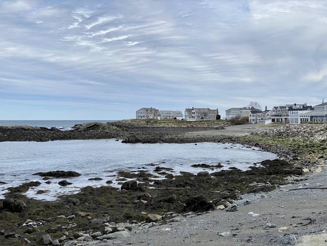
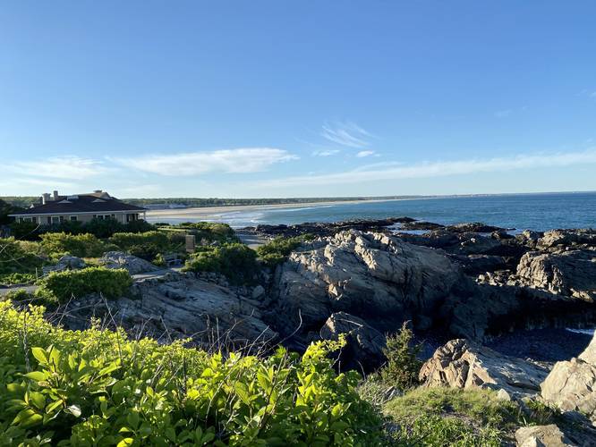
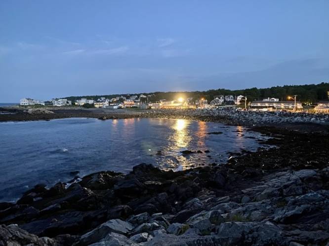
The Marginal Way at the Marginal Way Preservation in Ogunquit, Maine is an easy 2 mile out-and-back trail that leads from Perkins Cove to the Sparhawk hotel in the center of Ogunquit and features some of the most scenic coastline found in southern Maine.

Walkers and hikers can enter on either end of the trail, but there's more parking in Perkins Cove. The trail leads along the ocean for 95% of the trip with numerous lookout points, benches, and also includes a couple of small beaches.

This trail also gives access to the rocky coastline where you can explore among the tide pools.

The entire trail length is 1 mile one-way but most people choose to hike it out-and-back. The alternative route is to walk back along Shore Road for a similar distance of about 2 miles.

Pets
Dogs are not allowed between April 1 - September 30; otherwise they're allowed if on a leash. 

Parking

Most parking at the Marginal Way requires a fee. Perkins Cove has the most parking options, but Ogunquit center also has parking options too. Free 2 hour parking can be found in Ogunquit center near the bank, while Perkins Cove requires a fee to park.
Explore 41 trails near Ogunquit, ME

Know Before You Go

  • Marginal Way is a scenic 2-mile (out-and-back) coastal trail in Ogunquit, Maine, offering stunning ocean views, tide pools, and access to small beaches.
  • Parking is available at both Perkins Cove and Ogunquit center, with Perkins Cove providing more options, but Ogunquit center offers some free 2-hour parking spots.
  • Dogs are restricted on the trail from April 1st to September 30th, but are allowed on a leash during the rest of the year.
Interactive topographic map for Marginal Way located in Ogunquit, ME. Click the "View Map" button to load GPS coordinates and trail markers.
Get directions
Distance
2.0 mi
Difficulty
Easy
Type
Out-and-Back
Est. Time
1 hrs
Elev. Gain
162'
Rating
5.0
Added
August 26, 2016
Updated
April 26, 2022

Weather Forecast

Loading...
Total Change
36'
Ascent
162'
Descent
162'
Loading...

Download the GPX Data for Offline Use

Supporters get exclusive access to download trail routes to the MyHikes app for offline use. Stay prepared on your adventure, even without an internet connection! Become a Supporter today to unlock this feature and hike with confidence.

Download Marginal Way GPX Data to the MyHikes Mobile App

Features

Vista / Lookout Point
Dogs

Points of interest

  1. Parking

    43.237442, -70.591347
  2. Main Trailhead

    43.237672, -70.590931

Safety information

For your own safety: plan ahead, let someone know where you'll be, and hike at your own risk.

Availability

All seasons

Surface type

Dirt

Trip Reports (Reviews)

Rated 5.0 out of 5 based on 1 rating.

Ready to help fellow hikers? Add a trip report to share your experience and provide valuable insights for other hikers!

2.0 miles / 3.2 km
April 24, 2022
Hiking
2.0 miles / 3.2 km
May 27, 2021
Hiking
2.0 miles / 3.2 km
May 27, 2021
Quiet pre-Memorial Day Weekend evening hike along the Marginal Way. Traffic was a bit busier than during COVID 2020.
Hiking
No community routes found. To add your own hike as a Community Route for this Trail guide, leave a Trip Report with an attached GPX file.

Popular categories

Scenic mountain view representing vista trails
Vista trails
Scenic gorge of cascades representing waterfall trails
Waterfall hikes
Rugged mountain terrain representing summit trails
Summit trails
Scenic mountain view representing dog-friendly trails
Dog-friendly
Scenic campsite with a view representing camping trails
Camping trails
Appalachian Trail logo representing A.T. hikes
A.T. hikes

You May Also Like

Colorado's Million Dollar Highway - Plan a day's drive adventure along the iconic Million Dollar Highway in Colorado. Explore the best short trails, roadside stops, waterfalls, vistas, ghost towns, and hot springs within a ~6 hour road trip.
Explore

Colorado's Million Dollar Highway

Plan a day's drive adventure along the iconic Million Dollar Highway in Colorado. Explore the best short trails, roadside stops, waterfalls, vistas, ghost towns, and hot springs within a ~6 hour road trip.

Read
Glacier's Going-to-the-Sun Road - Discover the breathtaking beauty of Glacier National Park along the iconic Going-to-the-Sun Road. From stunning roadside stops to picturesque waterfalls and vistas, this engineering marvel offers endless opportunities for exploration.
Explore

Glacier's Going-to-the-Sun Road

Discover the breathtaking beauty of Glacier National Park along the iconic Going-to-the-Sun Road. From stunning roadside stops to picturesque waterfalls and vistas, this engineering marvel offers endless opportunities for exploration.

Read
🍪 We use cookies to learn about site usage and to serve map tiles. You may block cookies manually in the browser. By continuing you agree. Learn more