The Niagara Falls Hike at Niagara Falls State Park in Niagara Falls, New York is an easy 2.1-mile out-and-back hike that features stunning views of Horseshoe Falls, Bridal Veil Falls, and American Falls.
This hike leads to:
- The top of Horseshoe Falls at Terrapin Point.
- The top of Bridal Veil Falls and American Falls.
- The top of American Falls at Prospect Point.
For the best view of Horseshoe Falls, you have to view the waterfall from the Canadian side. If you plan to explore both sides of Niagara Gorge, feel free to check out our guide on Niagara Falls Trail (Canadian Side).
Hike
This hike starts at the main parking lot for Niagara Falls on Goat Island and first follows the paved, universally-accessible pathway out toward Terrapin Point at the top of Horseshoe Falls. Instead of following the longer universal-access paths to Terrapin Point, this route leads down a few staircases to lead to the top of Horseshoe Falls and provides views of the falls on your way down.
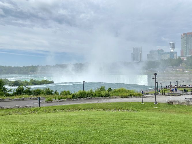
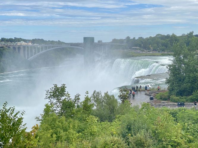
Horseshoe Falls at Terrapin Point - Mile 0.25 (.43km)
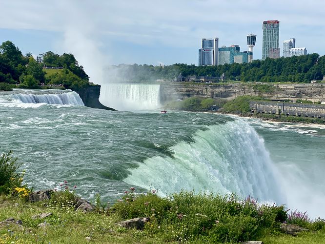
Around mile 0.25 (.43km), hikers will reach the top of Horseshoe Falls at Terrapin Point. Horseshoe Falls is most-impressive on the American side from this lookout, but be mindful that the mist of the waterfall envelopes the viewing platform. Plan to get a bit wet while visiting Terrapin Point. Horseshoe Falls, however, is quite the cascade sending 675,000 gallon/second over its 167-foot tall and 2,500-foot wide cliffs. From Terrapin Point, visitors will also find Bridal Veil and American Falls spilling over cliffs further downstream.
Niagara River Lookout - Mile 0.45 (.75km)
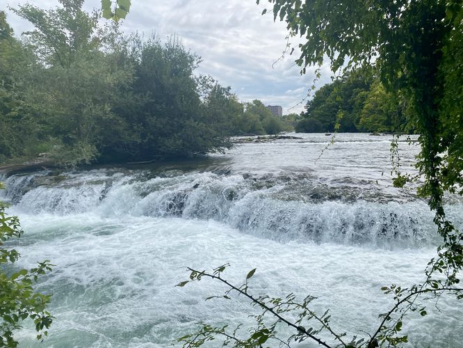
After exploring Terrapin Point, this route leads up the closest set of stairs to lead back to a flat and paved trail that runs down the Niagara River from the top of the cliff. Around mile 0.45 (.75km), you'll find a nice lookout point that sits high above the river. From this lookout, you'll find the turquoise color of the Niagara River below, old structures in the gorge on the Canadian side, and the far side of Horseshoe Falls as it plummets into the gorge.
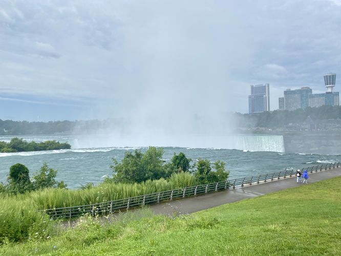
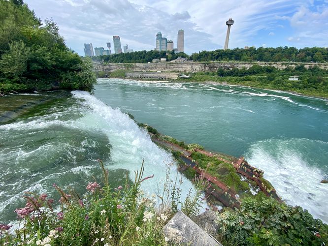
American Falls Lookout Point - Mile 0.6 (.95km)
Around mile 0.6 (.95km), hikers will reach a viewing platform that sits high above Bridal Veil Falls with a view of Bridal Veil and American Falls below your feet.
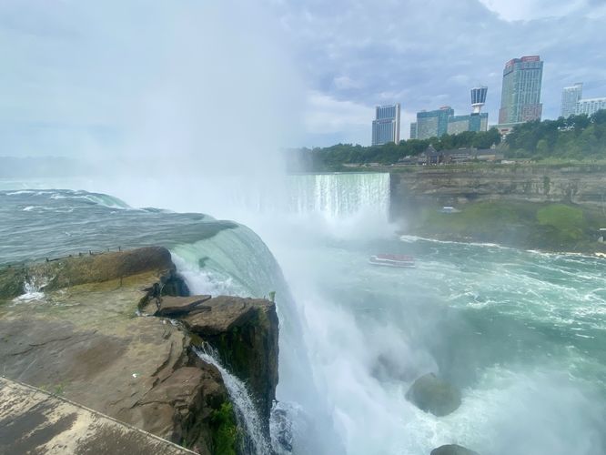
Luna Island, Bridal Veil & American Falls - Mile 0.67 (1.07km)
Just below the American Falls Lookout is Luna Island, the next stop along this route. Visitors can take the staircase that leads down from the lookout, then cross a scenic stone footbridge, to reach Luna Island sitting in the middle of the Niagara River. Here, you'll find the top of Bridal Veil Falls (78-feet/24km) spilling over the edge of the cliff. On the other side of Luna Island is a view of American Falls (69 - 98-feet / 21 - 30m). Both waterfalls create additional mist, so plan on getting a little bit wet while standing on Luna Island.
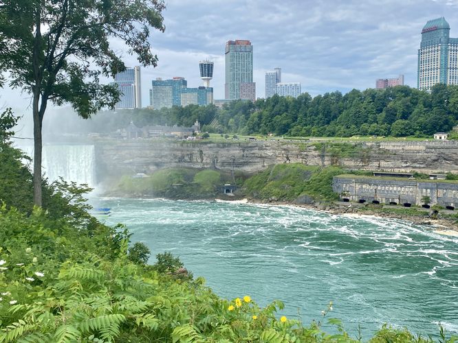
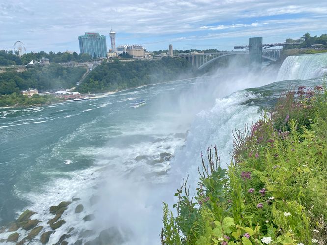
Hike to Prospect Point - Mile 0.7 to 1.38 (1.14km to 2.21km)
After exploring Luna Island, you might want to check out American Falls from Prospect Point since the perspective from Prospect Point provides stunning views of American Falls, Bridal Veil Falls, with Horseshoe Falls in the background. To get there, this route leads along the flat trail (no stairs required) from Luna Island east where it reaches a junction with a pedestrian footbridge. Hike the footbridge trail across the Niagara River, capturing views along the way of the river's rapids, to finally reach the north side of American Falls. The trail leads westward, back toward Niagara Gorge, to reach Prospect Point around mile 1.38 (2.21km). Here, you'll find the scenic American Falls plummeting over the cliffs with Bridal Veil and Horseshoe Falls cascading in the background.
Hiking Back to Parking - Mile 1.38 to 2.1 (2.21km to 3.38km)
The hike back, following this route, leads up the hill toward the welcome center. The welcome center has a couple of restroom facilities, so it's worth noting after listening to rushing water for the majority of this hike. The trail then leads back along the pedestrian bridge and along the entrance road, following all universally-accessible pathways, to reach the parking area to complete the hike.
Universal Accessibility
Note that this exact route follows a series of pathways that are mostly universally-accessible. The route provided leads down and up stairs by Terrapin Point and Bridal Veil Falls; however, by taking alternative paths through the park at these locations, you can follow universally-accessible pathways that lead to the same place. Please see the park's main map (better in-person) to plan a universally-accessible adventure.
Parking & Fees
Visitors will find a large parking lot at the coordinates provided, located on Goat Island at Niagara Falls State Park. This is not the only parking lot for the falls, so please do some additional research to find other places you can park. Note that as of August 2024, there's a $10-weekday parking fee and a $15-weekend parking fee.
Pets
Dogs are allowed only if leashed and must be cleaned up after.
Warning
Steep cliffs: This trail leads to obvious steep cliffs with often very-wet surfaces, mostly near the waterfalls. Be cautious and don't climb the railings and guardrails to ensure your own safety.
This hike leads to:
- The top of Horseshoe Falls at Terrapin Point.
- The top of Bridal Veil Falls and American Falls.
- The top of American Falls at Prospect Point.
For the best view of Horseshoe Falls, you have to view the waterfall from the Canadian side. If you plan to explore both sides of Niagara Gorge, feel free to check out our guide on Niagara Falls Trail (Canadian Side).
Hike
This hike starts at the main parking lot for Niagara Falls on Goat Island and first follows the paved, universally-accessible pathway out toward Terrapin Point at the top of Horseshoe Falls. Instead of following the longer universal-access paths to Terrapin Point, this route leads down a few staircases to lead to the top of Horseshoe Falls and provides views of the falls on your way down.
Horseshoe Falls at Terrapin Point - Mile 0.25 (.43km)
Around mile 0.25 (.43km), hikers will reach the top of Horseshoe Falls at Terrapin Point. Horseshoe Falls is most-impressive on the American side from this lookout, but be mindful that the mist of the waterfall envelopes the viewing platform. Plan to get a bit wet while visiting Terrapin Point. Horseshoe Falls, however, is quite the cascade sending 675,000 gallon/second over its 167-foot tall and 2,500-foot wide cliffs. From Terrapin Point, visitors will also find Bridal Veil and American Falls spilling over cliffs further downstream.
Niagara River Lookout - Mile 0.45 (.75km)
After exploring Terrapin Point, this route leads up the closest set of stairs to lead back to a flat and paved trail that runs down the Niagara River from the top of the cliff. Around mile 0.45 (.75km), you'll find a nice lookout point that sits high above the river. From this lookout, you'll find the turquoise color of the Niagara River below, old structures in the gorge on the Canadian side, and the far side of Horseshoe Falls as it plummets into the gorge.
American Falls Lookout Point - Mile 0.6 (.95km)
Around mile 0.6 (.95km), hikers will reach a viewing platform that sits high above Bridal Veil Falls with a view of Bridal Veil and American Falls below your feet.
Luna Island, Bridal Veil & American Falls - Mile 0.67 (1.07km)
Just below the American Falls Lookout is Luna Island, the next stop along this route. Visitors can take the staircase that leads down from the lookout, then cross a scenic stone footbridge, to reach Luna Island sitting in the middle of the Niagara River. Here, you'll find the top of Bridal Veil Falls (78-feet/24km) spilling over the edge of the cliff. On the other side of Luna Island is a view of American Falls (69 - 98-feet / 21 - 30m). Both waterfalls create additional mist, so plan on getting a little bit wet while standing on Luna Island.
Hike to Prospect Point - Mile 0.7 to 1.38 (1.14km to 2.21km)
After exploring Luna Island, you might want to check out American Falls from Prospect Point since the perspective from Prospect Point provides stunning views of American Falls, Bridal Veil Falls, with Horseshoe Falls in the background. To get there, this route leads along the flat trail (no stairs required) from Luna Island east where it reaches a junction with a pedestrian footbridge. Hike the footbridge trail across the Niagara River, capturing views along the way of the river's rapids, to finally reach the north side of American Falls. The trail leads westward, back toward Niagara Gorge, to reach Prospect Point around mile 1.38 (2.21km). Here, you'll find the scenic American Falls plummeting over the cliffs with Bridal Veil and Horseshoe Falls cascading in the background.
Hiking Back to Parking - Mile 1.38 to 2.1 (2.21km to 3.38km)
The hike back, following this route, leads up the hill toward the welcome center. The welcome center has a couple of restroom facilities, so it's worth noting after listening to rushing water for the majority of this hike. The trail then leads back along the pedestrian bridge and along the entrance road, following all universally-accessible pathways, to reach the parking area to complete the hike.
Universal Accessibility
Note that this exact route follows a series of pathways that are mostly universally-accessible. The route provided leads down and up stairs by Terrapin Point and Bridal Veil Falls; however, by taking alternative paths through the park at these locations, you can follow universally-accessible pathways that lead to the same place. Please see the park's main map (better in-person) to plan a universally-accessible adventure.
Parking & Fees
Visitors will find a large parking lot at the coordinates provided, located on Goat Island at Niagara Falls State Park. This is not the only parking lot for the falls, so please do some additional research to find other places you can park. Note that as of August 2024, there's a $10-weekday parking fee and a $15-weekend parking fee.
Pets
Dogs are allowed only if leashed and must be cleaned up after.
Warning
Steep cliffs: This trail leads to obvious steep cliffs with often very-wet surfaces, mostly near the waterfalls. Be cautious and don't climb the railings and guardrails to ensure your own safety.