The Neversink Mountain hike at
Neversink Mountain Preserve in Reading, Pennsylvania is a moderate 2.2-mile lollipop (out-and-back / loop) hike that leads to the summit of Neversink Mountain, the "Witches Hat" pavilion, and features views of the
Reading Pagoda from a cliff line.
Hiking Neversink Mountain
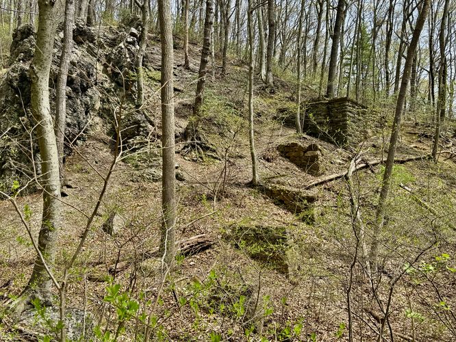
This hike begins at the southern parking lot at the preserve, located at the very end of Klapperthal Road. You'll find the trail on the north side of the parking lot as it follows purple blazes (Klapperthal Trail) that run up the mountain before they quickly switch to orange blazes (Upper Glen Trail). The southern section of the hike follows a mountain hollow that includes large rock outcroppings along with a series of old stone trestle bridge ruins.
This route follows just one way to reach the summit of Neversink Mountain, but uses the Centennial Springs Hotel Pond as a halfway point-of-interest. At mile 0.2 take a right-hand turn and at mile 0.35 take a left-hand turn to reach the pond.
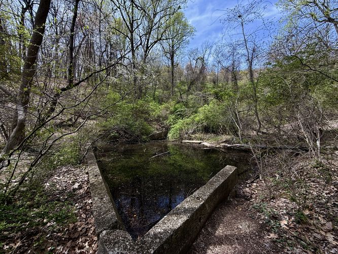
Centennial Springs Hotel Pond - Mile 0.45
One of the strangest points-of-interest along this hike is a concrete-bound pond that was once part of the long-gone Centennial Springs Hotel. This pond is essentially just standing water on the side of Neversink Mountain and thus doesn't provide much to see, but it's a good sanity check for the hike to ensure you're on the "fastest" path up the mountain. Note that just beyond the pond is the steepest section of the hike, so plan for some gnarly uphill for a short period of time.
Reaching the Summit of Neversink Mountain - Mile 0.9
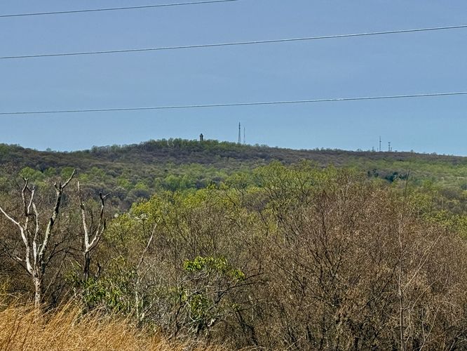
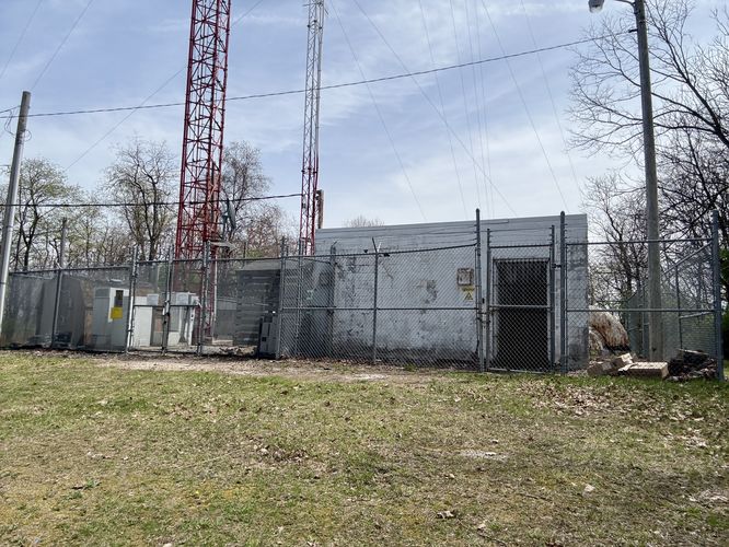
After hiking up the steep section of trail from the Centennial Springs Hotel Pond, you'll be faced with several ways to reach the summit. Here, we decided to take the "longer" route after the grueling uphill. We hiked straight, at the junction at mile 0.6 then we took a right-hand turn as the trail wrapped around the east side of the summit. Then the trail will reach a power line area where you'll follow the gravel path uphill further toward the summit. Finally, there's an unofficial trail that connects straight up to the summit of Neversink Mountain. At the summit, the mountain includes a radio tower and power station with no views.
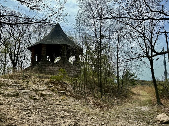
The Witches Hat Pavilion - Mile 1.1
The hike down from Neversink Mountain's summit leads to a pavilion nicknamed the "Witches Hat" which is named after what it looks like. This stone pavilion is a great place to take a break, eat a snack, or get a drink. The views from the Witches Hat are not very good, but there are beautiful cliff views nearby!
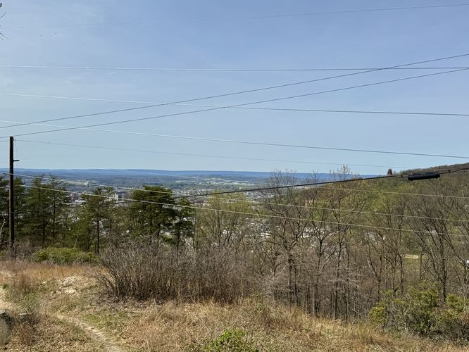
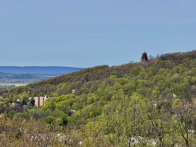
Cliff with Views - Mile 1.2
After exploring the Witches Hat, the trail leads west and runs down the dirt gravel path toward Neversink Mountain Road. Along the way, however, is a cliff that sits to the north. This cliff is by-far the best part of the hike as it provides stunning views of Reading, Pennsylvania, Mount Penn, and the iconic
Reading Pagoda. If you've hiked (or driven) up to the
Reading Pagoda previously, this hike along Neversink Mountain gives you a neat perspective of the area from a different vantage point.
Hiking Out - Mile 1.2 to 2.2
After exploring the cliffs along Neversink Mountain's northern slopes, this route leads hikers down to Neversink Mountain Road before it follows the Upper Glen Trail back to the out-and-back section of the hike. At mile 1.6 take a right-hand turn. Hike own the steep slopes to reach the concrete-bound pond, and then follow the orange blazes down to the purple blazes to reach the parking lot. Finish the hike at the parking lot for a 2.2-mile moderate hike on Neversink Mountain.
Parking
Hikers will find a small parking lot located at the very end of Klapperthal Road in Reading, PA. The lot is large enough to fit about 8 vehicles as of April 2025.
Pets
Dogs are allowed if leashed and should be cleaned up after.