Nelson Falls at Cowanesque Lake Recreation Area near Lawrenceville, Pennsylvania is an easy 0.3-mile out-and-back trail that leads to a short, but scenic waterfall, Nelson Falls.
This short and easy trail starts along PA Route 49, just west of Thornbottom Road and runs along an oxbow in the Cowanesque River, passing two seasonal vistas, to reach Nelson Falls. Nelson Falls is extremely unique because of how quiet the waterfall is considering its size and the massive amount of water that rushes over the rocky ledges.
While standing near Nelson Falls, be aware that the rock ledges may not be safe and sturdy, so it's best to stand back a bit. Do not pass the ropes and signs that tell hikers to keep back.
Nelson Falls History
Nelson Falls is about 5-feet tall and 20-feet wide, which makes for a quiet and peaceful setting along the Cowanesque River. The waterfall was created naturally in the 1930's or 1940's when a series of floods caused the Cowanesque River to reroute over this oxbow in the river, making the waterfall as seen today.
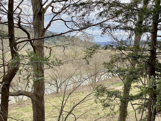
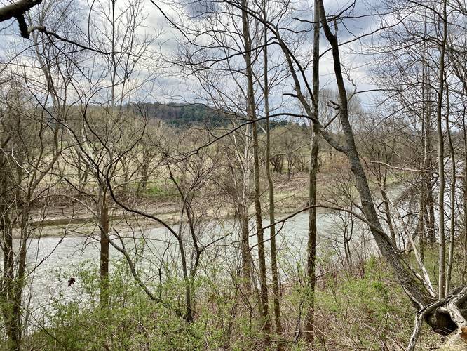
Vistas
There are two vista points along this trail, but both are seasonal (when no leaves are on the trees). Both are located along the right-hand side of the trail, if heading in toward the waterfall. See the pictures for more details.
Trailhead
Please note that the trailhead is located on the south side of PA Route 49. This recording begins at the parking lot to show the full hike.
Parking
Hikers can find parking at the coordinates provided. The parking lot is large enough to fit about ten vehicles. The signage for the parking lot is for the Moccasin Trail, but it's a shared parking lot regardless. Hikers will have to cross PA Route 49, which can be extremely dangerous - so hike at your own risk.
Pets
Dogs are allowed if leashed.
This short and easy trail starts along PA Route 49, just west of Thornbottom Road and runs along an oxbow in the Cowanesque River, passing two seasonal vistas, to reach Nelson Falls. Nelson Falls is extremely unique because of how quiet the waterfall is considering its size and the massive amount of water that rushes over the rocky ledges.
While standing near Nelson Falls, be aware that the rock ledges may not be safe and sturdy, so it's best to stand back a bit. Do not pass the ropes and signs that tell hikers to keep back.
Nelson Falls History
Nelson Falls is about 5-feet tall and 20-feet wide, which makes for a quiet and peaceful setting along the Cowanesque River. The waterfall was created naturally in the 1930's or 1940's when a series of floods caused the Cowanesque River to reroute over this oxbow in the river, making the waterfall as seen today.
Vistas
There are two vista points along this trail, but both are seasonal (when no leaves are on the trees). Both are located along the right-hand side of the trail, if heading in toward the waterfall. See the pictures for more details.
Trailhead
Please note that the trailhead is located on the south side of PA Route 49. This recording begins at the parking lot to show the full hike.
Parking
Hikers can find parking at the coordinates provided. The parking lot is large enough to fit about ten vehicles. The signage for the parking lot is for the Moccasin Trail, but it's a shared parking lot regardless. Hikers will have to cross PA Route 49, which can be extremely dangerous - so hike at your own risk.
Pets
Dogs are allowed if leashed.