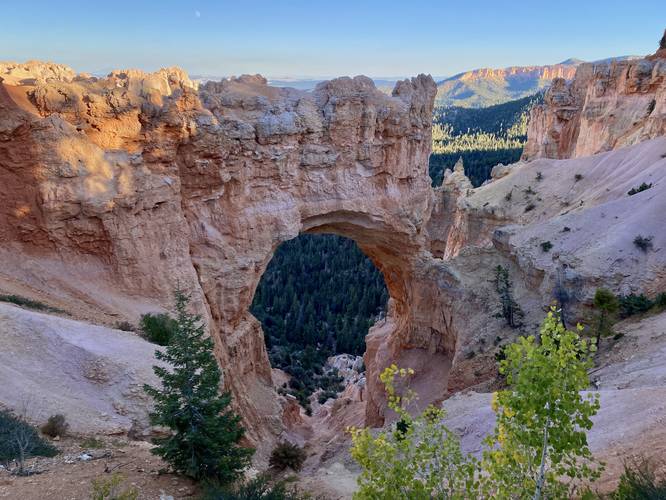
The Natural Bridge Overlook at Bryce Canyon National Park near Bryce Canyon
City, Utah is an easy 0.1-mile out-and-back walk that features a stunning natural bridge arch within Bryce Canyon.
This is not a hike but rather a short walk that follows a universally-accessible paved path that leads to a stunning overlook of Bryce Canyon where visitors will find a very large rock arch formation named the Natural Bridge. This short walk is one of the best overlooks at the park as it leads to one of the most interesting points-of-interest along the rim of Bryce Canyon.
Universal Access
This trail includes a paved universal access pathway.
Fees
Bryce Canyon National Park has a $35/week entry fee as of September 2023. Visitors are highly encouraged to purchase an annual National Parks pass before their trip to reduce entry fees (especially if you're passing through multiple parks) and to also speed-up the very-long line that leads into the park.
Parking
Visitors will find a large parking lot at the coordinates provided.
Pets
Dogs are only allowed on paved surfaces at Bryce Canyon National Park like parking lots and fully paved trails, as of September 2023. Please read more about Bryce Canyon National Park's pet policy here.