The Mount Diablo Summit and Eagle Peak hike at Mount Diablo State Park in Clayton, California is a strenuous 13.5 mile loop that brings you to two different peaks. The entire hike is over 3,000 feet of ascent and descent, so be prepared before heading out. It's also recommended that you bring a map of the area just in case.
Views: A multitude of views can be found along this hike - from Eagle Peak to the Mount Diablo summit, and more.
Parking: Parking can be found at the Mitchell Canyon Interpretive Center - where there is a $6 fee.
Hiking directions:
Note: Following signs for Eagle Peak (from the parking lot) may be easier than looking for specific trail names, as long as you start off the hike at the same place as this recording.
1. The hike starts off by following Oak Road for a short while before hopping onto the Coulter Pines Trail.
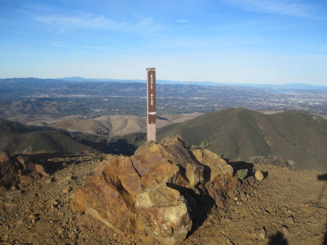
2. From the Coulter Pines Trail, hike for 0.4 miles to a trail junction with the Eagle Peak Trail. Follow the Eagle Peak Trail for 1.7 miles uphill to Eagle Peak.
3. From Eagle Peak, hike south along the Eagle Peak Trail for 0.7 miles to reach the Bald Ridge Trail.
4. Follow the Bald Ridge Trail for 1.4 miles to Prospectors Gap.
5. From Prospectors Gap, take the North Peak Trail for 1.4 miles up to the Mount Diablo Summit.
6. From the Mount Diablo Summit, hike the Juniper Trail into Juniper Campground.
7. From the Juniper Campground, hike along Deer Flat Road until you reach the Meridian Ridge Rd. Follow the Meridian Ridge Rd to the Mitchell Canyon Road and follow the Mitchell Canyon Road all the way back to parking. It’s a 5.25 mile hike back to parking from the Juniper Campground.
For more details, check out the Norcalhiker blog post about this trip.
Views: A multitude of views can be found along this hike - from Eagle Peak to the Mount Diablo summit, and more.
Parking: Parking can be found at the Mitchell Canyon Interpretive Center - where there is a $6 fee.
Hiking directions:
Note: Following signs for Eagle Peak (from the parking lot) may be easier than looking for specific trail names, as long as you start off the hike at the same place as this recording.
1. The hike starts off by following Oak Road for a short while before hopping onto the Coulter Pines Trail.
2. From the Coulter Pines Trail, hike for 0.4 miles to a trail junction with the Eagle Peak Trail. Follow the Eagle Peak Trail for 1.7 miles uphill to Eagle Peak.
3. From Eagle Peak, hike south along the Eagle Peak Trail for 0.7 miles to reach the Bald Ridge Trail.
4. Follow the Bald Ridge Trail for 1.4 miles to Prospectors Gap.
5. From Prospectors Gap, take the North Peak Trail for 1.4 miles up to the Mount Diablo Summit.
6. From the Mount Diablo Summit, hike the Juniper Trail into Juniper Campground.
7. From the Juniper Campground, hike along Deer Flat Road until you reach the Meridian Ridge Rd. Follow the Meridian Ridge Rd to the Mitchell Canyon Road and follow the Mitchell Canyon Road all the way back to parking. It’s a 5.25 mile hike back to parking from the Juniper Campground.
For more details, check out the Norcalhiker blog post about this trip.