Loading...

Bennet Pass Road Snowshoe and Cross-Country Ski Trail

Distance:
3.0 Miles / 4.8 km
Type:
Out-and-Back
Difficulty:
Moderate
Time to Hike:
1 hour, ~30 minutes
Features:
Surface Type:
Dirt
Park:
Mount Hood National Forest
Town:
Mount Hood, Oregon
Directions:
45.310013, -121.642041
Added:
March 21, 2018
Updated:
February 19, 2019
Loading...
Loading...
260 '

Total Change
242 '

Ascent
224 '

Descent

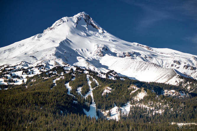
Take a 3 mile out-and-back snowshoe hike along a forest road in Mount Hood National Forest, passing several viewpoints along the way. The road is heavily used in winter by snowshoers and cross-country skiiers.

From the trailhead, you will climb at a very steady pace. At the first junction, keep going straight to avoid turning right.

The first viewpoint is a small detour on a road off to the left.

If you choose to keep going past the first initial viewpoint and reach the Terrible Traverse, just keep going down that road that you took to the viewpoint and veer left as it re-joins the main Bennet Pass Road. Follow the road up a series of switchbacks that precedes the Terrible Traverse. The Terrible Traverse is a knife-edge section of the road that travels along the edge of the ridgeline.

Explore 13 trails near Mount Hood, OR
  1. Parking

    45.310013, -121.642041
  2. Main Trailhead

    45.309916, -121.641122
Explore other routes for this Trail guide, added by the MyHikes' community via Trip Reports. To add your own hike as a Community Route for this Trail guide, leave a Trip Report with an attached GPX file.

Season

Winter

Photo Albums

2 Trip Reports

No Star-Ratings
3.0 miles / 4.8 km
Trail added
March 21, 2018
Hiked on
January 01, 2018
Updated on
February 19, 2019
3.9 miles / 6.3 km
January 07, 2018
On our second trip, we went cross-country skiing instead (last time was a snowshoe). We kept going, past the first initial viewpoint, to the base of the switchbacks that precedes the Terrible Traverse. The Terrible Traverse is a knife-edge section of the road that travels along the edge of the ridgeline.
Cross-Country Skiing

Weather Forecast

In Mount Hood, OR

Explore Hiking Trails

New Hikes

Lake Estes Trail
0.9 Miles
1.4 km
Easy
Out-and-Back
Boulder Falls Trail
0.2 Miles
0.3 km
Moderate
Out-and-Back
Albert Birch Ruins and Cabin Trail
0.4 Miles
0.6 km
Easy
Loop
Conklin's Gully Loop
2.4 Miles
3.9 km
Hard
Loop

Before you boogie...

Find our trail guides useful? Consider becoming a Supporter to unlock perks!

MyHikes is an indie platform that makes exploring public trails easier for everyone. The platform has no investors, runs no ads, and is owned and operated by one person, Dave Miller. Dave has personally mapped and written over 1,600 trail guides on MyHikes for the public to explore. As of 2024, MyHikes has helped over 1,300,000 outdoor enthusiasts plan their next adventure.

But it takes a lot of time 🕦, money 💰, and work, and espresso shots ☕ to run MyHikes, including hiking , mapping , writing , and publishing new trails with high-quality (accurate) information... along with software engineering (coding) the platform like building new features, site and mobile app development for iOS and Android, site maintainance . and much much more.

Supporters unlock website and mobile app perks with an annual one-time payment of $25 (you renew) 😎👍. Or you can simply make a Donation of your choice. Otherwise, you can support us by telling your friends about MyHikes - both quick and free 🎉

Admin user profile picture

Dave Miller
MyHikes Founder