Moss Falls and Campsite at Tioga State Forest near Cedar Run is a 0.1-mile off-trail walk that leads to a scenic seasonal 8-foot tall waterfall that spills off a mossy rock ledge and also features a make-shift campsite.
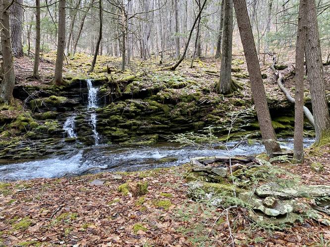
Moss Falls, 8-feet Tall
This is not really a hike but rather a quick walk down a steep hillside to reach Mine Hole Run to get a view of Moss Falls. Moss Falls spills over a scenic mossy rock ledge with a sea of green moss-covered rocks upstream from the waterfall.
Campsite
At the waterfall, as of March 25, 2023, is a rock campfire with at least 3 stone rock seats. Backpackers and campers, following the state forest rules, could likely setup a campsite on flat ground nearby and use this fire ring to cook food.
Parking
Hikers will find no real parking lot for this walk, but rather a grassy turnout alongside the road with enough space to get your car off of the road.
Pets
Dogs are allowed if leased and cleaned up after.
Camping and Backpacking
While this campsite does not sit along a trail, campers and backpackers can use this spot if they follow the state forest rules and regulations for dispersed / backcountry / primitive camping.
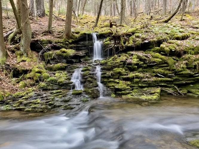