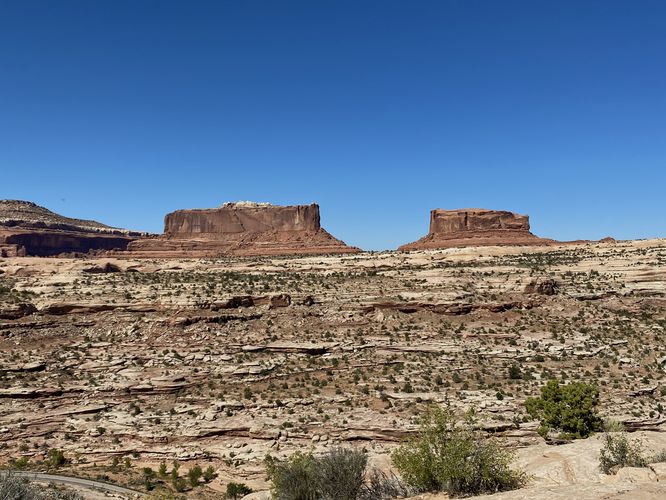
The Monitor and Merrimac Viewpoint at Monitor and Merrimac Trailhead near Moab, Utah is an easy 0.2-mile out-and-back walk that leads to a beautiful viewpoint of the Monitor and Merrimac buttes.
This very short hike begins at the main trailhead and follows the loosely-defined dirt path as it traverses the top of a desert mesa to reach a cliff edge viewpoint of the large buttes named Monitor and Merrimac.
Universal Access
This trail should be considered universally-accessible for the first ~50-feet as the trail follows a paved pathway that leads to an information kiosk. From the information kiosk, visitors will get a view of the Monitor and Merrimac buttes. The trail beyond the paved section is not universally accessible.
Parking
Visitors will find a very large parking lot at the coordinates provided, large enough to fit over a dozen vehicles.
Pets
Dogs are allowed only if leashed and must be cleaned up after.
Warnings
Sun exposure: This trail has very little shade and no water sources. Pack-in all water and wear sun screen and a hat to protect against sun exposure. It's smart to hike either in the early morning or late afternoon to avoid the intense desert sun.
No water: This trail has no water sources so you must pack-in all water. A general rule of thumb in the desert is 1 gallon of water per person per day.
Rattlesnakes: This is rattlesnake territory, so be on the lookout and give any rattlers you find plenty of space.