Lace up your walking shoes and prepare for an unforgettable stroll along the Menaggio Promenade (Lungolago di Menaggio), a picturesque 0.9 km one-way path that perfectly captures the essence of Lake Como's charm.
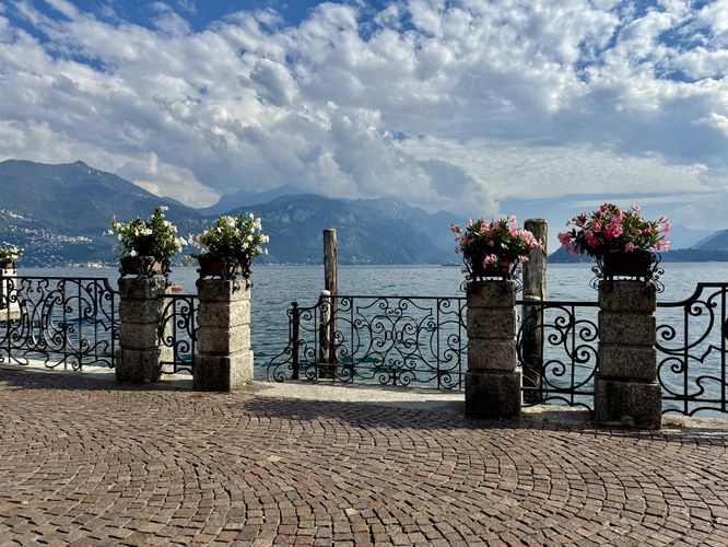
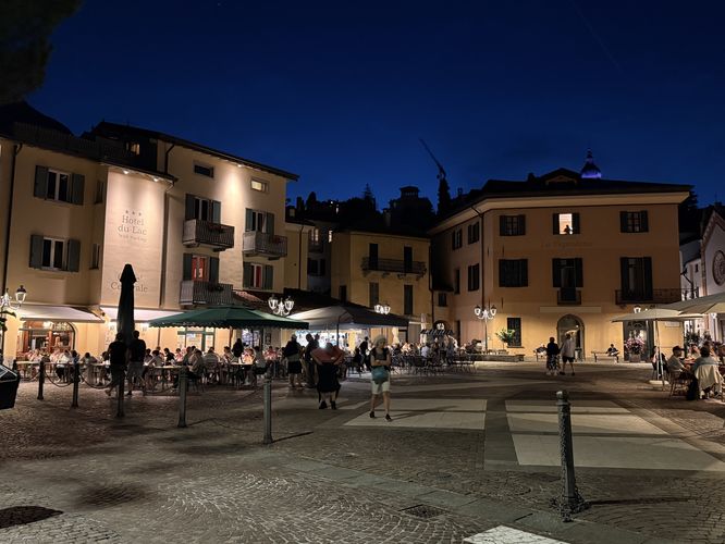
This easily accessible lakeside route offers stunning, uninterrupted views of the Southern Alps, the crystal-clear waters of Lago di Como, and the quaint historic architecture of Menaggio, Italy. Ideal for a relaxing walk, the promenade is dotted with inviting benches, providing the perfect spot to pause, unwind, and soak in the landscape. The Menaggio Promenade will lead you directly past the vibrant heart of the old town — Piazza Giuseppe Garibaldi — where you can easily grab a scoop of gelato, enjoy a classic Italian bite, or sip a refreshing spritz with a spectacular view. Whether you're a seasoned traveler seeking Italian tranquility or looking for the best things to do in Menaggio, this beautiful walk is a must-do and the ultimate spot for Lake Como photography.
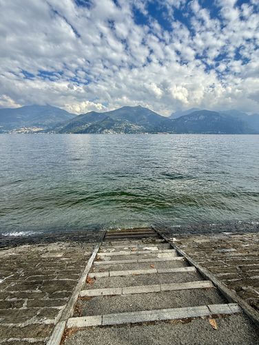
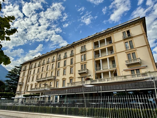
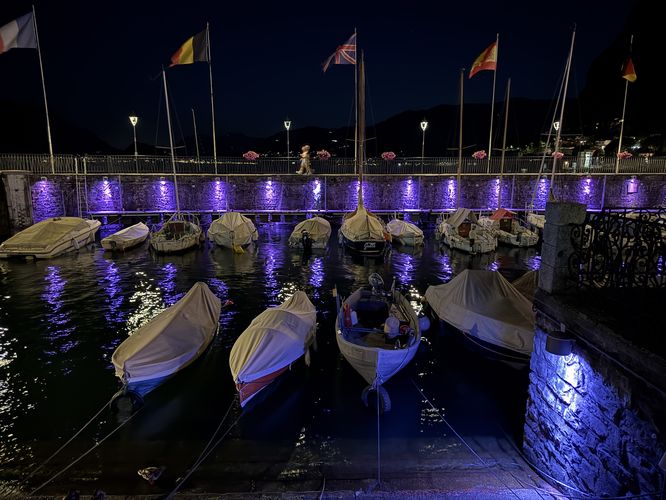
As you stroll south along the shore of Lago di Como, keep an eye out for a staircase offering unique access down to the water's edge. You'll soon pass the impressive, historic facade of the Grand Hotel Victoria and arrive at the central tourist hub: Piazza Giuseppe Garibaldi, the vibrant heart of Menaggio's old town. This is the perfect spot to pause your walk; consider crossing the road to indulge in authentic Italian gelato or cool off with a classic spritz on a warm day. The scenic walk finally concludes at the serene Menaggio Marina (Marina di Menaggio), marking the end of your approximately 0.9 km lakeside adventure.
This easily accessible lakeside route offers stunning, uninterrupted views of the Southern Alps, the crystal-clear waters of Lago di Como, and the quaint historic architecture of Menaggio, Italy. Ideal for a relaxing walk, the promenade is dotted with inviting benches, providing the perfect spot to pause, unwind, and soak in the landscape. The Menaggio Promenade will lead you directly past the vibrant heart of the old town — Piazza Giuseppe Garibaldi — where you can easily grab a scoop of gelato, enjoy a classic Italian bite, or sip a refreshing spritz with a spectacular view. Whether you're a seasoned traveler seeking Italian tranquility or looking for the best things to do in Menaggio, this beautiful walk is a must-do and the ultimate spot for Lake Como photography.
Explore the Menaggio Promenade: Your Gateway to Lake Como's Waterfront
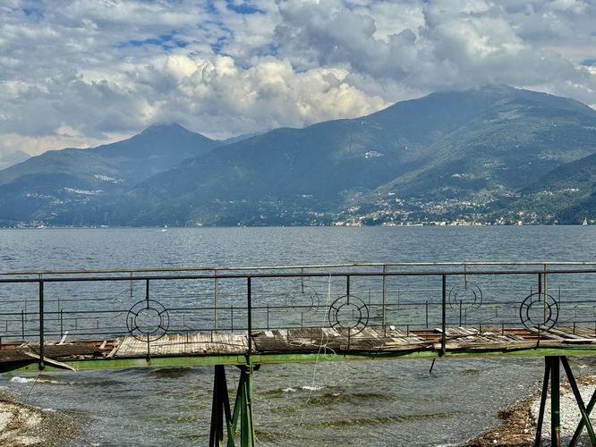
This walk on the Menaggio Promenade officially begins on the north side of town, near Victoria Beach on Via dei Cipressi. However, the beauty of this route is its accessibility: visitors can hop on the Menaggio Promenade almost anywhere along Viale Benedetto Castelli. The route follows Via dei Cipressi as it leads around the private-owned Victoria Beach access before reaching the sidewalk on Via Roma. From Via Roma, the walk crosses over the Val Sanagra River where you'll find an old footbridge that now sits as a foreground photo opportunity with Lake Como in the background. After crossing the Val Sanagra River, the path leads to the lakefront park on Viale Benedetto Castelli. Here, the Menaggio Promenade truly begins as it leads visitors through the public waterfront parks (Lungolago di Menaggio).Views, Landmarks, and the Heart of Menaggio
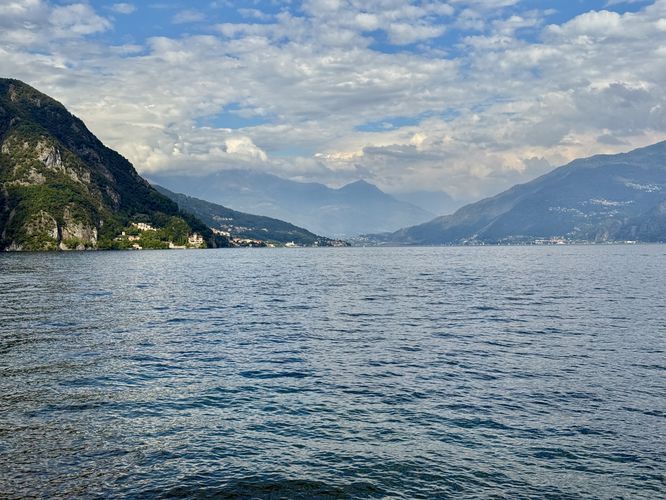
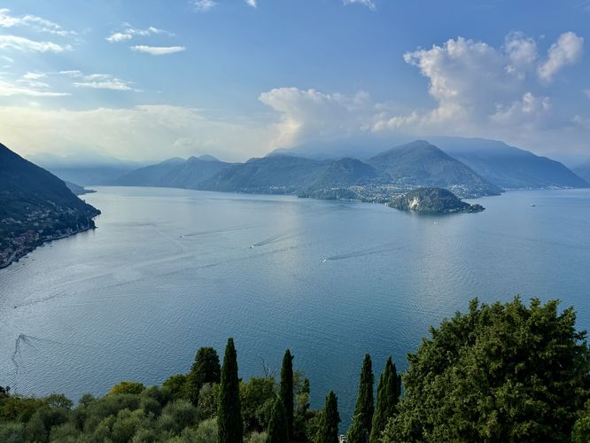
Once on the park's walking trail, it runs directly along the waters of Lake Como. The panoramic views are breathtaking: directly across the lake, admire the charming villages of Vezio and Bellagio, dramatically framed by the towering, majestic peaks of the Southern Alps.As you stroll south along the shore of Lago di Como, keep an eye out for a staircase offering unique access down to the water's edge. You'll soon pass the impressive, historic facade of the Grand Hotel Victoria and arrive at the central tourist hub: Piazza Giuseppe Garibaldi, the vibrant heart of Menaggio's old town. This is the perfect spot to pause your walk; consider crossing the road to indulge in authentic Italian gelato or cool off with a classic spritz on a warm day. The scenic walk finally concludes at the serene Menaggio Marina (Marina di Menaggio), marking the end of your approximately 0.9 km lakeside adventure.