Loading...

Meadowlark Trail

Directions
Map
Pictures
Send to App
Distance:
1.9 Miles / 3.1 km
Type:
Loop
Difficulty:
Moderate
Time to Hike:
1 hour
Features:
Surface Type:
Dirt
Park:
Meadowlark Natural Area
Town:
Winthrop, Washington
Directions:
48.472986, -120.171165
Added:
June 20, 2025
Updated:
July 09, 2025
Copy Trail Link Hiking this trail? Send a friend or family member a link to this trail guide for your own safety. Hike at your own risk (disclaimer)
Loading...
Loading...
343'

Total Change
393'

Ascent
393'

Descent

Download the Trail Route for Offline Use

Supporters get exclusive access to download trail routes to the MyHikes app for offline use. Stay prepared on your adventure, even without an internet connection! Become a Supporter today to unlock this feature and hike with confidence.

Send to App

Meadowlark Trail

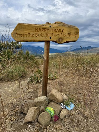
The Meadowlark Trail at the Meadowlark Natural Area in Winthrop, Washington is an easy to moderate 1.9-mile loop hike that features wildflowers and views of the alpine mountains within North Cascades National Park and Okanogan-Wenatchee National Forest.

Hike the Meadowlark Trail

The trailhead sits on the northeast corner of the parking area where you'll find information signs about rules and regulations.

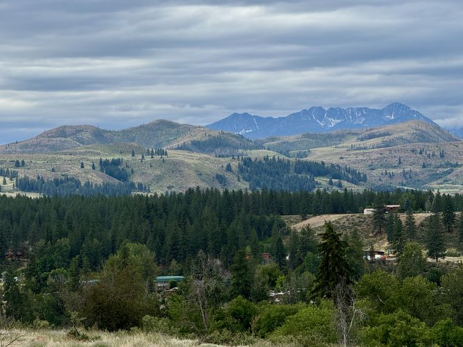
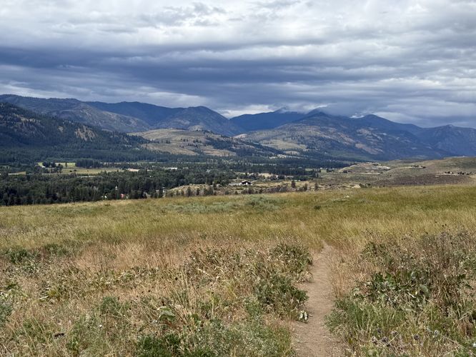
The Meadowlark Trail is a large loop, but it includes a bisecting trail where you can choose to hike 1.9-miles on the outer loop or a shorter ~1-mile hike along the bisecting loop, your choice. This guide follows the larger outer loop counter-clockwise. To start, you'll find large blue-tinted grasses swaying in the breeze near the trailhead as the trail leads through the exposed meadows. Following the trail south bound features distant alpine vistas of Hoodoo Peak and Bigelow Peak in the southwest.

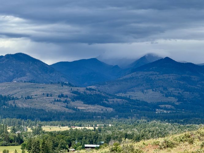
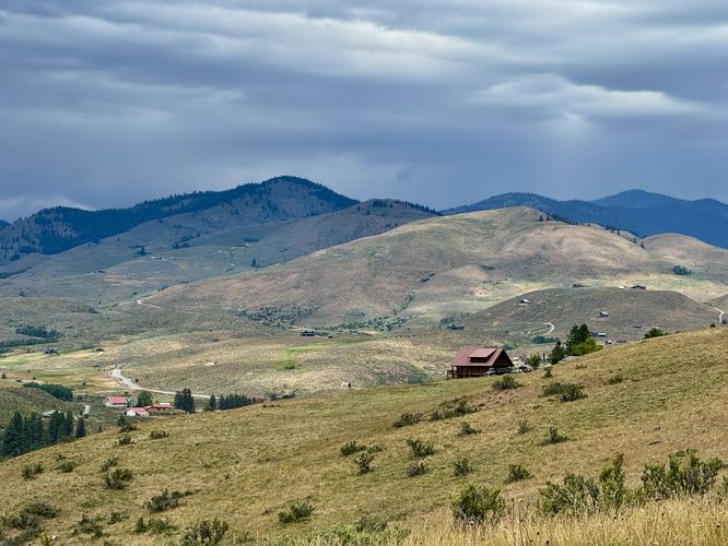
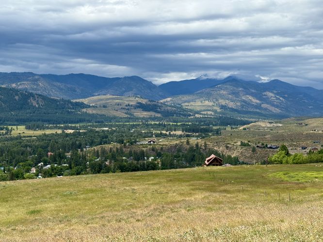
As the trail begins to curve around and ascend, it becomes a bit steeper and follows a moderate grade. On your way up the hill, you'll find more distant views of alpine mountains, like the towering peaks that surround Washington Pass and the Washington Pass Overlook. Eventually, the trail reaches its highest point around mile 0.9 where the best views of downtown Winthrop come into view. You'll also find panoramic views of the grassy hills and nearby mountains that surround the Methow River valley.

Follow the trail as it leads back downhill as it wraps around to the south again. Reach the spur trail that leads to the trailhead near mile 1.87. End the hike back at the parking area at mile 1.9.

Parking

This hike begins near the south end of Wister Way in Winthrop, Washington. To reach the parking area, simply drive to the end of the road and past the cemetery. You'll find wooden fences that surround the parking lot. The parking lot can fit about a dozen vehicles as of June 2025.

Pets

Dogs are allowed only if leashed and must be cleaned up after.

Warning

Western rattlesnakes: This area is home to the Western Rattlesnake which can be found basking in the sunlight during the day. While they can be rare, they could be on the trail or located just off-trail. Be on the lookout and give any rattlers you find plenty of space.
Explore 4 trails near Winthrop, WA
  1. Parking

    48.472986, -120.171165
  2. Main Trailhead

    48.472986, -120.171165
  3. View of the alpine peaks near Hoodoo Peak and Mount Bigelow

    48.472478, -120.169844
    View of the alpine peaks near Hoodoo Peak and Mount Bigelow
  4. View of the mountains surrounding Washington Pass (with rain clouds)

    48.472486, -120.166861
     View of the mountains surrounding Washington Pass (with rain clouds)
  5. Happy Trails sign by the Bob Heckendorn family

    48.474575, -120.168914
    Happy Trails sign by the Bob Heckendorn family
  6. View of rolling mountains and grasslands of the Winthrop area

    48.474621, -120.16892
    View of rolling mountains and grasslands of the Winthrop area
  7. View high above Winthrop

    48.479444, -120.171561
    View high above Winthrop
  8. Another view above the town of Winthrop, WA

    48.478853, -120.172156
    Another view above the town of Winthrop, WA
No community routes found. To add your own hike as a Community Route for this Trail guide, leave a Trip Report with an attached GPX file.

Hazards

Snakes

Seasons

All

Trip Reports

Trail Guide By:
Admin user profile picture
1.9 miles / 3.1 km
1.9 miles / 3.1 km
June 20, 2025
Hiking
Preview of the MyHikes mobile app interface

Track, Log, and Explore Hikes with the MyHikes App

Shop Landscape Prints
Shop our Washington State landscape prints

Weather Forecast

In Winthrop, WA

Explore Hiking Trails

You May Also Like

Colorado's Million Dollar Highway - Plan a day's drive adventure along the iconic Million Dollar Highway in Colorado. Explore the best short trails, roadside stops, waterfalls, vistas, ghost towns, and hot springs within a ~6 hour road trip.
Explore

Colorado's Million Dollar Highway

Plan a day's drive adventure along the iconic Million Dollar Highway in Colorado. Explore the best short trails, roadside stops, waterfalls, vistas, ghost towns, and hot springs within a ~6 hour road trip.

Read
Glacier's Going-to-the-Sun Road - Discover the breathtaking beauty of Glacier National Park along the iconic Going-to-the-Sun Road. From stunning roadside stops to picturesque waterfalls and vistas, this engineering marvel offers endless opportunities for exploration.
Explore

Glacier's Going-to-the-Sun Road

Discover the breathtaking beauty of Glacier National Park along the iconic Going-to-the-Sun Road. From stunning roadside stops to picturesque waterfalls and vistas, this engineering marvel offers endless opportunities for exploration.

Read
New York's Best Waterfalls - Whether you're planning a day hike, roadside stop, or a leisurely short walk, this guide provides hikers, travelers, and locals alike with 63 different locations to over 100 scenic waterfalls to help plan your next adventure!
Explore

New York's Best Waterfalls

Whether you're planning a day hike, roadside stop, or a leisurely short walk, this guide provides hikers, travelers, and locals alike with 63 different locations to over 100 scenic waterfalls to help plan your next adventure!

Read

Before you boogie...

Find our trail guides useful? Consider becoming a Supporter to unlock perks!

MyHikes is an indie platform that makes exploring public trails easier for everyone. The platform has no investors, no ads, and is owned and operated by one person, Dave Miller. Dave has personally mapped and written over 1,800 trail guides on MyHikes for the public to explore. MyHikes has helped millions outdoor enthusiasts plan their next adventure.

But it takes a lot of time 🕦, money 💰, work, and espresso shots ☕ to run MyHikes, including hiking , mapping , writing , and publishing new trails with high-quality (accurate) information... along with software engineering (coding) the platform like building new features, website and mobile app development (iOS and Android), site maintainance . and much much more.

Supporters unlock website and mobile app perks with an annual one-time payment of $25 (you renew) 😎👍. Or you can simply make a Donation of your choice. Otherwise, you can support us by telling your friends about MyHikes - both quick and free 🎉

Admin user profile picture

Dave Miller
MyHikes Founder