The McCalls Dam Trail at McCalls Dam State Park near Mifflinburg, Pennsylvania is an easy 0.4-mile out-and-back trail that runs through the entire park along White Deer Creek and features scenic creek views and tall lush ferns during warm months.
Exploring McCalls Dam State Park
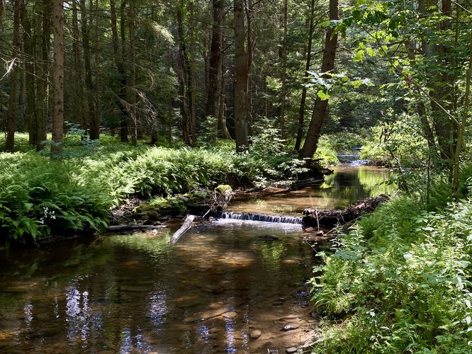
Since this is the only hiking trail within the tiny McCalls Dam State Park, exploring these woods is a fairly quick hit for road trippers and day explorers. The trailhead for the trail can be found on the west side of McCall Dam Road where hikers will find an open area with picnic tables and a trailhead kiosk with minimal information. The trail continues along the north banks of White Deer Creek and runs westward through the park. During warm months, and during our hike here in July, we found large ferns growing alongside the trail as it meandered through the forest heading westward toward Bald Eagle State Forest. The trail ends within the state park boundaries near the turn-around point in this route, but hikers can choose to hike further into Bald Eagle State Forest if they wish. The trail ends at the main trailhead for an easy and short 0.4-mile out-and-back hike.
Nearby Hikes
While in the area, you might want to explore more trails near Mifflinburg, PA like the Lakeside Trail at Raymond B. Winter State Park.
Pets
Dogs are allowed if leashed and must be cleaned up after.
Restrooms
As of July 2024, there's a short trail that leads off of the main trail to reach a forest pit toilet (non-flush).
Exploring McCalls Dam State Park
Since this is the only hiking trail within the tiny McCalls Dam State Park, exploring these woods is a fairly quick hit for road trippers and day explorers. The trailhead for the trail can be found on the west side of McCall Dam Road where hikers will find an open area with picnic tables and a trailhead kiosk with minimal information. The trail continues along the north banks of White Deer Creek and runs westward through the park. During warm months, and during our hike here in July, we found large ferns growing alongside the trail as it meandered through the forest heading westward toward Bald Eagle State Forest. The trail ends within the state park boundaries near the turn-around point in this route, but hikers can choose to hike further into Bald Eagle State Forest if they wish. The trail ends at the main trailhead for an easy and short 0.4-mile out-and-back hike.
Nearby Hikes
While in the area, you might want to explore more trails near Mifflinburg, PA like the Lakeside Trail at Raymond B. Winter State Park.
Pets
Dogs are allowed if leashed and must be cleaned up after.
Restrooms
As of July 2024, there's a short trail that leads off of the main trail to reach a forest pit toilet (non-flush).