The Lakeside Trail at Raymond B Winter State Park near Mifflinburg, Pennsylvania is an easy 0.6-mile loop trail that encompasses Halfway Lake and features views of the lake and a ~8-foot tall spillway waterfall.
Hike
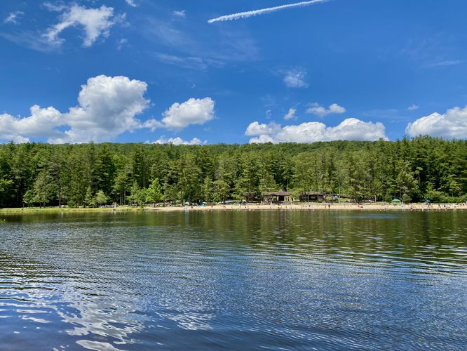
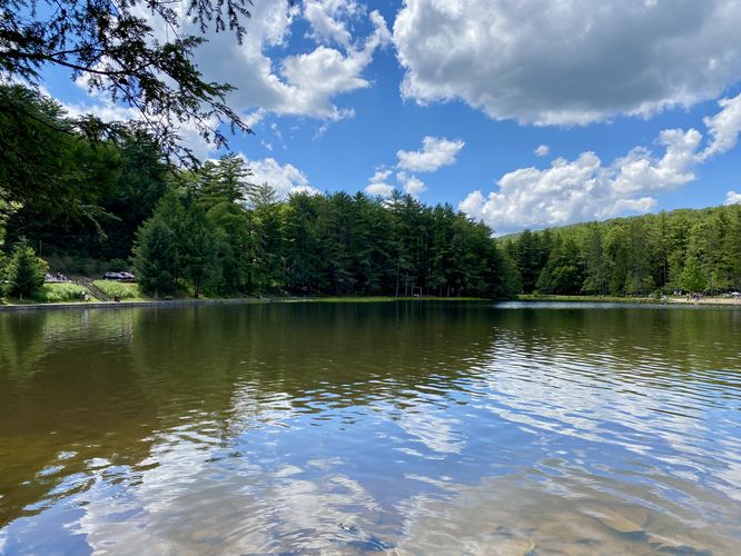
This hike begins at the large parking lot located along PA-182 (Buffalo Road) where visitors will find a view of Halfway Lake and a staircase that leads down to the Lakeside Trail. This route follows the trail clockwise, starting with the staircase descent. The trail then leads around Halfway Lake, providing views along the way. This popular trail is generally very busy during summer months as Halfway Lake as a beach and concession stands.
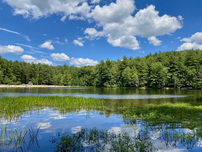
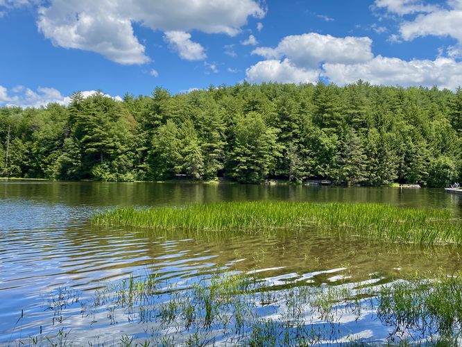
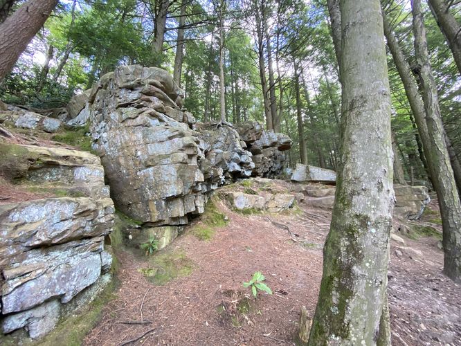
This route leads toward the beach area, but passes the concession stands to the north before reconnecting to the main trail. The Lakeside Trail then leads into the woods, passing under an evergreen (pine) forest with a couple of lake viewpoints located on-trail.
Spillway Waterfall - Mile 0.5
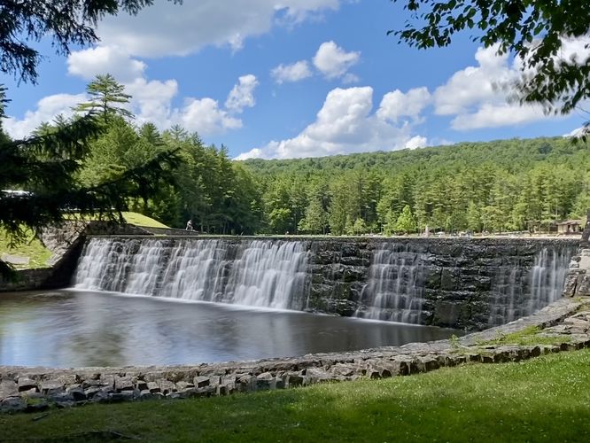
Around mile 0.5, just before the trail reaches the road, sits the ~8-foot tall spillway waterfall that spans approximately 100-feet long. This human-made waterfall is the active spillway from Halfway Lake and flows at a consistent rate down the beautiful stonework spillway.
The trail then leads to the road where hikers will follow the road to connect back to the main path. It then follows the paved surface to reach the staircase. Follow the staircase back to parking. Alternatively, you can skip the staircase and head directly to the parking lot from the road section instead.
Universal Access
Note that this trail has universal access along the paved portion of the path. The paved section is located on the west side of the loop connecting the staircase (at this trailhead) to the concession stands on the north side of Halfway Lake. Accessible parking can be found in the park instead of along PA-192. The rest of the trail should not be considered universally-accessible.
Popularity
This is a very popular trail, especially during the summer due to the swimming opportunities at Halfway Lake.
Parking
This route brings hikers to a large parking lot located on the north side of PA-192 (Buffalo Road) where you'll find a large parking lot that can fit a couple dozen vehicles as of July 2024. Additional parking is located in the state park if you follow the entrance road.
Pets
Dogs are allowed only if leashed and must be cleaned up after.
Hike
This hike begins at the large parking lot located along PA-182 (Buffalo Road) where visitors will find a view of Halfway Lake and a staircase that leads down to the Lakeside Trail. This route follows the trail clockwise, starting with the staircase descent. The trail then leads around Halfway Lake, providing views along the way. This popular trail is generally very busy during summer months as Halfway Lake as a beach and concession stands.
This route leads toward the beach area, but passes the concession stands to the north before reconnecting to the main trail. The Lakeside Trail then leads into the woods, passing under an evergreen (pine) forest with a couple of lake viewpoints located on-trail.
Spillway Waterfall - Mile 0.5
Around mile 0.5, just before the trail reaches the road, sits the ~8-foot tall spillway waterfall that spans approximately 100-feet long. This human-made waterfall is the active spillway from Halfway Lake and flows at a consistent rate down the beautiful stonework spillway.
The trail then leads to the road where hikers will follow the road to connect back to the main path. It then follows the paved surface to reach the staircase. Follow the staircase back to parking. Alternatively, you can skip the staircase and head directly to the parking lot from the road section instead.
Universal Access
Note that this trail has universal access along the paved portion of the path. The paved section is located on the west side of the loop connecting the staircase (at this trailhead) to the concession stands on the north side of Halfway Lake. Accessible parking can be found in the park instead of along PA-192. The rest of the trail should not be considered universally-accessible.
Popularity
This is a very popular trail, especially during the summer due to the swimming opportunities at Halfway Lake.
Parking
This route brings hikers to a large parking lot located on the north side of PA-192 (Buffalo Road) where you'll find a large parking lot that can fit a couple dozen vehicles as of July 2024. Additional parking is located in the state park if you follow the entrance road.
Pets
Dogs are allowed only if leashed and must be cleaned up after.