Marcy Dam at Adirondack Park within the High Peaks Wilderness in North Elba, New York is an easy and popular 4.6-mile out-and-back hike that features the old abandoned Marcy Dam and views of the surrounding mountains.
Trails
This hike follows the Van Hoevenberg Trail for the entire length of the hike out-and-back. Please note that this is not the same trail as the Mt. Van Hoevenberg Trail.
Hike Description
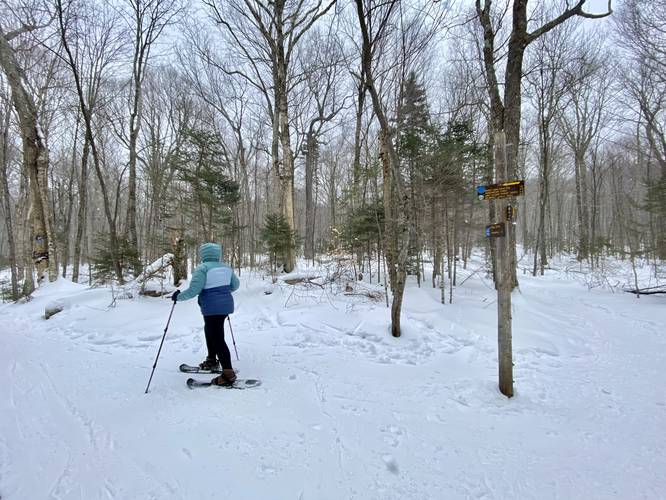
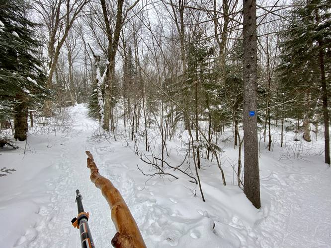
This hike begins at the parking lot adjacent to the High Peaks Information Center. Hikers will find a large trailhead registry where they should sign-in and out just in case something were to happen while out on the trail. Note that the Van Hoevenberg Trail follows a forested undulating path that leads south toward Marcy Dam. During the winter, the trail is generally smooth and groomed by skiers and snowshoers; however, the trail may be rocky in many places during warmer months. Along the way, hikers will hike in and out of mixed forests of hardwoods and conifers as they pass several named trails along the way.
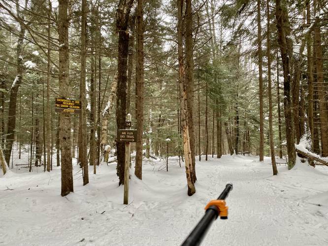
Mr. Van Ski Trail Junction - Mile 0.1
At mile 0.1, hikers will stay right at the Mr. Van Ski Trail.
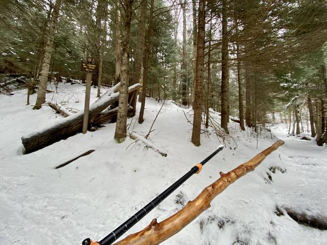
Southeast Corner Bypass Junction - Mile 0.4
Around mile 0.4, hikers will stay right once again at a junction with the Southeast Corner Bypass ski trail.
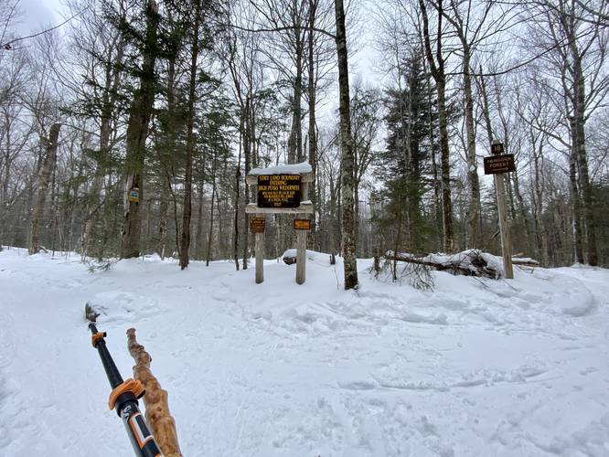
Stay Left at High Peaks Wilderness Entrance - Mile 0.75
At mile 0.75, hikers will keep left once they reach the large sign for the High Peaks Wilderness area. There's also a small trail sign for the Fangorn Forest Trail here as well.
Left-Turn at Junction - Mile 1
At mile 1, hikers will take a left-hand turn to head toward Marcy Dam. There's signage here stating that Marcy Dam is 1.2 miles from this point.
Junction - Mile 2
At mile 2, hikers will find yet another trail junction which connects with itself further down the trail. Feel free to take either route; however, this recording stays left at this junction.
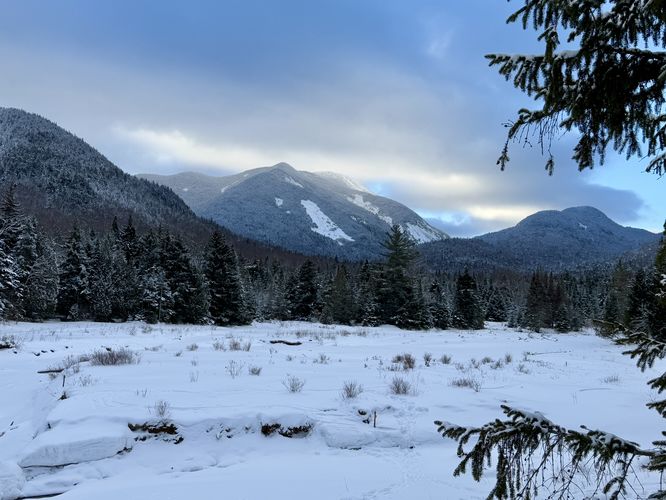
Marcy Dam - Mile 2.25
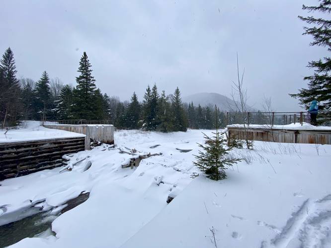
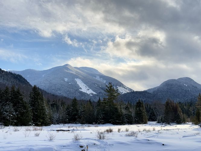
Finally, around mile 2.25, hikers will reach the old abandoned Marcy Dam. At Marcy Dam hikers will find a nice view of the dam, a very small cascade in the brook below, and a view of the mountains surrounding Marcy meadows and Marcy Pond. During this hike in late January, 2023, unfortunately the falling snow covered all but one mountain in the view. During warmer months, when it's not raining or too foggy, Marcy Dam provides stunning views of the surrounding mountains within the High Peaks Wilderness. Hikers can also choose to walk out along the top of the old dam where they'll find a metal bar-fence that's meant to tell folks to stay off of the broken and deteriorating sections of the wooden surfaces. After checking out Marcy Dam, hikers can walk down to the shores of Marcy Pond to get a different and wider view of the area of the Marcy Meadows - again, which is better during warm months.
Popularity
This hike is one of the most popular day hikes within Adirondack Park and the High Peaks Wilderness. Expect plenty of foot traffic, especially during warmer months.
Cross-Country Skiing / Driftboarding
This hike was mapped on Driftboards which are a combination of snowshoes and cross-country skis meant for mountain ascents. While Driftboarding this trail was do-able, some downhill sections were too steep and long for the difficult-to-maneuver Driftboards, so we found that we had to walk backwards down some of these hills.
Winter Rules
Note that snowshoes or skis are required by law during the winter on this trail.
Parking and Fees
There's a very large parking lot, with several other large parking lots, located at the coordinates provided. There's a parking fee as of late January 2023: ADK-Members: $7/day. Non-members: $15/day.
Blaze Color
This trail follows circular blue blaze markers.
Trails
This hike follows the Van Hoevenberg Trail for the entire length of the hike out-and-back. Please note that this is not the same trail as the Mt. Van Hoevenberg Trail.
Hike Description
This hike begins at the parking lot adjacent to the High Peaks Information Center. Hikers will find a large trailhead registry where they should sign-in and out just in case something were to happen while out on the trail. Note that the Van Hoevenberg Trail follows a forested undulating path that leads south toward Marcy Dam. During the winter, the trail is generally smooth and groomed by skiers and snowshoers; however, the trail may be rocky in many places during warmer months. Along the way, hikers will hike in and out of mixed forests of hardwoods and conifers as they pass several named trails along the way.
Mr. Van Ski Trail Junction - Mile 0.1
At mile 0.1, hikers will stay right at the Mr. Van Ski Trail.
Southeast Corner Bypass Junction - Mile 0.4
Around mile 0.4, hikers will stay right once again at a junction with the Southeast Corner Bypass ski trail.
Stay Left at High Peaks Wilderness Entrance - Mile 0.75
At mile 0.75, hikers will keep left once they reach the large sign for the High Peaks Wilderness area. There's also a small trail sign for the Fangorn Forest Trail here as well.
Left-Turn at Junction - Mile 1
At mile 1, hikers will take a left-hand turn to head toward Marcy Dam. There's signage here stating that Marcy Dam is 1.2 miles from this point.
Junction - Mile 2
At mile 2, hikers will find yet another trail junction which connects with itself further down the trail. Feel free to take either route; however, this recording stays left at this junction.
Marcy Dam - Mile 2.25
Finally, around mile 2.25, hikers will reach the old abandoned Marcy Dam. At Marcy Dam hikers will find a nice view of the dam, a very small cascade in the brook below, and a view of the mountains surrounding Marcy meadows and Marcy Pond. During this hike in late January, 2023, unfortunately the falling snow covered all but one mountain in the view. During warmer months, when it's not raining or too foggy, Marcy Dam provides stunning views of the surrounding mountains within the High Peaks Wilderness. Hikers can also choose to walk out along the top of the old dam where they'll find a metal bar-fence that's meant to tell folks to stay off of the broken and deteriorating sections of the wooden surfaces. After checking out Marcy Dam, hikers can walk down to the shores of Marcy Pond to get a different and wider view of the area of the Marcy Meadows - again, which is better during warm months.
Popularity
This hike is one of the most popular day hikes within Adirondack Park and the High Peaks Wilderness. Expect plenty of foot traffic, especially during warmer months.
Cross-Country Skiing / Driftboarding
This hike was mapped on Driftboards which are a combination of snowshoes and cross-country skis meant for mountain ascents. While Driftboarding this trail was do-able, some downhill sections were too steep and long for the difficult-to-maneuver Driftboards, so we found that we had to walk backwards down some of these hills.
Winter Rules
Note that snowshoes or skis are required by law during the winter on this trail.
Parking and Fees
There's a very large parking lot, with several other large parking lots, located at the coordinates provided. There's a parking fee as of late January 2023: ADK-Members: $7/day. Non-members: $15/day.
Blaze Color
This trail follows circular blue blaze markers.