Lower Stockbridge Falls in Munnsville, New York is a moderate 0.1-mile out-and-back hike that leads to the 8-foot tall waterfall, Lower Stockbridge Falls.
Hike Description
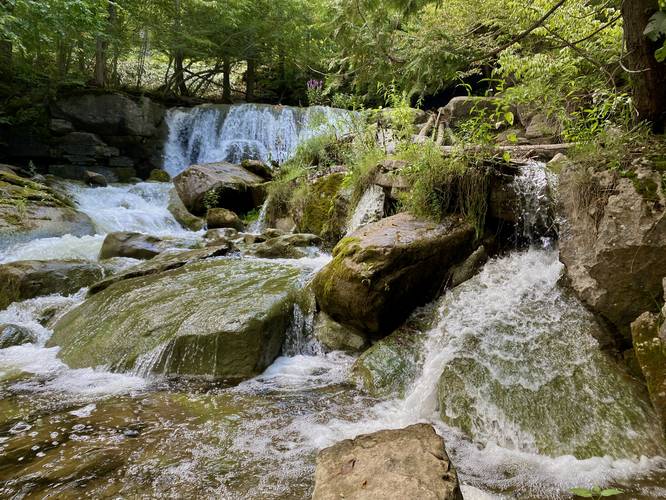
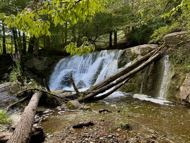
While very short, this hike leads out-and-back down to the rocky ledge embankment of Oneida Creek to reach the ~8-foot tall waterfall known as Lower Stockbridge Falls. Most visitors will skip this waterfall due to the annoying - and slightly sketchy - ledge scramble that's involved with getting to/from the waterfall. Most visitors will just check out the easily-accessible Stockbridge Falls which can be viewed from the road located just across the street.
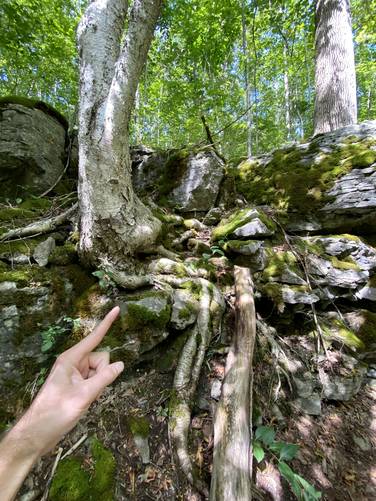
Hikers will find an easy-to-miss trailhead (no signage) located on the eastern side of Falls Road. Follow the steep trail down to the ledge. Using the tree and ledge rocks, you can scramble down to the waterfall and creek bed. At the creek, hikers will find the 8-foot tall Lower Stockbridge Falls in addition to a bunch of other small cascades like a beautiful ~3-foot slide waterfall that spills down the creek.
The hike out, as stated previously, requires a scramble back up the ledge which is about 8-feet tall or slightly less. Again, if you somehow missed it before this one, check out Stockbridge Falls before you leave.
Parking
Hikers will find parking at the coordinates provided on the west side of Falls Road in Munnsville, NY.
Pets
Dogs are allowed only if leashed and should be cleaned up after.
Hike Description
While very short, this hike leads out-and-back down to the rocky ledge embankment of Oneida Creek to reach the ~8-foot tall waterfall known as Lower Stockbridge Falls. Most visitors will skip this waterfall due to the annoying - and slightly sketchy - ledge scramble that's involved with getting to/from the waterfall. Most visitors will just check out the easily-accessible Stockbridge Falls which can be viewed from the road located just across the street.
Hikers will find an easy-to-miss trailhead (no signage) located on the eastern side of Falls Road. Follow the steep trail down to the ledge. Using the tree and ledge rocks, you can scramble down to the waterfall and creek bed. At the creek, hikers will find the 8-foot tall Lower Stockbridge Falls in addition to a bunch of other small cascades like a beautiful ~3-foot slide waterfall that spills down the creek.
The hike out, as stated previously, requires a scramble back up the ledge which is about 8-feet tall or slightly less. Again, if you somehow missed it before this one, check out Stockbridge Falls before you leave.
Parking
Hikers will find parking at the coordinates provided on the west side of Falls Road in Munnsville, NY.
Pets
Dogs are allowed only if leashed and should be cleaned up after.