Loading...

WINTER SALE! 50% OFF Supporter Accounts — now through January 31st. Learn More.

Lower Rock Run Falls

The Lower Rock Run Falls Trail at the McIntyre Wild Area near McIntyre Township, Pennsylvania is a moderate 0.4-mile out-and-back trail that leads to the 2-foot Lower Falls along Rock Run.

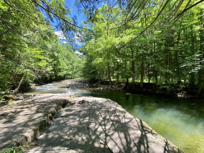
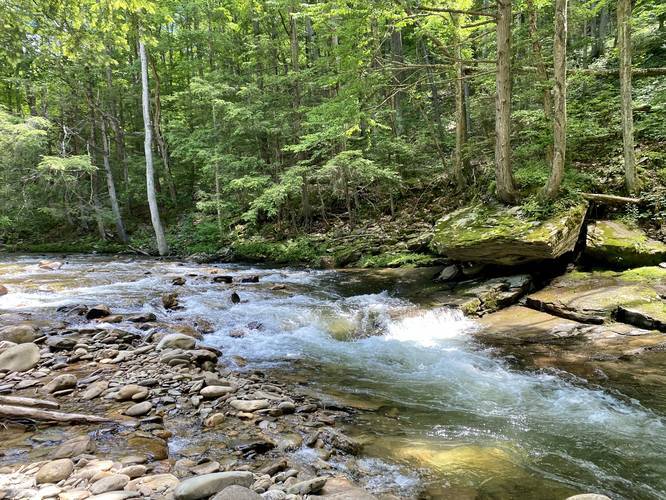
This trail heads downhill along a gradual grade before reaching a set of rock stairs. Those rock stairs lead down to Rock Run where hikers can hike downstream. The Lower Falls were not immediately obvious, so we ended up hiking back uphill and across a set of rocks along the trail that lead over to an unmaintained path. This unmaintained path heads downhill closest to the Lower Falls of Rock Run.

The hike back uphill is not the easiest, hence the moderate difficulty.

Lower Rock Run Falls
This short waterfall is only about 2 or 3-feet tall and about 10-feet wide.

Pets
Dogs area allowed if leashed and their waste must be carried out.

Parking
Hikers will find a small parking lot at the coordinates provided - large enough to fit about four vehicles.

Swimming
This is one of the popular swimming holes along Rock Run, however, not as popular as Middle Rock Run Falls or Upper Rock Run Falls since those slide waterfalls are taller and better suited for rockslide swimming. Swim and hike at your own risk.
Explore 192 trails near McIntyre Township, PA

Know Before You Go

  • Lower Rock Run Falls Trail is a short, moderate 0.4-mile hike in McIntyre Wild Area, PA, leading to a small, 2-3 foot waterfall.
  • The trail involves a downhill hike with rock stairs, potentially requiring an unmaintained path to reach the falls, and a more challenging uphill return.
  • The area features a small parking lot (about 4 vehicles), allows leashed dogs (with waste removal), and is a swimming spot, though less popular than other Rock Run falls.
Interactive topographic map for Lower Rock Run Falls located in McIntyre Township, PA. Click the "View Map" button to load GPS coordinates and trail markers.
Get directions
Distance
0.4 mi
Difficulty
Moderate
Type
Out-and-Back
Est. Time
12 min
Elev. Gain
108'
Rating
0.0
Added
June 13, 2020
Updated
June 13, 2020

Weather Forecast

Loading...
Total Change
53'
Ascent
108'
Descent
108'
Loading...

Download the GPX Data for Offline Use

Supporters get exclusive access to download trail routes to the MyHikes app for offline use. Stay prepared on your adventure, even without an internet connection! Become a Supporter today to unlock this feature and hike with confidence.

Download Lower Rock Run Falls GPX Data to the MyHikes Mobile App

Features

Dogs
Waterfalls
Water Source
PA Wilds logo PA Wilds

Points of interest

  1. Parking

    41.505979, -76.937056
  2. Main Trailhead

    41.505973, -76.937002

Safety information

For your own safety: plan ahead, let someone know where you'll be, and hike at your own risk.

Hazards

Poison Ivy or Poison Oak

Availability

All seasons

Surface type

Dirt

Trip Reports (Reviews)

Your opinion matters! Be the first to rate this trail.

Ready to help fellow hikers? Add a trip report to share your experience and provide valuable insights for other hikers!

0.4 miles / 0.6 km
June 13, 2020
Dogs Hiking
No community routes found. To add your own hike as a Community Route for this Trail guide, leave a Trip Report with an attached GPX file.

Popular categories

Scenic mountain view representing vista trails
Vista trails
Scenic gorge of cascades representing waterfall trails
Waterfall hikes
Rugged mountain terrain representing summit trails
Summit trails
Scenic mountain view representing dog-friendly trails
Dog-friendly
Scenic campsite with a view representing camping trails
Camping trails
Appalachian Trail logo representing A.T. hikes
A.T. hikes

You May Also Like

New York's Best Waterfalls - Whether you're planning a day hike, roadside stop, or a leisurely short walk, this guide provides hikers, travelers, and locals alike with 63 different locations to over 100 scenic waterfalls to help plan your next adventure!
Explore

New York's Best Waterfalls

Whether you're planning a day hike, roadside stop, or a leisurely short walk, this guide provides hikers, travelers, and locals alike with 63 different locations to over 100 scenic waterfalls to help plan your next adventure!

Read
🍪 We use cookies to learn about site usage and to serve map tiles. You may block cookies manually in the browser. By continuing you agree. Learn more