Loading...

Distance:
0 Miles / 0 km
Type:
Out-and-Back
Difficulty:
Easy
Time to Hike:
~5 minutes
Features:
Surface Type:
Dirt
Park:
Dixie National Forest
Town:
Garfield County, Utah
Directions:
38.073266, -111.338296
Added:
September 26, 2023
Updated:
October 04, 2023
Loading...
Loading...
7 '

Total Change
7 '

Ascent
7 '

Descent

The Lower Bowns Reservoir Overlook at Dixie National Forest in Garfield County, Utah is a roadside vista that features northeastward views of the Lower Bowns Reservoir.

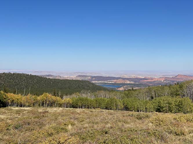
This is not a hike, but rather a quick roadside stop that can be enjoyed on a long road trip through southern Utah. Visitors will find sweeping views facing east and northeastward. The main point-of-interest within the view here is the Lower Bowns Reservoir which is located to the northeast -- simply look for the large body of blue water out in the middle of the Utah desert.

Parking
Visitors will find a small parking turnout at the coordinates provided, which is simply an off-road parking spot.

Pets
Dogs are allowed if leashed and must be cleaned up after.

Explore 24 trails near Garfield County, UT
  1. Parking

    38.073266, -111.338296
  2. Main Trailhead

    38.073266, -111.338296
  3. Lower Bowns Reservoir Overlook in Dixie National Forest

    38.073219, -111.338256
    Lower Bowns Reservoir Overlook in Dixie National Forest
No community routes found. To add your own hike as a Community Route for this Trail guide, leave a Trip Report with an attached GPX file.

Hazards

Snakes

Seasons

All

Photo Albums

2 Trip Reports

No Star-Ratings
Write-up by:
Admin user profile picture
0 miles / 0 km
Trail added
September 26, 2023
Hiked on
September 26, 2023
Updated on
October 04, 2023
0 miles / 0 km
September 26, 2023
Hiking

Weather Forecast

In Garfield County, UT

Explore Hiking Trails

New Hikes

Lehigh Gap Ridge via Appalachian Trail
2.5 Miles
4 km
Hard
Loop
Diana's Baths Trail
1.2 Miles
1.9 km
Easy
Out-and-Back
Upper Rattler Run Falls
1.9 Miles
3.1 km
Hard
Out-and-Back
Silver Cascade
0.2 Miles
0.3 km
Easy
Out-and-Back

Before you leave...

MyHikes is an indie web platform aimed to make exploring public trails easier for everyone. The site has no investors and is owned and operated by one person, Dave Miller (Founder & Admin). As the Founder, main contributor, and doer-of-all-things for MyHikes, I share my trips with over-detailed write-ups for fun on a volunteer basis and I believe that public trail information should be available to everyone.

It takes a lot of time 🕦, money 💰, and effort (including espresso shots ☕) to run MyHikes, including hiking , mapping , writing , and publishing new trails with high-quality content... along with building new features, moderating, site maintainance, and app development for iOS and Android . I simply ask that if you find MyHikes' trail guides helpful to please consider becoming a Supporter to help keep the site, iOS, and Android apps available to everyone.

Supporters unlock website and in-app perks with a one-time payment of $25 (you renew) 😎👍. Or you can simply make a Donation of your choice without a MyHikes user account. Otherwise, telling your friends about MyHikes is the next-best thing - both quick and free 🎉

Thanks for visiting MyHikes and have a great hike!️

Admin user profile picture

Dave Miller
MyHikes Founder & Admin