The Little Bay Loop Trail at Little Bay Conservation Area in Bourne, Massachusetts is a moderate 0.7-mile loop hike that features views of Little Bay and includes a decent workout.
Hike Description
This hike begins at the main parking lot for the Little Bay Walking Trails / Little Bay Conservation Area and follows the main trail in before reaching the loop. This GPS track heads north along the loop before it reaches a spur trail that leads to the views of Little Bay.
Little Bay Views Junction - Mile 0.15
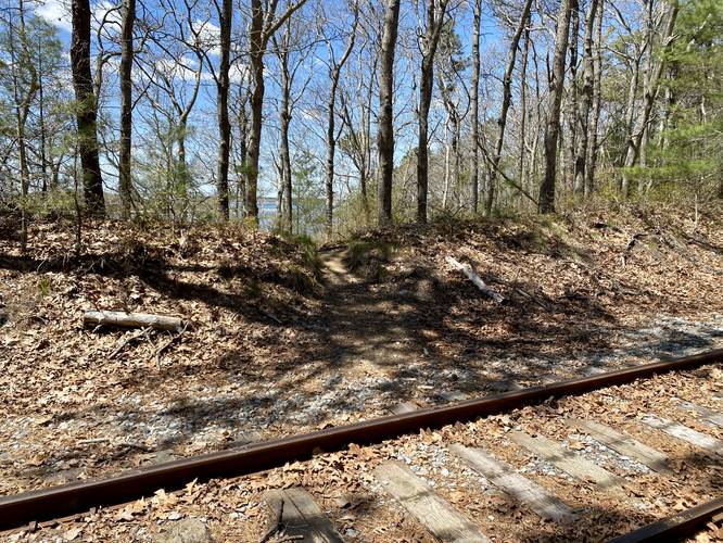
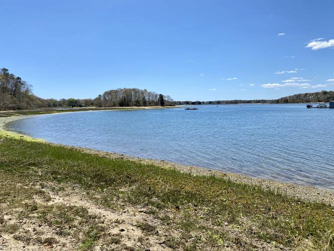
At mile 0.15, hikers will reach a junction with a spur trail that leads down to Little Bay. Hikers will follow this trail, cross the railroad tracks, and then head down a steep embankment to reach the sandy shores of Little Bay at mile 0.2. Here, you can hang out to take in the views of Little Bay.
After visiting Little Bay, hikers will head back up the steep embankment and spur trail to reach the main loop. Once on the main loop, the trail will head south toward Monks Park before it curves around the bend. The trail will eventually hit some undulating hills as it loops around back to the main entrance trail for a 0.7-mile hike.
Before leaving the area, hikers can also check out the Monks Park Loop Trail.
Parking
Hikers will find a very small parking lot at the coordinates provided. The lot is large enough to fit about 3 or 4 vehicles, max. There's a larger parking lot located along Valley Bar Road near Monks Park for additional parking.
Pets
Dogs are allowed only if leashed and must be cleaned up after.
Hike Description
This hike begins at the main parking lot for the Little Bay Walking Trails / Little Bay Conservation Area and follows the main trail in before reaching the loop. This GPS track heads north along the loop before it reaches a spur trail that leads to the views of Little Bay.
Little Bay Views Junction - Mile 0.15
At mile 0.15, hikers will reach a junction with a spur trail that leads down to Little Bay. Hikers will follow this trail, cross the railroad tracks, and then head down a steep embankment to reach the sandy shores of Little Bay at mile 0.2. Here, you can hang out to take in the views of Little Bay.
After visiting Little Bay, hikers will head back up the steep embankment and spur trail to reach the main loop. Once on the main loop, the trail will head south toward Monks Park before it curves around the bend. The trail will eventually hit some undulating hills as it loops around back to the main entrance trail for a 0.7-mile hike.
Before leaving the area, hikers can also check out the Monks Park Loop Trail.
Parking
Hikers will find a very small parking lot at the coordinates provided. The lot is large enough to fit about 3 or 4 vehicles, max. There's a larger parking lot located along Valley Bar Road near Monks Park for additional parking.
Pets
Dogs are allowed only if leashed and must be cleaned up after.