The Left Branch Asaph Run Trail at Tioga State Forest in Shippen Township, Pennsylvania is an easy 1.2-mile out-and-back trail that runs adjacent to Left Branch Asaph Run and Left Asaph Road.
This track begins at the western trailhead, across the street from the Asaph Wild Area and the Big Tree Hollow Trail. The trail heads into the woods and immediately drops about 15-feet along a semi-steep grade to where the trail flattens out next to the creek.
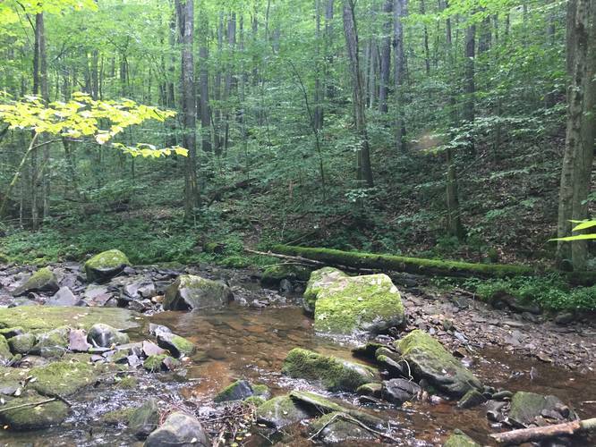
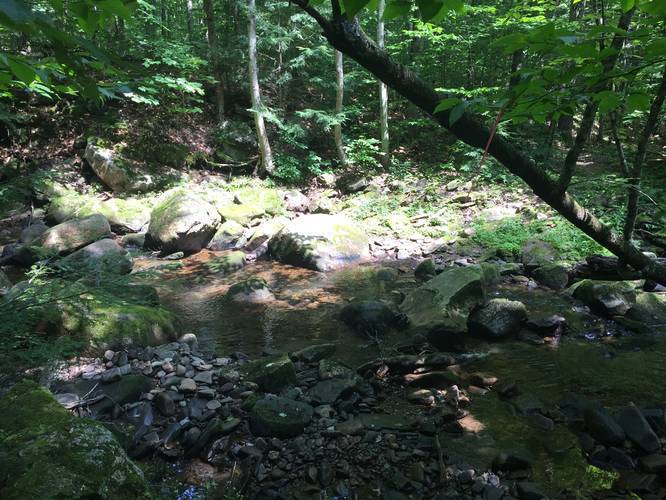
The trail follows yellow blazes as it meanders along Left Branch Asaph Run. Along the creek, you'll find scenic mossy areas where you can sit and relax next to the trickling creek. Hikers will need to cross the creek a couple of times throughout the hike, so plan accordingly.
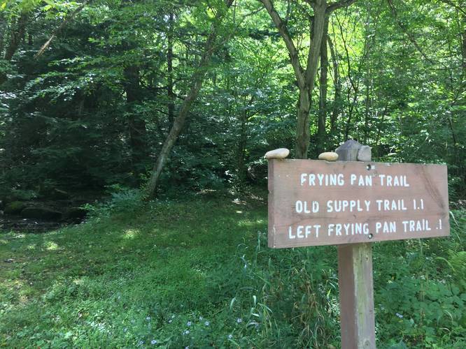
Once hikers make it to the eastern side of the trail, you'll find the trail junction with the Frying Pan Trail and the larger parking lot.
Warning
This trail crosses the creek twice and while the creek crossings are not difficult, they're also not always the most straight-forward to cross either. Take your time and stay low to the ground in case you need to get from rock to rock to avoid injury. Do not attempt the creek crossing if the water level is very high and rushing to prevent risk of drowning.
Parking
The parking coordinates will bring you to a small parking turnoff area next to the Big Tree Hollow Trail; however, you can also park here: at the eastern trailhead for this trail. The eastern trailhead is a full off-road parking lot that can accommodate about 3 vehicles.
Pets
Dogs are allowed if leashed and their waste must be carried out by the hiker.
Bugs
Plan to bring bug spray for the Summer and warmer months. Black eye gnats can be a problem on this trail and they're generally quite relentless.
Water Source
If you use a water filter, you can filter water in the creek to refill your water bottle.
Camping
Camping is not allowed on this trail despite the state forest's primitive camping rules. Designated signs state "no camping" at the trailheads.
Winter Road Conditions
Tioga State Forest does not maintain this road during the winter. Do not attempt driving on this road without proper equipment including snow tires and/or chains unless the road is clear. High wind storms may also cause trees to fall across the road, making the road impassible. If you plan to visit during the winter, plan accordingly.
This track begins at the western trailhead, across the street from the Asaph Wild Area and the Big Tree Hollow Trail. The trail heads into the woods and immediately drops about 15-feet along a semi-steep grade to where the trail flattens out next to the creek.
The trail follows yellow blazes as it meanders along Left Branch Asaph Run. Along the creek, you'll find scenic mossy areas where you can sit and relax next to the trickling creek. Hikers will need to cross the creek a couple of times throughout the hike, so plan accordingly.
Once hikers make it to the eastern side of the trail, you'll find the trail junction with the Frying Pan Trail and the larger parking lot.
Warning
This trail crosses the creek twice and while the creek crossings are not difficult, they're also not always the most straight-forward to cross either. Take your time and stay low to the ground in case you need to get from rock to rock to avoid injury. Do not attempt the creek crossing if the water level is very high and rushing to prevent risk of drowning.
Parking
The parking coordinates will bring you to a small parking turnoff area next to the Big Tree Hollow Trail; however, you can also park here: at the eastern trailhead for this trail. The eastern trailhead is a full off-road parking lot that can accommodate about 3 vehicles.
Pets
Dogs are allowed if leashed and their waste must be carried out by the hiker.
Bugs
Plan to bring bug spray for the Summer and warmer months. Black eye gnats can be a problem on this trail and they're generally quite relentless.
Water Source
If you use a water filter, you can filter water in the creek to refill your water bottle.
Camping
Camping is not allowed on this trail despite the state forest's primitive camping rules. Designated signs state "no camping" at the trailheads.
Winter Road Conditions
Tioga State Forest does not maintain this road during the winter. Do not attempt driving on this road without proper equipment including snow tires and/or chains unless the road is clear. High wind storms may also cause trees to fall across the road, making the road impassible. If you plan to visit during the winter, plan accordingly.