Loading...

Landrus Wildlife Observation Blind Trail

Distance:
0.1 Miles / 0.2 km
Type:
Out-and-Back
Difficulty:
Easy
Time to Hike:
~5 minutes
Features:
PA Wilds
Surface Type:
Universal Access
Park:
Tioga State Forest
Town:
Arnot, Pennsylvania
Directions:
41.664636, -77.141894
Added:
March 14, 2021
Updated:
March 14, 2021
Loading...
Loading...
2 '

Total Change
2 '

Ascent
2 '

Descent

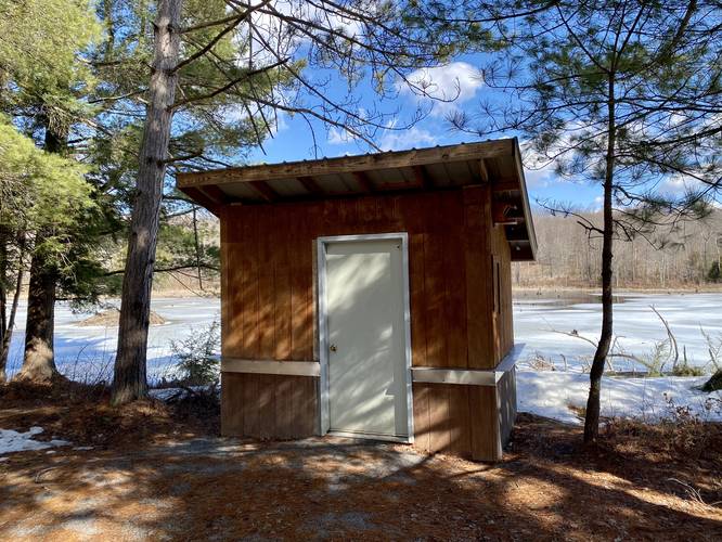
The Landrus Wildlife Observation Blind Trail at Tioga State Forest near Arnot, Pennsylvania is an easy 0.1-mile out-and-back trail that leads to a small blind that sits along a pond with several windows for wildlife viewing.

This trail is a universal access trail with gravel substrate - completely flat with almost no elevation change. It appears to have been built sometime in 2020 and as the sign states, it's a cooperative project between the Tiadaghton Audubon Society and the Pennsylvania Bureau of Forestry.

Wildlife Viewing
This trail is perfect for viewing wildlife like beaver, heron, and other bird species.

Parking
Hikers will find parking at the coordinates provided, but the lot is only large enough for about 2 vehicles. The road is not wide enough to park along either.

Pet
Dogs are allowed if leashed and their waste should be carried out by the hiker.

Explore 259 trails near Arnot, PA
  1. Parking

    41.664636, -77.141894
  2. Main Trailhead

    41.664741, -77.141957
  3. Wildlife viewing blind

    41.665181, -77.142364
    Wildlife viewing blind
  4. View of pond

    41.665325, -77.142478
    View of pond
No community routes found. To add your own hike as a Community Route for this Trail guide, leave a Trip Report with an attached GPX file.

Hazards

Ticks - Lyme Disease More Info (CDC)

Seasons

All

Photo Albums

2 Trip Reports

No Star-Ratings
Trail Guide By:
Admin user profile picture
0.1 miles / 0.2 km
Trail added
March 14, 2021
Hiked on
March 14, 2021
Updated on
March 14, 2021
0.1 miles / 0.2 km
March 14, 2021
Hiking

Weather Forecast

In Arnot, PA

Explore Hiking Trails

New Hikes

Hidden Valley Nature Trail
0.7 Miles
1.1 km
Easy
Loop
Conklin's Gully Loop
2.4 Miles
3.9 km
Hard
Loop
State Camp CCC Trail
0.7 Miles
1.1 km
Easy
Loop
Knoll-Willows Overlook Trail
0.2 Miles
0.3 km
Easy
One-Way

Before you boogie...

Find our trail guides useful? Consider becoming a Supporter to unlock perks!

MyHikes is an indie platform that makes exploring public trails easier for everyone. The platform has no investors, runs no ads, and is owned and operated by one person, Dave Miller. Dave has personally mapped and written over 1,600 trail guides on MyHikes for the public to explore. As of 2024, MyHikes has helped over 1,300,000 outdoor enthusiasts plan their next adventure.

But it takes a lot of time 🕦, money 💰, and work, and espresso shots ☕ to run MyHikes, including hiking , mapping , writing , and publishing new trails with high-quality (accurate) information... along with software engineering (coding) the platform like building new features, site and mobile app development for iOS and Android, site maintainance . and much much more.

Supporters unlock website and mobile app perks with an annual one-time payment of $25 (you renew) 😎👍. Or you can simply make a Donation of your choice. Otherwise, you can support us by telling your friends about MyHikes - both quick and free 🎉

Admin user profile picture

Dave Miller
MyHikes Founder