The Lagoon Trail to Lake Huron at Bay City State Park in Bay City, Michigan is a 1-mile out-and-back walk that leads to a view of a lakeside lagoon and views of Lake Huron's Saginaw Bay from the shore.
Universal Accessibility
This walk follows a universally accessible paved trail that ends along the shores of Lake Huron.
Walk Description
This walk begins at the northwest corner of the main parking lot for Bay City State Park and heads in along the Lagoon Trail to first reach a boardwalk that juts over the lagoon. Here, visitors can get a nice view of the water, go fishing (permit required), or get a view of wildlife.
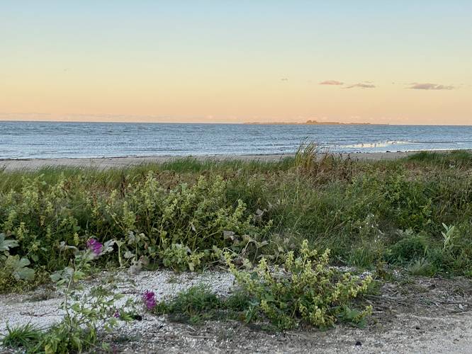
After passing the lagoon, the track heads southeast along the paved path as it heads towards the shores of Lake Huron. Walkers will pass another large parking lot along the way before the trail curves around the parking lot to reach the shores of Lake Huron and Saginaw Bay. Once the path ends, visitors can walk onto the beach to get a better view of the lake. The walk back is opposite to the walk in, or walkers can take a different path meandering through the park to get back to parking for a ~1-mile walk.
Saginaw Bay According to the park's signage: "Saginaw Bay derives its name from the Sauk Indians [Native Americans] who once dwelt by its shores. Adrien Jolliet, on his voyage down Lake Huron's western shore in 1669, first made it known to the white man. In the late 1800's an immense lumber industry flourished in the region. Schooners by the scores daily passed through the bay bringing to the sawmills more logs and hauling off cut lumber. The bay's waters for years also made good business."
Parking & Fees
Visitors will find a massive parking lot at the coordinates provided. Out of state plates must pay a $10 fee as of September, 2022.
Pets
Dogs are allowed if leashed and their waste must be carried out by the hiker.
Restrooms
There are restroom facilities just south of where this trail turns around at the shores of Lake Huron.
Universal Accessibility
This walk follows a universally accessible paved trail that ends along the shores of Lake Huron.
Walk Description
This walk begins at the northwest corner of the main parking lot for Bay City State Park and heads in along the Lagoon Trail to first reach a boardwalk that juts over the lagoon. Here, visitors can get a nice view of the water, go fishing (permit required), or get a view of wildlife.
After passing the lagoon, the track heads southeast along the paved path as it heads towards the shores of Lake Huron. Walkers will pass another large parking lot along the way before the trail curves around the parking lot to reach the shores of Lake Huron and Saginaw Bay. Once the path ends, visitors can walk onto the beach to get a better view of the lake. The walk back is opposite to the walk in, or walkers can take a different path meandering through the park to get back to parking for a ~1-mile walk.
Saginaw Bay According to the park's signage: "Saginaw Bay derives its name from the Sauk Indians [Native Americans] who once dwelt by its shores. Adrien Jolliet, on his voyage down Lake Huron's western shore in 1669, first made it known to the white man. In the late 1800's an immense lumber industry flourished in the region. Schooners by the scores daily passed through the bay bringing to the sawmills more logs and hauling off cut lumber. The bay's waters for years also made good business."
Parking & Fees
Visitors will find a massive parking lot at the coordinates provided. Out of state plates must pay a $10 fee as of September, 2022.
Pets
Dogs are allowed if leashed and their waste must be carried out by the hiker.
Restrooms
There are restroom facilities just south of where this trail turns around at the shores of Lake Huron.