Discover the enchanting beauty of Lago di Carezza (Karersee in German or the "Rainbow Lake"), a small but stunning alpine lake nestled in the Dolomites of South Tyrol, Italy. Famous for its deep emerald-green waters and the dramatic reflection of the surrounding Latemar mountain range, this easily accessible trail is a must-visit. Located near Nova Levante (Welschnofen), this exquisite mountain lake is one of the most photographed sites in northern Italy.
Whether you're searching for the tranquility of the Karersee or the magical atmosphere of Lake Carezza, your journey here will be unforgettable. This guide details the quick, 1.43 km (0.9 miles) trail that offers universal access to the primary viewing area, ensuring everyone can experience the lake's legendary charm.
After passing the shops, the trail leads down into a tunnel where it runs under SS241 (Karerstrasse - Via Carezza) where you'll also find public restrooms along the way. On the opposite side of the tunnel is the official loop trail that encompasses Lago di Carezza (Lake Carezza).
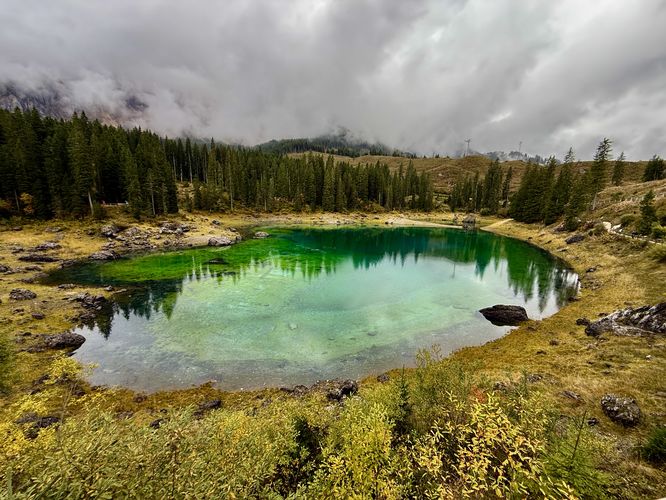
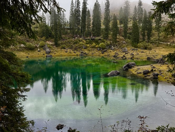
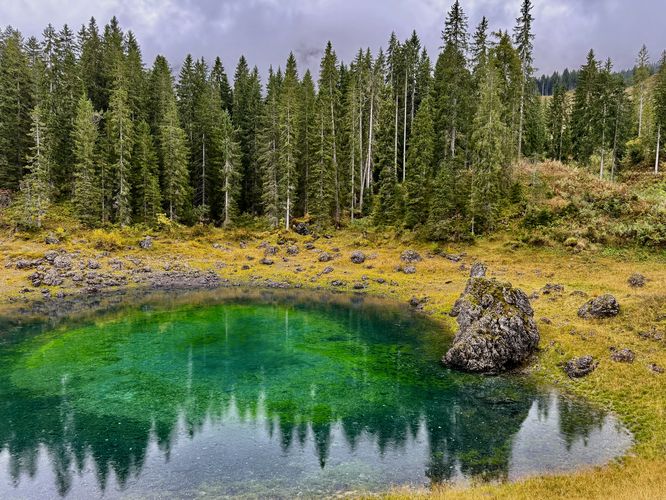
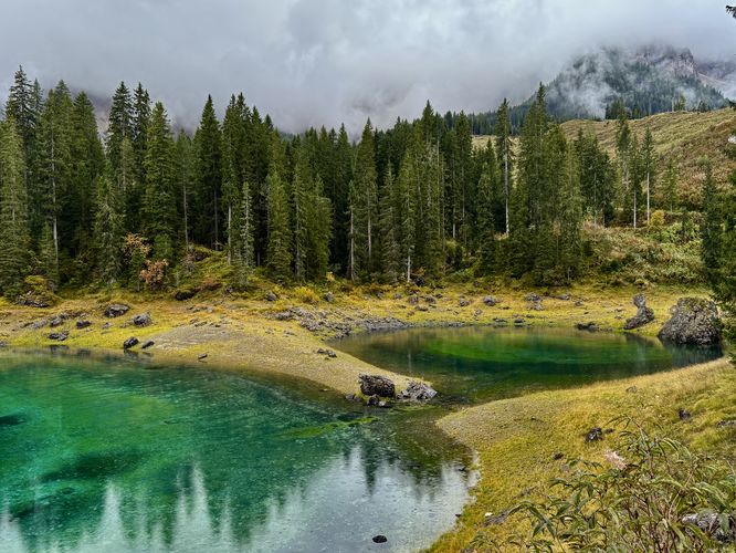
The trail then wraps around the western side of Lake Carezza, with at least one distant view of the lake from the path. Here, hikers will also find several trails that lead further into the alpine of the Dolomites, but this route continues along the water's edge instead. Eventually, the trail curves back to the north shore where some of the best views can be found. On the northwest side of the lake, visitors will find a small pond that connects to the main lake. This small pond includes several "layers" of emerald-turquoise colors, which form the shape of an eye. With a backdrop of the stunning alpine peaks of the Dolomites, the north shore views are unmatched along the Lago di Carezza Trail. As you hike back toward the observation deck, the views get better and better with more sweeping, 180-degree vistas of the emerald-turquoise waters of Lago di Carezza (Karersee).
The loop portion of the hike ends back at the junction with the observation deck overlook. If the weather changed or you want more pictures from the observation deck overlook, now is your chance before you hike back to parking. Enjoy the last views of Lago di Carezza, then follow the trail back through the tunnel to connect back to the parking lot. The hike wraps up at the parking for a short and easy, but stunning 1.4 km (0.9 mile) alpine lake hike around Lago di Carezza.
Whether you're searching for the tranquility of the Karersee or the magical atmosphere of Lake Carezza, your journey here will be unforgettable. This guide details the quick, 1.43 km (0.9 miles) trail that offers universal access to the primary viewing area, ensuring everyone can experience the lake's legendary charm.
Lago di Carezza (Karersee) Trail Guide: Access, Parking & The Rainbow Lake Loop
This hike around Lago di Carezza begins in the main, large parking lot where visitors will find a path that runs along the east side of the entrance road. The path leads toward "Rainbow Lake", but hits a fork where visitors can grab a bite to eat or an espresso for the walk. During our visit to Lago di Carezza, we stopped at a small shop for a double shot of espresso to refuel before the short hike.After passing the shops, the trail leads down into a tunnel where it runs under SS241 (Karerstrasse - Via Carezza) where you'll also find public restrooms along the way. On the opposite side of the tunnel is the official loop trail that encompasses Lago di Carezza (Lake Carezza).
Universal Access and the Observation Deck Overlook
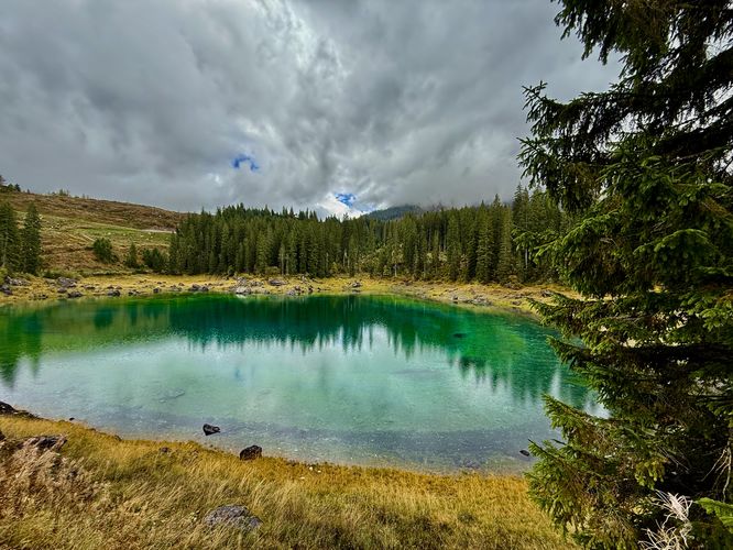
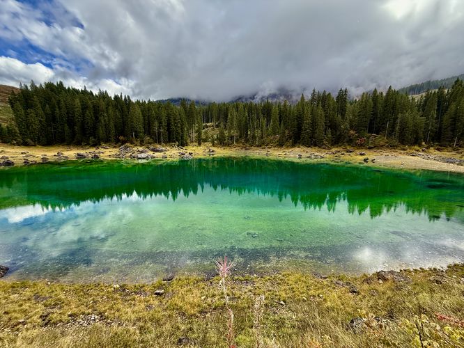
After exiting the south side of the tunnel, the first spot you'll want to visit along the trail is the large observation deck overlook that sits above the emerald-turquoise waters of Lago di Carezza. Here, visitors can enjoy some of the best views of Lake Carezza, especially for visitors who are in wheelchairs or have mobility issues. The observation deck is the perfect place for photos, selfies, and to take in the breathtaking views of this alpine lake in the heart of the Dolomites!Hiking the Lake Carezza Trail
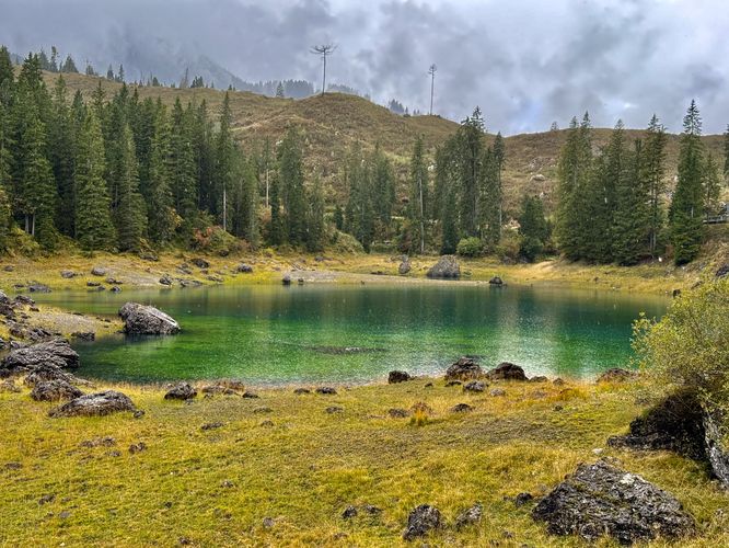
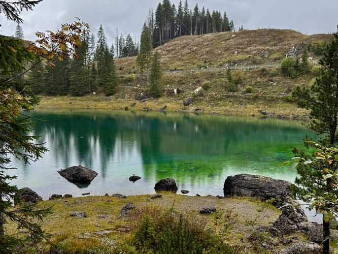
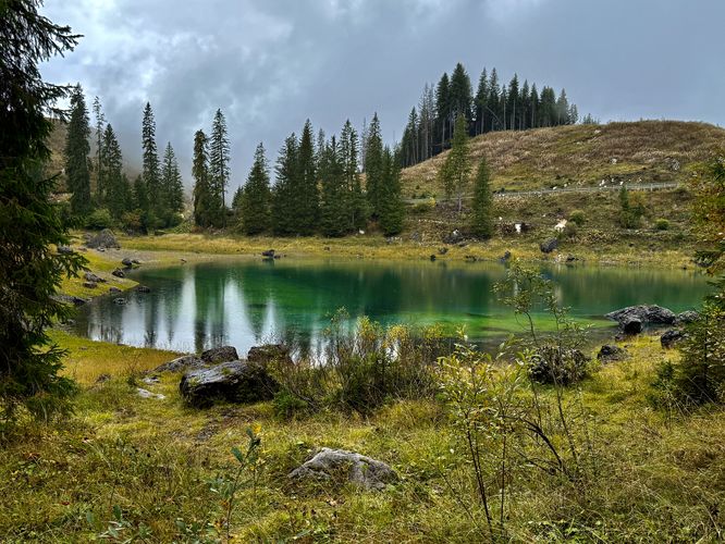
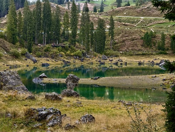
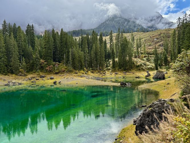
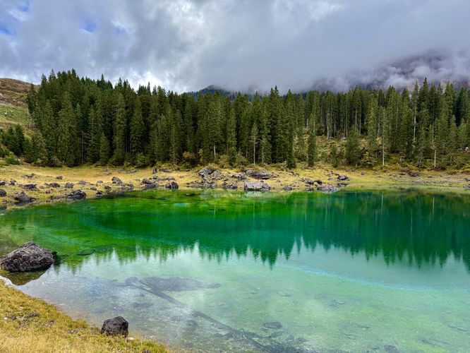
The next stops along this route lead you around the entire lake to take in views from various points of the deep emerald-turquoise hues of Lake Carezza (Karersee). From the observation deck, the loop leads eastward before heading to the south side of the lake where you'll find views along the way. The eastern side of the Lago di Carezza Trail have distant views of the lake, but they're still worth exploring. As you reach the south side of the lake, the trail will switch from a crushed gravel, universally-acccessible path to a root-filled, rocky path. Along the south side of the trail, visitors will find a few different overlooks and viewpoints of Lago di Carezza with views back toward the road and observation deck. While the views might not boast the stunning alpine peaks of the Dolomites, the south side of the lake is much quieter and more secluded than the north.The trail then wraps around the western side of Lake Carezza, with at least one distant view of the lake from the path. Here, hikers will also find several trails that lead further into the alpine of the Dolomites, but this route continues along the water's edge instead. Eventually, the trail curves back to the north shore where some of the best views can be found. On the northwest side of the lake, visitors will find a small pond that connects to the main lake. This small pond includes several "layers" of emerald-turquoise colors, which form the shape of an eye. With a backdrop of the stunning alpine peaks of the Dolomites, the north shore views are unmatched along the Lago di Carezza Trail. As you hike back toward the observation deck, the views get better and better with more sweeping, 180-degree vistas of the emerald-turquoise waters of Lago di Carezza (Karersee).
The loop portion of the hike ends back at the junction with the observation deck overlook. If the weather changed or you want more pictures from the observation deck overlook, now is your chance before you hike back to parking. Enjoy the last views of Lago di Carezza, then follow the trail back through the tunnel to connect back to the parking lot. The hike wraps up at the parking for a short and easy, but stunning 1.4 km (0.9 mile) alpine lake hike around Lago di Carezza.