The Kirk Park Connector Trail at Kirk Park in West Olive, Michigan is an easy 0.3-mile out-and-back trail that connects the northern parking lot to the shores of Lake Michigan.
This short and easy trail leads hikers out to a beautiful view point of Lake Michigan. Hikers will find high bluffs and forested dunes along this hike. During the winter, this trail and other trails at the park are used for cross country skiing as well.
Pets
Dogs are allowed if leashed and their waste must be carried out by the hiker.
Parking
Hikers will find a very large parking lot at the coordinates provided.
Author's Note
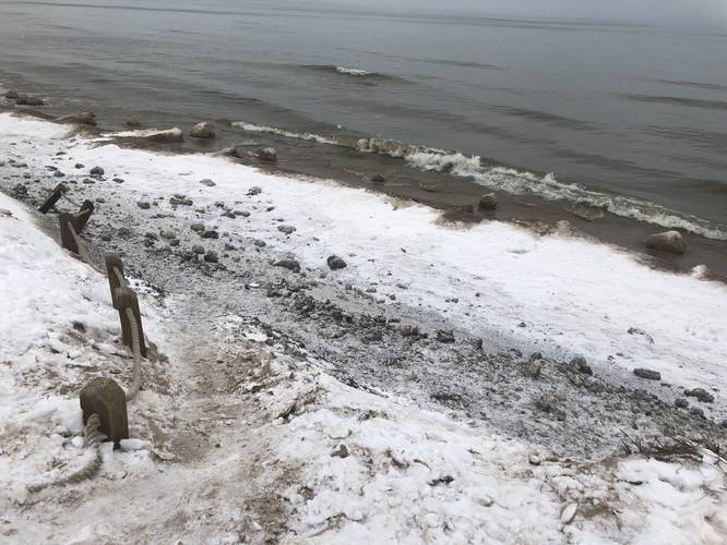
Because of high water levels and extreme beach/dune erosion, much of Kirk Park is presently closed, including several of the dune paths. The North side trail to the beach, featured above, presently ends in a steep drop and hazardous beach conditions. Exercise extreme caution at Kirk Park this season (winter 2020)!
This short and easy trail leads hikers out to a beautiful view point of Lake Michigan. Hikers will find high bluffs and forested dunes along this hike. During the winter, this trail and other trails at the park are used for cross country skiing as well.
Pets
Dogs are allowed if leashed and their waste must be carried out by the hiker.
Parking
Hikers will find a very large parking lot at the coordinates provided.
Author's Note
Because of high water levels and extreme beach/dune erosion, much of Kirk Park is presently closed, including several of the dune paths. The North side trail to the beach, featured above, presently ends in a steep drop and hazardous beach conditions. Exercise extreme caution at Kirk Park this season (winter 2020)!