Loading...

Distance:
0 Miles / 0 km
Type:
One-Way
Difficulty:
Easy
Time to Hike:
~5 minutes
Features:
Surface Type:
Dirt
Town:
Hanksville, Utah
Directions:
38.459388, -110.675244
Added:
September 28, 2023
Updated:
November 30, 2023
Loading...
Loading...
0 '

Total Change
0 '

Ascent
0 '

Descent

Kathline Rock near Hanksville, Utah is a roadside stop in the middle of Utah's vast desert that provides interesting views of the desert landscape including Kathline Rock and distant mesas.

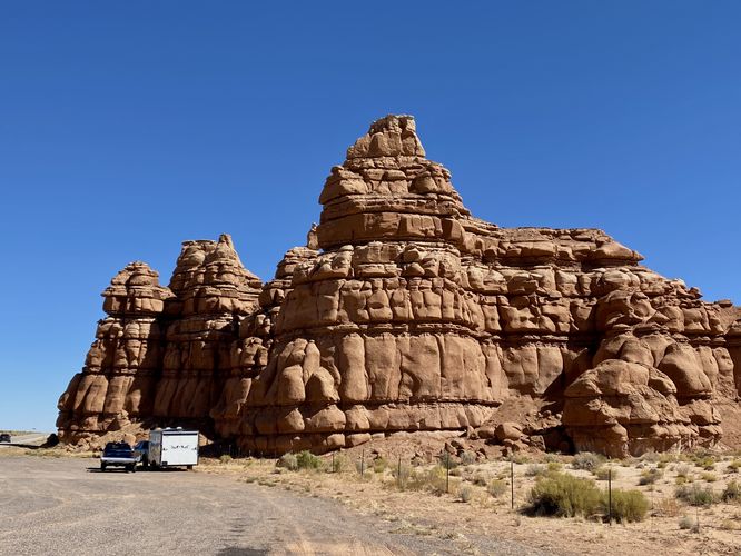
This is not a hike and not necessarily even a walk, unless you need to stretch your legs on a long Utah road trip. Kathline Rock is a massive rock formation that sits along the south side of UT-24. Note that Kathline Rock sits on private property, defined by a fence line with posted signs. The roadside stop is open to the public, but do not trespass.

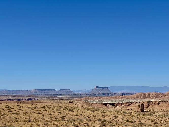
To the north of UT-24 are views of Utah's vast southern desert with massive mesas that jut out of the earth like random tables scattered throughout.

Parking
Visitors will find a large parking turnout at the coordinates provided.

Pets
Dogs are allowed only if leashed and should be cleaned up after.

Explore 1 trail near Hanksville, UT
  1. Parking

    38.459388, -110.675244
  2. Main Trailhead

    38.459463, -110.675194
  3. View of distant mesas in Utah's vast landscape from Kathline Rock

    38.459439, -110.6753
    View of distant mesas in Utah's vast landscape from Kathline Rock
  4. View of Kathline Rock (private property, dont pass fence line)

    38.459464, -110.675164
     View of Kathline Rock (private property, dont pass fence line)
No community routes found. To add your own hike as a Community Route for this Trail guide, leave a Trip Report with an attached GPX file.

Hazards

Snakes

Seasons

All

Photo Albums

2 Trip Reports

No Star-Ratings
Write-up by:
Admin user profile picture
0 miles / 0 km
Trail added
September 28, 2023
Hiked on
September 27, 2023
Updated on
November 30, 2023
0 miles / 0 km
September 27, 2023
Roadside stop. It's a bunch of rocks
Hiking

Weather Forecast

In Hanksville, UT

Explore Hiking Trails

New Hikes

Upper Rattler Run Falls
1.9 Miles
3.1 km
Hard
Out-and-Back
Tibwin Plantation Trail
0.9 Miles
1.4 km
Easy
Out-and-Back
Diana's Baths Trail
1.2 Miles
1.9 km
Easy
Out-and-Back
Mt. Morris Dam Overlook
3.3 Miles
5.3 km
Easy
Out-and-Back

Before you leave...

MyHikes is an indie web platform aimed to make exploring public trails easier for everyone. The site has no investors and is owned and operated by one person, Dave Miller (Founder & Admin). As the Founder, main contributor, and doer-of-all-things for MyHikes, I share my trips with over-detailed write-ups for fun on a volunteer basis and I believe that public trail information should be available to everyone.

It takes a lot of time 🕦, money 💰, and effort (including espresso shots ☕) to run MyHikes, including hiking , mapping , writing , and publishing new trails with high-quality content... along with building new features, moderating, site maintainance, and app development for iOS and Android . I simply ask that if you find MyHikes' trail guides helpful to please consider becoming a Supporter to help keep the site, iOS, and Android apps available to everyone.

Supporters unlock website and in-app perks with a one-time payment of $25 (you renew) 😎👍. Or you can simply make a Donation of your choice without a MyHikes user account. Otherwise, telling your friends about MyHikes is the next-best thing - both quick and free 🎉

Thanks for visiting MyHikes and have a great hike!️

Admin user profile picture

Dave Miller
MyHikes Founder & Admin