The Ka'anapali Beachwalk in Ka'anapali, Hawaii (Maui) is a crowded and easy 2.7-mile out-and-back trail that runs along Ka'anapali Beach and features views of Lanai, Molokai, and as of Feb 2023 includes a shipwreck on the beach.
Walk Description
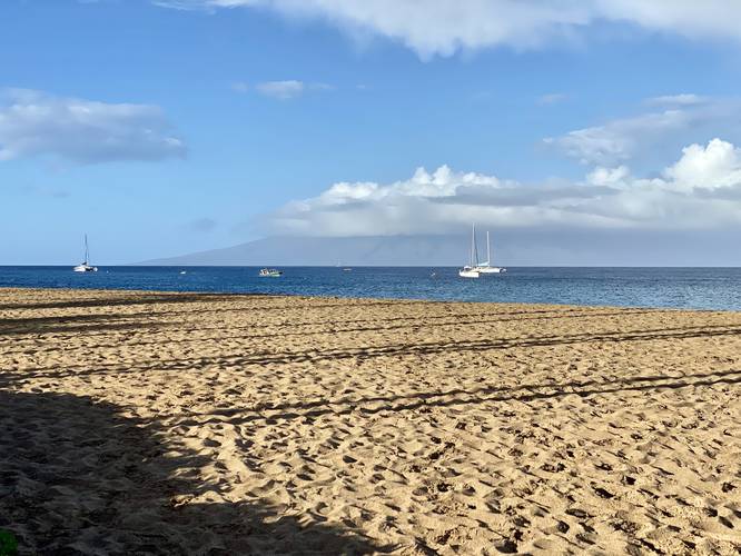
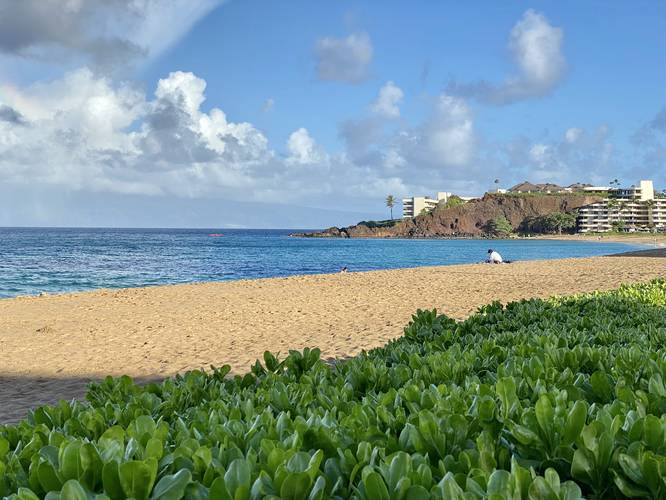
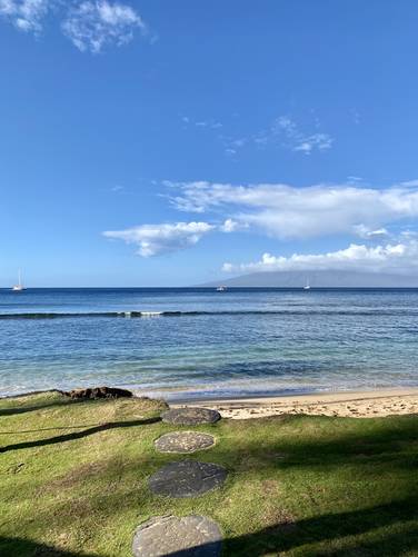
This is not a hike, but rather a nice long walk along a fully-paved path. Aside from the constant views of Lanai and Molokai, walkers get to enjoy the manicured resort pathway that extends the length of Ka'anapali Beach. Right where the walker enters, just north, is Black Rock Beach - a popular snorkel and cliff jumping spot where the waters are generally very calm on the south face of Black Rock cliffs.
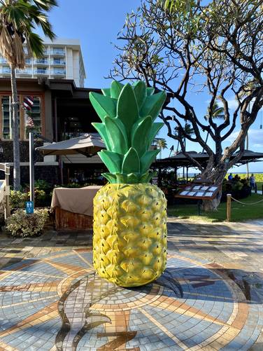
Giant Pineapple - Mile 0.4
As of February 2023, there's a large pineapple located on-trail around mile 0.4, which is an interesting sight and in general a photo-taking spot for visitors.
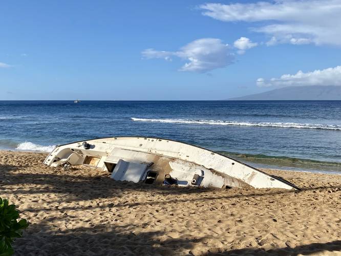
Shipwreck - Mile 0.8
As of February 2023, there's a shipwreck located on the beach just off-trail around mile 0.8. It's unclear how old this ship has been stranded and abandoned on the beach or if the state of Hawaii has any plans to remove it. For now, it's a neat oddity on this walk.
End of Trail / Turn-Around - Mile 1.35
Eventually, if you walk the entire length of the trail, you'll reach the end located just north of Hanakao'o Beach Park located around mile 1.35. Here, the walk back is just as flat and enjoyable.
Connecting to Ka'anapali Beach Path
Walkers can connect this southern trail to another trail that runs along Ka'anapali Beach, located to the north, called the Ka'anapali Beach Path if you walk through the resort areas located between both routes.
Accessibility
This trail is fully accessible. Note that as of February, 2023, a small section of the trail was washed away and thus is rerouted along a fully-paved and accessible pathway. Walkers can choose to take the paved path or walk through sand. Please note that this rerouted path is not depicted in this trail map.
Parking
Walkers will find a small parking lot at the coordinates provided that allows for about 10 vehicles to park for public beach and trail access. On the southern end of the trail, at 20.910040, -156.688575, you may find additional public parking at Hanakao'o Park.
Pets
Dogs are not allowed on this trail.
Popularity
This trail connects several resorts and runs along a popular beach, thus this trail is generally very busy all day, especially during the morning.
Respecting the Land
Hawaiian land is considered sacred to native Hawaiians and many locals, so please stay on-trail, take nothing but photos, and leave nothing but footprints. Respect the locals - don't stay for long and have a backup hike planned in case the parking lot is full.
Walk Description
This is not a hike, but rather a nice long walk along a fully-paved path. Aside from the constant views of Lanai and Molokai, walkers get to enjoy the manicured resort pathway that extends the length of Ka'anapali Beach. Right where the walker enters, just north, is Black Rock Beach - a popular snorkel and cliff jumping spot where the waters are generally very calm on the south face of Black Rock cliffs.
Giant Pineapple - Mile 0.4
As of February 2023, there's a large pineapple located on-trail around mile 0.4, which is an interesting sight and in general a photo-taking spot for visitors.
Shipwreck - Mile 0.8
As of February 2023, there's a shipwreck located on the beach just off-trail around mile 0.8. It's unclear how old this ship has been stranded and abandoned on the beach or if the state of Hawaii has any plans to remove it. For now, it's a neat oddity on this walk.
End of Trail / Turn-Around - Mile 1.35
Eventually, if you walk the entire length of the trail, you'll reach the end located just north of Hanakao'o Beach Park located around mile 1.35. Here, the walk back is just as flat and enjoyable.
Connecting to Ka'anapali Beach Path
Walkers can connect this southern trail to another trail that runs along Ka'anapali Beach, located to the north, called the Ka'anapali Beach Path if you walk through the resort areas located between both routes.
Accessibility
This trail is fully accessible. Note that as of February, 2023, a small section of the trail was washed away and thus is rerouted along a fully-paved and accessible pathway. Walkers can choose to take the paved path or walk through sand. Please note that this rerouted path is not depicted in this trail map.
Parking
Walkers will find a small parking lot at the coordinates provided that allows for about 10 vehicles to park for public beach and trail access. On the southern end of the trail, at 20.910040, -156.688575, you may find additional public parking at Hanakao'o Park.
Pets
Dogs are not allowed on this trail.
Popularity
This trail connects several resorts and runs along a popular beach, thus this trail is generally very busy all day, especially during the morning.
Respecting the Land
Hawaiian land is considered sacred to native Hawaiians and many locals, so please stay on-trail, take nothing but photos, and leave nothing but footprints. Respect the locals - don't stay for long and have a backup hike planned in case the parking lot is full.