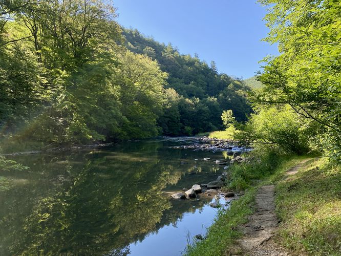
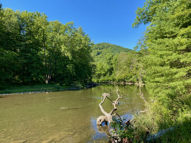
The John & Ann Snyder Trail at Poe Paddy State Park near Woodward, Pennsylvania is an easy 0.6-mile out-and-back trail that runs along Penn's Creek and provides views of the water and Paddy Mountain that sits in the background.
Hike
This hike begins at the parking lot for the Poe Paddy boat launch (canoe/kayak launch). Hikers will follow the main trailhead that leads down from the parking lot to reach the banks of Penn's Creek. This route leads south first to reach a wide tributary creek crossing -- about 10-feet wide. During our hike here in early July 2024, this tributary creek was still flowing fairly strong and for our 2nd trail of the day, we decided not to get our feet wet. We turned back to follow the trail north instead, hence the GPS track provided.
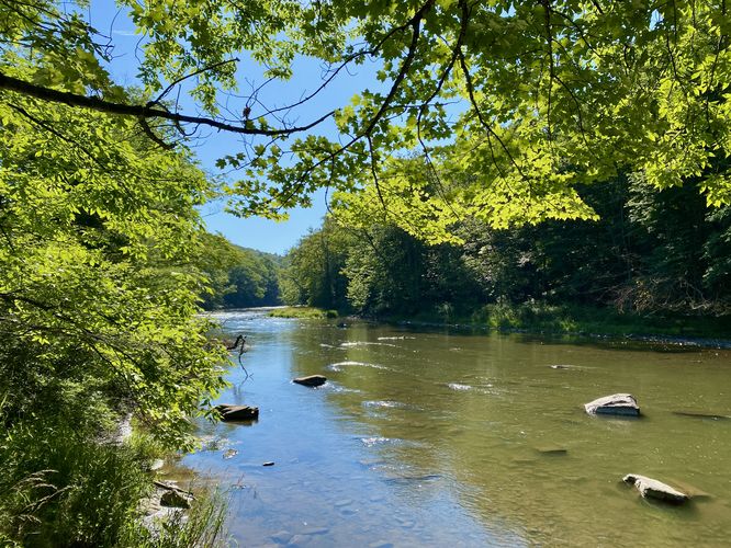
Heading north along Penn's Creek, hikers will first pass a sign labeled "John & Ann Snyder Trail" before the trail leads further along the water. This route does not last for long - we ran into a decent amount of bugs and overgrowth. The trail becomes skinnier with more vegetation growing into the trail, which wasn't that bad, but the bugs made it worse. We lasted for about 0.3-miles in total before turning back for this short 0.6-mile hike along the John & Ann Snyder Trail.
Parking
Hikers will find a small parking lot at the coordinates provided, located in the middle of Poe Paddy State Park at the boat launch area. The lot is large enough to fit less than a dozen vehicles as of July 2024.
Pets
Dogs are allowed only if leashed and must be cleaned up after.
Hike
This hike begins at the parking lot for the Poe Paddy boat launch (canoe/kayak launch). Hikers will follow the main trailhead that leads down from the parking lot to reach the banks of Penn's Creek. This route leads south first to reach a wide tributary creek crossing -- about 10-feet wide. During our hike here in early July 2024, this tributary creek was still flowing fairly strong and for our 2nd trail of the day, we decided not to get our feet wet. We turned back to follow the trail north instead, hence the GPS track provided.
Heading north along Penn's Creek, hikers will first pass a sign labeled "John & Ann Snyder Trail" before the trail leads further along the water. This route does not last for long - we ran into a decent amount of bugs and overgrowth. The trail becomes skinnier with more vegetation growing into the trail, which wasn't that bad, but the bugs made it worse. We lasted for about 0.3-miles in total before turning back for this short 0.6-mile hike along the John & Ann Snyder Trail.
Parking
Hikers will find a small parking lot at the coordinates provided, located in the middle of Poe Paddy State Park at the boat launch area. The lot is large enough to fit less than a dozen vehicles as of July 2024.
Pets
Dogs are allowed only if leashed and must be cleaned up after.