Loading...

Distance:
0.2 Miles / 0.3 km
Type:
Loop
Difficulty:
Easy
Time to Hike:
~6 minutes
Surface Type:
Dirt
Park:
Capitol Reef National Park
Town:
Fruita, Utah
Directions:
38.289458, -111.25594
Added:
September 28, 2023
Updated:
October 04, 2023
Loading...
Loading...
10 '

Total Change
11 '

Ascent
11 '

Descent

Jackson Orchard at Capitol Reef National Park near Fruita, Utah is an easy 0.2-mile loop walk that features seasonal apple picking.

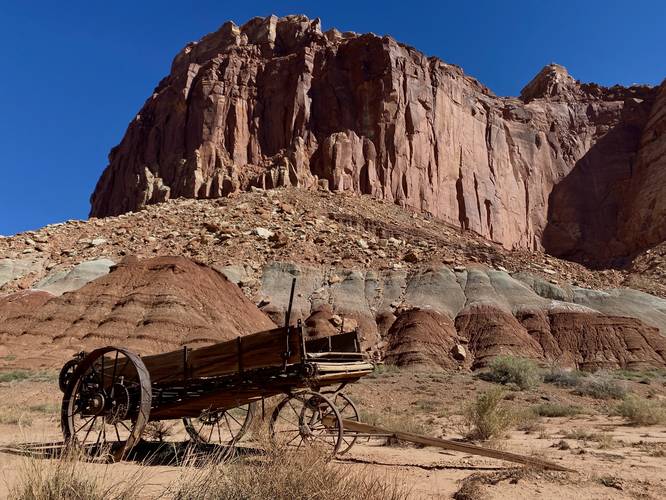
This is not a hike but rather a short walk through a historic apple orchard that the national park still keeps-up. During apple season (end of September), and when the park has this orchard open, visitors can walk through Jackson Orchard to pick apples for a modest fee. During our visit here in September, 2023 the apples were $2/pound. We hiked through the orchard picking the best apples we could find while taking in the scenery of Capitol Reef's towering rock walls high above our heads.

Parking
Visitors will find a small parking lot at the coordinates provided.

Pets
Dogs are not allowed in the orchard.

Warning
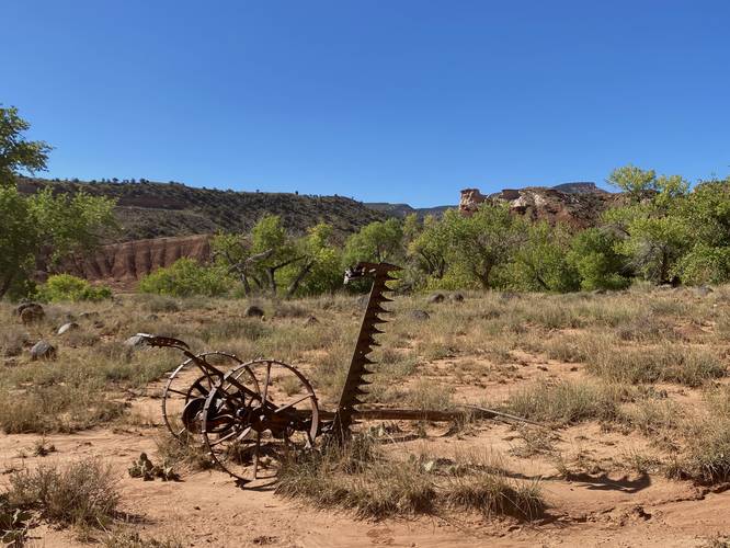
Rough terrain: Note that this orchard's terrain is full of ruts by tractors (or maybe wagons from another era), so watch your step and go slow otherwise you'll likely roll your ankles over and over again.

Explore 20 trails near Fruita, UT
  1. Parking

    38.289458, -111.25594
  2. Main Trailhead

    38.289422, -111.255855
  3. Old orchard / farming equipment

    38.289711, -111.256369
    Old orchard / farming equipment
  4. Old orchard / farming wagon

    38.2896, -111.256089
    Old orchard / farming wagon
No community routes found. To add your own hike as a Community Route for this Trail guide, leave a Trip Report with an attached GPX file.

Hazards

Snakes

Seasons

All

Photo Albums

2 Trip Reports

No Star-Ratings
Write-up by:
Admin user profile picture
0.2 miles / 0.3 km
Trail added
September 28, 2023
Hiked on
September 27, 2023
Updated on
October 04, 2023
0.2 miles / 0.3 km
September 27, 2023
Hiking

Weather Forecast

In Fruita, UT

Explore Hiking Trails

New Hikes

Raven Rocks via Appalachian Trail
5.1 Miles
8.2 km
Strenuous
Out-and-Back
Battery Warren Trail
1 Mile
1.6 km
Easy
Out-and-Back
Keshequa Creek Falls Trail
2.9 Miles
4.7 km
Easy
Out-and-Back
Mt. Morris Dam Overlook
3.3 Miles
5.3 km
Easy
Out-and-Back

Before you leave...

MyHikes is an indie web platform aimed to make exploring public trails easier for everyone. The site has no investors and is owned and operated by one person, Dave Miller (Founder & Admin). As the Founder, main contributor, and doer-of-all-things for MyHikes, I share my trips with over-detailed write-ups for fun on a volunteer basis and I believe that public trail information should be available to everyone.

It takes a lot of time 🕦, money 💰, and effort (including espresso shots ☕) to run MyHikes, including hiking , mapping , writing , and publishing new trails with high-quality content... along with building new features, moderating, site maintainance, and app development for iOS and Android . I simply ask that if you find MyHikes' trail guides helpful to please consider becoming a Supporter to help keep the site, iOS, and Android apps available to everyone.

Supporters unlock website and in-app perks with a one-time payment of $25 (you renew) 😎👍. Or you can simply make a Donation of your choice without a MyHikes user account. Otherwise, telling your friends about MyHikes is the next-best thing - both quick and free 🎉

Thanks for visiting MyHikes and have a great hike!️

Admin user profile picture

Dave Miller
MyHikes Founder & Admin