The Jabish Brook Loop Trail at the Jabish Brook Conservation Area in Belchertown, Massachuetts is an easy 1.2 mile hike trail. This easy forested loop trail provides
access to the pristine Jabish Brook and a
window into abundant wildlife habitat.
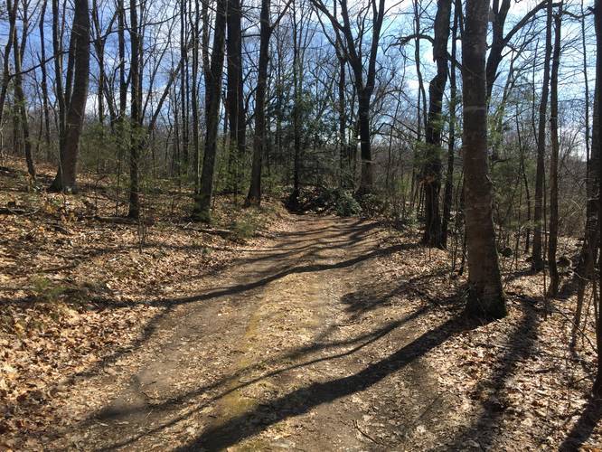
Route: This counterclockwise loop trail is just over 1 mile, and includes a handful of bridges. Follow the trail down from the parking area that is located a few hundred yards off 202, to Jabish Brook. Cross over the main bridge and turn right where the trail forks. The trail is well marked with a yellow star on a blue blaze. You will walk up a low ridge with mountain laurel, which is spectacular in late spring. The walk is then slightly uphill through deciduous forest, and small bridges allow you to cross seasonal brooks. The many nibbled hemlock saplings indicate that moose visit the area. Look for a big oak and further on a rock puzzle. The trail enters a shady hemlock forest with an inviting, open understory. There are numerous large sitting rocks; find a favorite one to sit on and enjoy the forest with all your senses! The trail descends back to Jabish Brook and stays close to the water. Enjoy the flowing water and note the Boy Scout hut on the left. Head back over the bridge and up to the trailhead where you began.
Waterfalls: During wetter seasons, you can often find smaller waterfalls along the brook.
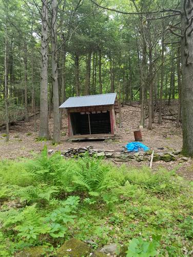
Shelter camping: There's a shelter located along the trail with a fire pit. There are no signs that permit or prohibit camping. Considering the shelter and fire pit, camping is likely allowed here.
Partner: This trail was submitted by our partner, Kestrel Land Trust. Kestrel Land Trust partners with towns to create, conserve, and care for public lands to help everyone connect with nature. The conservation lands here are owned by the Town and portions are monitored by Kestrel through a Conservation Restriction.
Route: This counterclockwise loop trail is just over 1 mile, and includes a handful of bridges. Follow the trail down from the parking area that is located a few hundred yards off 202, to Jabish Brook. Cross over the main bridge and turn right where the trail forks. The trail is well marked with a yellow star on a blue blaze. You will walk up a low ridge with mountain laurel, which is spectacular in late spring. The walk is then slightly uphill through deciduous forest, and small bridges allow you to cross seasonal brooks. The many nibbled hemlock saplings indicate that moose visit the area. Look for a big oak and further on a rock puzzle. The trail enters a shady hemlock forest with an inviting, open understory. There are numerous large sitting rocks; find a favorite one to sit on and enjoy the forest with all your senses! The trail descends back to Jabish Brook and stays close to the water. Enjoy the flowing water and note the Boy Scout hut on the left. Head back over the bridge and up to the trailhead where you began.
Waterfalls: During wetter seasons, you can often find smaller waterfalls along the brook.
Shelter camping: There's a shelter located along the trail with a fire pit. There are no signs that permit or prohibit camping. Considering the shelter and fire pit, camping is likely allowed here.
Partner: This trail was submitted by our partner, Kestrel Land Trust. Kestrel Land Trust partners with towns to create, conserve, and care for public lands to help everyone connect with nature. The conservation lands here are owned by the Town and portions are monitored by Kestrel through a Conservation Restriction.