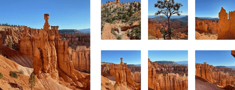
Inspiration Point at Bryce Canyon National Park is a moderate and popular 0.7-mile out-and-back hike that features three main vista points with stunning panoramic views into Bryce Canyon and its hoodoos.
Hike
This hike begins at the main parking lot for Inspiration Point / Lower Inspiration Point at the coordinates provided and follows the Rim Trail to reach Lower Inspiration Point first.
Lower Inspiration Point - Mile 0.05
Right as the hiker steps onto the Rim Trail, hikers will find Lower Inspiration Point. The view into Bryce Canyon from this vista is stunning and if you don't wish to hike any further, you don't necessarily need to (although Upper Inspiration Point is by-far the best view). After taking in the views, hike south along the Rim Trail to reach Middle Inspiration Point.
Middle Inspiration Point - Mile 0.13
Just south of the first vista, hikers will reach Middle Inspiration Point, which provides hikers with a similar, but still stunning view into Bryce Canyon and the hoodoos below. Middle Inspiration Point is a great view, but the real interesting part of this hike begins to show up if you put in a bit more legwork to reach Upper Inspiration Point.
Reaching Upper Inspiration Point
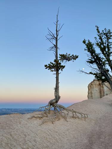
The hike to Upper Inspiration Point is where the actual moderate difficulty shows its true rating, but also where hikers will find more views into the canyon from the trail (don't walk too far to the edge), pine trees with exposed root structures clinging onto the cliff's edges, and scenic canyon plunges where hikers can peer into Bryce Canyon for different perspectives along the way. One scenic spot along the trail is the junction to Upper Inspiration Point with its trail sign located just above a super-steep canyon "hollow".
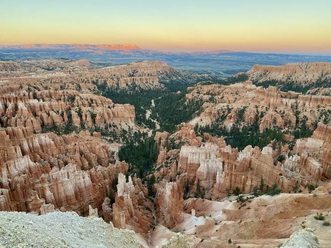
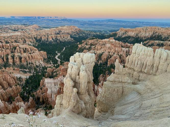
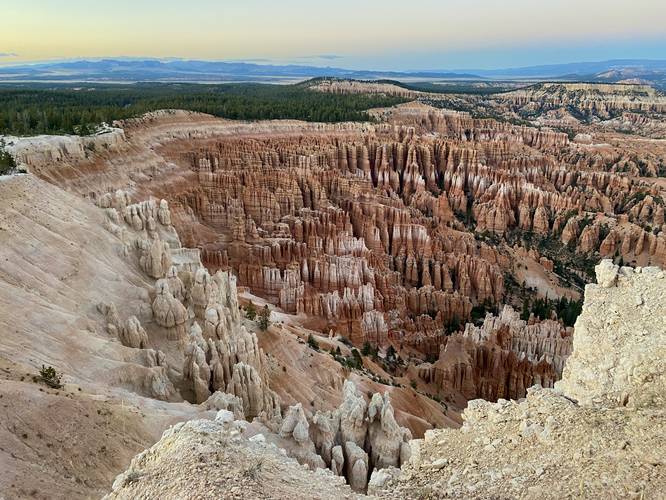
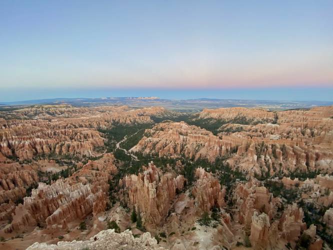
Upper Inspiration Point - Mile 0.33
Around mile 0.33, hikers will reach Upper Inspiration Point which is located on a jutting rock outcropping at the edge of the canyon's rim. Here, hikers will get nearly-360 panoramic views into Bryce Canyon. The best view by far is facing south with all of the hoodoos at your feet.
The hike out obviously follows the same path back to parking, but is all downhill for an easy hike back.
Fees
Bryce Canyon National Park has a $35/week entry fee as of September 2023. Visitors are highly encouraged to purchase an annual National Parks pass before their trip to reduce entry fees (especially if you're passing through multiple parks) and to also speed-up the very-long line that leads into the park.
Parking
Visitors will find a large parking lot at the coordinates provided.
Pets
Dogs are not allowed on this trail.
Hike
This hike begins at the main parking lot for Inspiration Point / Lower Inspiration Point at the coordinates provided and follows the Rim Trail to reach Lower Inspiration Point first.
Lower Inspiration Point - Mile 0.05
Right as the hiker steps onto the Rim Trail, hikers will find Lower Inspiration Point. The view into Bryce Canyon from this vista is stunning and if you don't wish to hike any further, you don't necessarily need to (although Upper Inspiration Point is by-far the best view). After taking in the views, hike south along the Rim Trail to reach Middle Inspiration Point.
Middle Inspiration Point - Mile 0.13
Just south of the first vista, hikers will reach Middle Inspiration Point, which provides hikers with a similar, but still stunning view into Bryce Canyon and the hoodoos below. Middle Inspiration Point is a great view, but the real interesting part of this hike begins to show up if you put in a bit more legwork to reach Upper Inspiration Point.
Reaching Upper Inspiration Point
The hike to Upper Inspiration Point is where the actual moderate difficulty shows its true rating, but also where hikers will find more views into the canyon from the trail (don't walk too far to the edge), pine trees with exposed root structures clinging onto the cliff's edges, and scenic canyon plunges where hikers can peer into Bryce Canyon for different perspectives along the way. One scenic spot along the trail is the junction to Upper Inspiration Point with its trail sign located just above a super-steep canyon "hollow".
Upper Inspiration Point - Mile 0.33
Around mile 0.33, hikers will reach Upper Inspiration Point which is located on a jutting rock outcropping at the edge of the canyon's rim. Here, hikers will get nearly-360 panoramic views into Bryce Canyon. The best view by far is facing south with all of the hoodoos at your feet.
The hike out obviously follows the same path back to parking, but is all downhill for an easy hike back.
Fees
Bryce Canyon National Park has a $35/week entry fee as of September 2023. Visitors are highly encouraged to purchase an annual National Parks pass before their trip to reduce entry fees (especially if you're passing through multiple parks) and to also speed-up the very-long line that leads into the park.
Parking
Visitors will find a large parking lot at the coordinates provided.
Pets
Dogs are not allowed on this trail.