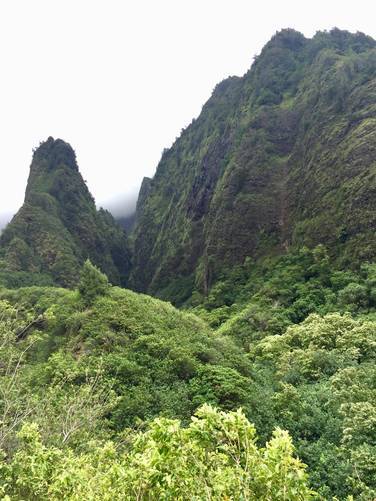
The 'Iao Needle Lookout Trail at 'Iao Valley State Monument in Wailuku, Maui is a moderate 0.7 mile out-and-back hike through a short paved path that leads along the 'Iao Stream and Kinihapai Stream with lookout points higher up near the end of the trail with views of the 'Iao Needle. The 'Iao Needle is a large rock spire that towers high above the 'Iao Valley in the middle of the west Maui mountains.
This is one of the most popular trails in central Maui and can get crowded, but the views and scenery are well worth the visit. Along the main trail, you'll find two offshoot trails which lead down to the 'Iao Stream and loop back up to the main trail.
The trail data here is a bit wonky due to the small offshoot trails, but the trail map picture in the photo albums depicts the trail better.
There are over a hundred steps at this trail as well, so it's not fully accessible.
Parking: Parking costs $5 at the gate, but you can also park for free along the road, just outside of the main parking lot if the parking lot is full.
Respecting the Land
Hawaiian land is considered sacred to native Hawaiians and many locals, so please stay on-trail, take nothing but photos, and leave nothing but footprints. Respect the locals - don't stay for long and have a backup hike planned in case the parking lot is full.