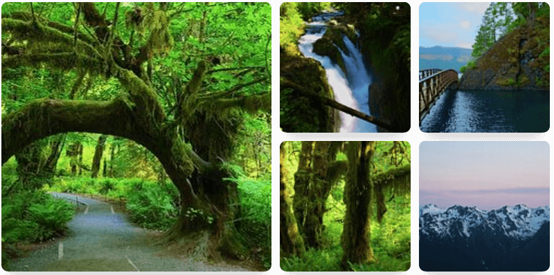
The Hoh River Trail hike at
Olympic National Park near Forks, Washington is an easy 2-mile out-and-back hike that features massive old-growth trees and lush vegetation within the Hoh Rainforest and leads to a nice view of the Hoh River.
Explore the Hoh Rainforest via Hoh River Trail
This short out-and-back 2-mile hike leads visitors along a very short section of the very-long Hoh River Trail. While most hikers and day visitors will focus their attention on the
Hall of Mosses Trail and the
Spruce Nature Trail, the Hoh River Trail has plenty to offer as well, albeit it's a less-popular option for visitors to the Hoh Rainforest.
The Hoh River Trail begins on the north side of the
Spruce Nature Trail, just a stone's throw from the
Spruce Nature Trail's trailhead, at the coordinates provided. The path leads through the forest as it heads eastward, following closely to the Hoh River, but just far enough away that you would never know it existed. As you hike the Hoh River Trail, you'll initially pass a point-of-interest distance sign that labels several locations that visitors might be interested in. The closest POI on the sign is ~2.9-miles (one-way), so if you plan to explore the entire Hoh River Trail, consider a wilderness backpacking permit.
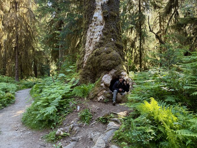
Old-Growth Notch Tree - Mile 0.1
Just up trail from the trailhead sits an old-growth tree that features a large hole or notch in its trunk. This funky natural oddity is a neat place to take a picture, especially if you can get your hiking companion to fit into the notch. It's especially fun for little kids or adults that can turn off their thinking cap and have a bit of fun.
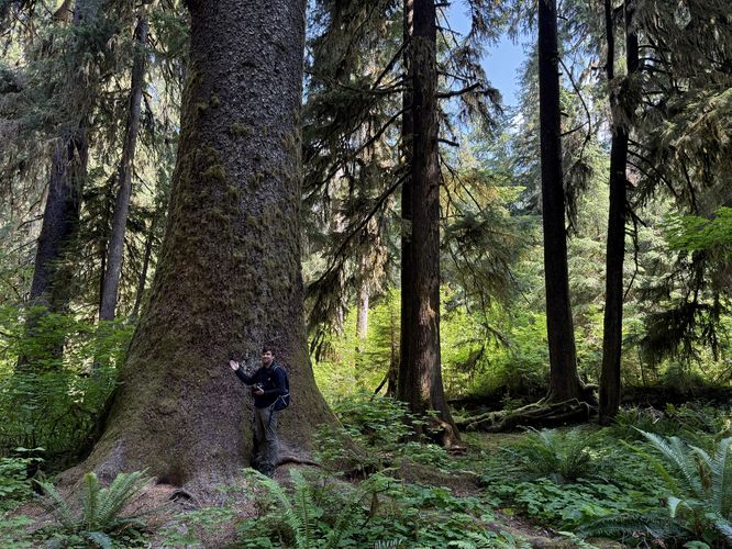
Old-Growth Tree - Mile 0.28
Around mile 0.28 sits another massive old-growth tree that can be found just off-trail. You literally cannot miss it, assuming you have decent eyesight. While it's difficult to tell the width or age of the tree, it's yet another spot to enjoy the old growths within the Hoh Rainforest.
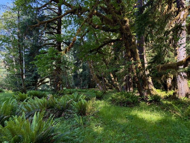
Hiking through Lush Rainforest - Mile 0.28 to 0.94
After passing the 2nd old-growth tree, the hike to reach the Hoh River view is straight forward. Simply follow the Hoh River Trail as it leads you through more lush vegetation of the rainforest, passing massive ferns and moss-covered trees along the way. Finally, around mile 0.94, you'll find a dirt path that leads south and out to the edge of the Hoh River.
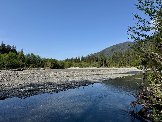
Hoh River View & Campsite - Mile 1.05
Just a couple-hundred feet down the dirt path is an opening in the trees that sits along the banks of the Hoh River. Here, you'll find nice views of the water as it flows westward. You'll also find open grassy spaces nearby — this area is used as a dispersed campsite area. Due to the lack of open ground, most backpackers either skip this dispersed camping area or use hammocks to camp here.
Hiking Out - Mile 1.05 to 2
The last leg of this trail guide is to simply hike back to the trailhead to wrap up the 2-mile out-and-back hike. You'll get an opportunity to check out the same old-growth trees you found on the way in, which is great if you forgot to photograph some of them. It's also a great way to look out for wildlife. On our hike out, we found an elk that was sitting in the brush located off-trail and was only ~30 feet from where we were standing. While we didn't get a great photo of the animal, we captured a video and it made the hike out worth while.
Other Hikes in the Hoh Rainforest
While exploring the area, you should consider hiking the
Hall of Mosses Trail and the
Spruce Nature Trail first as they're far more popular than the Hoh River Trail. Pro-tip: show up early to enjoy these trails with less people.
Parking & Fees
Hikers will find a massive parking
lot at the coordinates provided, located at the end of the Upper Hoh
Road. The lot is large enough to fit many dozens of vehicles as of June
2025. There's additional parking at a nearby parking lot just west of
the main parking area. Note that the Hoh Rainforest is a very-popular
destination for hikers and during peak season, the parking lot may be
very difficult to get into if you show up at the wrong time. Long wait
times may prevail. Last, to enter the park here, you must pay an
entrance fee, per vehicle of about $25 which is generally good to
re-enter the park for several days as of 2025. You can save time and
save yourself multiple park entrance fees by purchasing an Annual
National Parks Pass ahead of time.
Pets
Dogs are not allowed on this trail or any trails within the Hoh Rainforest area. Please leave your pets at home.
Warning
Wildlife: In the late spring and early summer, elk are calving which means that they're more aggressive than usual. If you spot any elk, especially with calves (small babies), be extra cautious and give the animals plenty of space. Angry elk are known to trample and charge people if they get too close.