The Hall of Mosses Trail at Olympic National Park near Forks, Washington is an easy 1.1-mile loop hike that leads visitors through the lush moss-covered, fern-filled Hoh Rainforest.
The hike begins at the main parking lot for the Hoh Rainforest and follows the Mini Trail in to reach the Hall of Mosses Trail. Along the way, you'll find old-growth trees, ferns, a small crystal-clear creek (Taft Creek), and lush moss-covered tree branches. Keep left to follow the Mini Trail as it leads to the Hall of Mosses and follow signs to stay on-course.
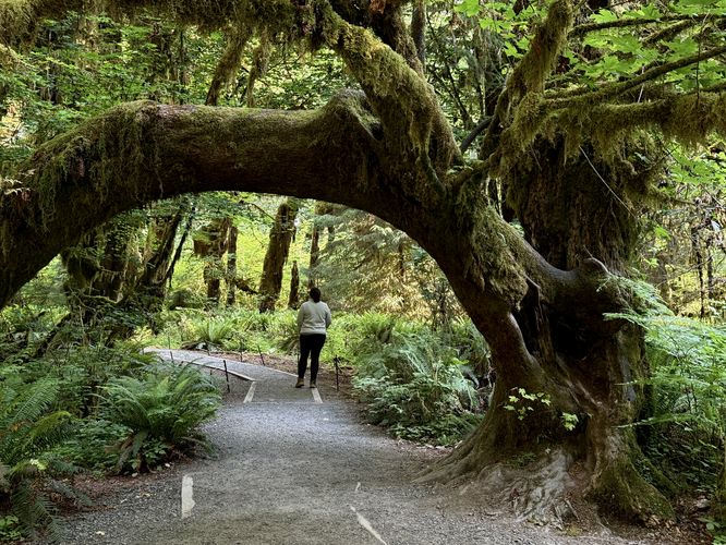
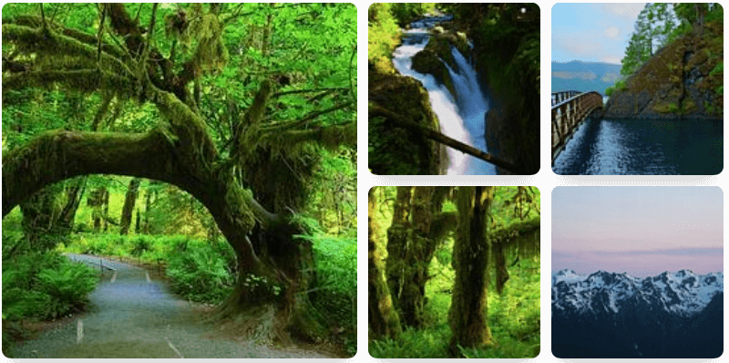
From miles 0.3 to 0.5 are arguably the best views of the forest along the trail. There's a short out-and-back walk that leads to a grove of trees with fuzzy, rug-like mosses growing up and encompassing their bark. Further up the trail from the out-and-back spur path sits a beautiful moss-covered tree that's arches over the pathway, which makes for a great spot to take photographs.
The trail then leads uphill for a short distance before heading eastward as it passes through a less-interesting section of forest; however, more neat stuff can be found ahead. If you look close enough at some of the trees, they grow in a straight line — this is the process of new trees growing up and on top of dead and decaying fallen trees. These dead fallen trees are called nurselogs for that reason. They provide nutrients and stability for new life to grow, hence their name. A beautiful view of trees that once grew out of a nurselog can be found around mile 0.7 in the route provided.
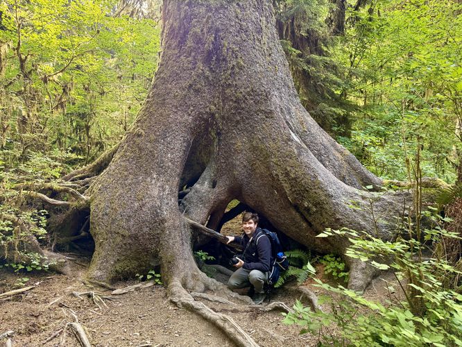
The last neat find along the hike that will likely excite most children (and adults alike) is a massive tree with a trunk that provides a tunnel view. I labelled this point-of-interest on the map "tunnel tree", but it might have an official name too. It's a different experience attempting to take a photo through the tunnel tree's trunk/root structure, but worth the extra time for a little bit of fun along the path.
Trails
This hike follows two named trails from the parking lot — the Mini Trail and the Hall of Mosses Trail. Combined, the hike forms a lollipop (out-and-back w/loop).Explore the Hoh Rainforest via Hall of Mosses
Most visitors to Olympic National Park are itching to hike through the Hoh Rainforest, one of the park's most-spectacular and sought-after locations to explore. Due to the Hoh's lush vegetation with massive ferns and ancient trees covered in hanging mosses, it's a special place to national parks visitors to seek out and for good reason.The hike begins at the main parking lot for the Hoh Rainforest and follows the Mini Trail in to reach the Hall of Mosses Trail. Along the way, you'll find old-growth trees, ferns, a small crystal-clear creek (Taft Creek), and lush moss-covered tree branches. Keep left to follow the Mini Trail as it leads to the Hall of Mosses and follow signs to stay on-course.
Hiking the Hall of Mosses - Mile 0.19 to 0.92
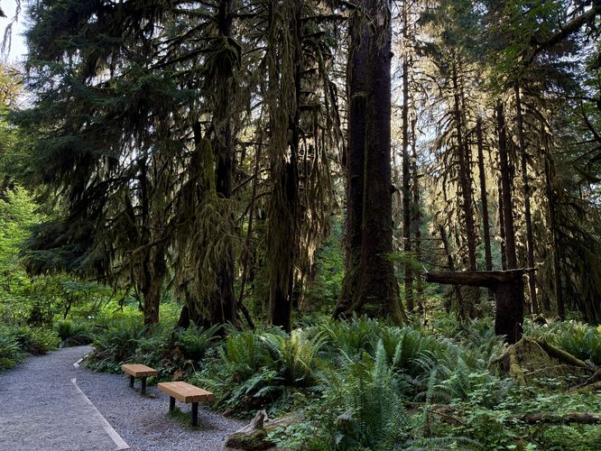
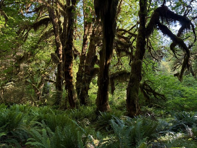
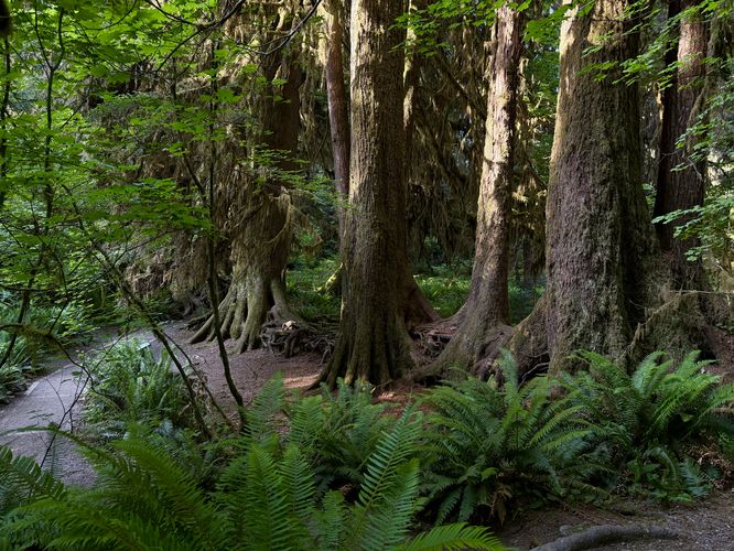
Not long after you pass over the Taft Creek footbridge, you'll hike up a very short hill to reach a one-way loop, the Hall of Mosses Trail. This section of the Hoh Rainforest is an elevated plateau of older-growth trees and plants where you'll find the forest floor covered in large ferns and massive ancient trees with moss covering their branches. If you show up in the early morning, like we did, then you'll likely find soft daylight filtered by the moss-covered branches overhead and it makes for great photos. If you show up later in the day, the harsh sunlight makes it harder to capture everything the forest has to offer to the eye. As you hike the trail, it winds its way through the lush understory of the Hoh Rainforest as it heads northward.From miles 0.3 to 0.5 are arguably the best views of the forest along the trail. There's a short out-and-back walk that leads to a grove of trees with fuzzy, rug-like mosses growing up and encompassing their bark. Further up the trail from the out-and-back spur path sits a beautiful moss-covered tree that's arches over the pathway, which makes for a great spot to take photographs.
The trail then leads uphill for a short distance before heading eastward as it passes through a less-interesting section of forest; however, more neat stuff can be found ahead. If you look close enough at some of the trees, they grow in a straight line — this is the process of new trees growing up and on top of dead and decaying fallen trees. These dead fallen trees are called nurselogs for that reason. They provide nutrients and stability for new life to grow, hence their name. A beautiful view of trees that once grew out of a nurselog can be found around mile 0.7 in the route provided.
The last neat find along the hike that will likely excite most children (and adults alike) is a massive tree with a trunk that provides a tunnel view. I labelled this point-of-interest on the map "tunnel tree", but it might have an official name too. It's a different experience attempting to take a photo through the tunnel tree's trunk/root structure, but worth the extra time for a little bit of fun along the path.