The High Point Trail at Uncompahgre National Forest in Ouray, Colorado is a moderate 0.6-mile out-and-back hike that leads to a beautiful vista high above Ouray, High Point and features views of Abrams Mountain, the town of Ouray, and its surrounding mountains.
Trails
This hike follows the officially-named Perimeter Trail which loops around the town of Ouray, Colorado.
Hike
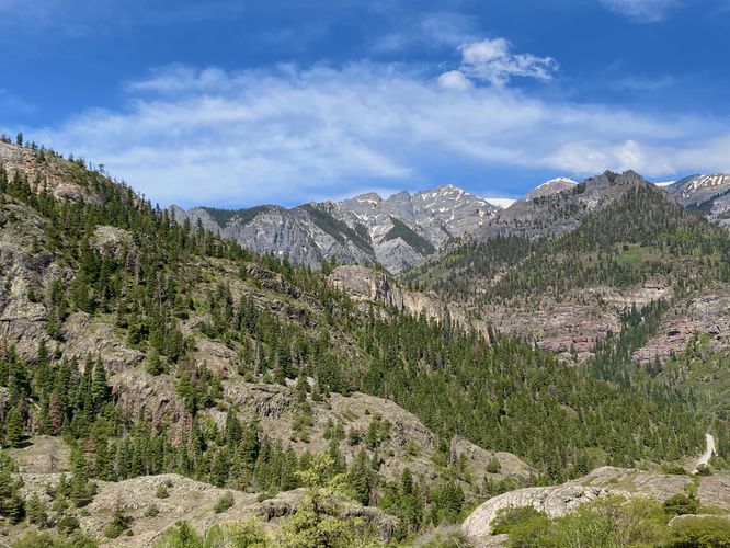
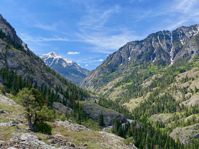
This short hike begins at a small parking turnout for High Point / The Perimeter Trail, located along the Million Dollar Highway just south of Ouray. The trailhead is located at the northern end of the parking turnout where hikers will start. The trail initially leads eastward before it takes a sharp right-hand turn to ascend switchbacks along the nearby hill. It leads mostly southward with views of Abrams Mountain straight ahead. During Spring, Abrams Mountain's snow-capped peak stands tall above the Million Dollar Highway and the valley below. The views along the trail are all similar as you ascend to High Point, but once you get closer to the top, you'll find views of the glacial bowl known as The Amphitheater located to the east. The trail's switchbacks lead along bedrock and some loose gravel, but is generally not difficult to hike.
High Point - Mile 0.3
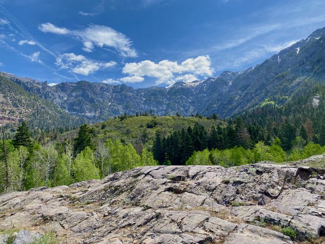
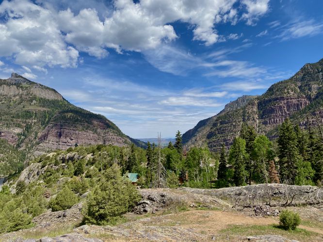
Hikers will reach a large bedrock outcropping near mile 0.3 -- this is High Point. Hike out to High Point to get a better view of The Amphitheater, Abrams Mountain, and the mountains surrounding Ouray. To the north is a view that peers over the trees into the Ouray valley; however, views of the town are arguably much better from the Switzerland of America Lookout Point instead.
After exploring High Point, the trail leads back to parking for a short 0.6-mile out-and-back hike.
Parking
Hikers will find a small parking turnout located at the coordinates provided, on the east side of the Million Dollar Highway just south of Ouray, Colorado. The turnout is large enough to fit a half dozen vehicles as of June 2024.
Pets
Dogs are allowed only if leashed and must be cleaned up after.
Trails
This hike follows the officially-named Perimeter Trail which loops around the town of Ouray, Colorado.
Hike
This short hike begins at a small parking turnout for High Point / The Perimeter Trail, located along the Million Dollar Highway just south of Ouray. The trailhead is located at the northern end of the parking turnout where hikers will start. The trail initially leads eastward before it takes a sharp right-hand turn to ascend switchbacks along the nearby hill. It leads mostly southward with views of Abrams Mountain straight ahead. During Spring, Abrams Mountain's snow-capped peak stands tall above the Million Dollar Highway and the valley below. The views along the trail are all similar as you ascend to High Point, but once you get closer to the top, you'll find views of the glacial bowl known as The Amphitheater located to the east. The trail's switchbacks lead along bedrock and some loose gravel, but is generally not difficult to hike.
High Point - Mile 0.3
Hikers will reach a large bedrock outcropping near mile 0.3 -- this is High Point. Hike out to High Point to get a better view of The Amphitheater, Abrams Mountain, and the mountains surrounding Ouray. To the north is a view that peers over the trees into the Ouray valley; however, views of the town are arguably much better from the Switzerland of America Lookout Point instead.
After exploring High Point, the trail leads back to parking for a short 0.6-mile out-and-back hike.
Parking
Hikers will find a small parking turnout located at the coordinates provided, on the east side of the Million Dollar Highway just south of Ouray, Colorado. The turnout is large enough to fit a half dozen vehicles as of June 2024.
Pets
Dogs are allowed only if leashed and must be cleaned up after.