This section of the Hiddenbrooke Trail at the Hiddenbrooke Open Space in Vallejo, California is a moderate to difficult 1.6-mile out-and-back trail that leads up to the Sulphur Springs Mountain Summit Trail and features stunning vistas.
This recording of the Hiddenbrooke Trail / Bay Area Ridge Trail, one way, is only about one-third of the entire trail because we hiked this trail to reach the Sulphur Springs Mountain Summit Trail before heading back to parking. The entire trail can be considered moderate to difficult except for the very steep grade near the southern parking area, which is certainly considered difficult.
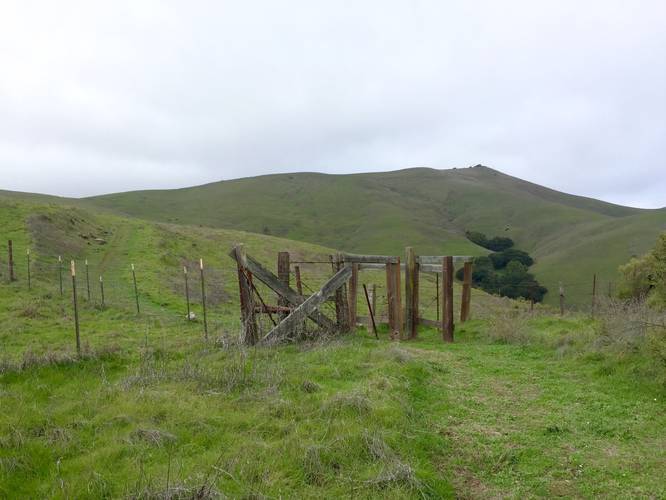
The hike begins right off of Highgate Road and follows a very steep hillside that eventually reaches a planked staircase and soon levels out. Where the steep section of the trail ends is a cow gate - hike through the cow gate and follow the main trail west and uphill along scenic green hillsides.
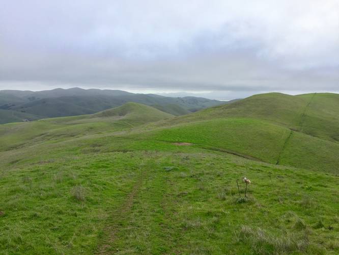
This open space often has cows roaming the green hillside, which makes for an interesting hike up toward Sulphur Springs Mountain as the cows will usually react to your presence. Not too far into the hike is a beautiful vista point of the San Pablo Bay and Mount Tamalpais in the distance.
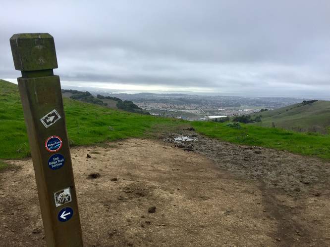
Continuing onward from the vista point, the trail continues uphill at a slightly steeper ascent up to the junction with the Sulphur Springs Mountain Summit Trail. Here, hikers can choose to visit the summit of Sulphur Springs Mountain or continue along the Hiddenbrooke Trail / Bay Area Ridge Trail heading north.
The hike back to parking follows the same exact path, but because of the elevation change, it can be a bit tough on the knees. It's smart to bring trekking poles on this hike to help spread the weight and keep some of the weight off of your knees.
Bay Area Ridge Trail
This trail is part of the much larger Bay Area Ridge Trail.
Parking
Hikers can find parking along the side of the road at the coordinates provided. The road itself has a closed gate and does not allow thru-traffic. The road has many houses near the parking area, so be mindful.
Trailhead
This trailhead is found next to the parking area and next to the road gate. There's some signage and some cut grass that shows where the trail follows uphill; however, it's not easy to spot right away.
Pets
Dogs are allowed if leashed and their waste must be carried out by the hiker. It's also best to keep dogs on leash as this open space will often have cows roaming the hillsides.
This recording of the Hiddenbrooke Trail / Bay Area Ridge Trail, one way, is only about one-third of the entire trail because we hiked this trail to reach the Sulphur Springs Mountain Summit Trail before heading back to parking. The entire trail can be considered moderate to difficult except for the very steep grade near the southern parking area, which is certainly considered difficult.
The hike begins right off of Highgate Road and follows a very steep hillside that eventually reaches a planked staircase and soon levels out. Where the steep section of the trail ends is a cow gate - hike through the cow gate and follow the main trail west and uphill along scenic green hillsides.
This open space often has cows roaming the green hillside, which makes for an interesting hike up toward Sulphur Springs Mountain as the cows will usually react to your presence. Not too far into the hike is a beautiful vista point of the San Pablo Bay and Mount Tamalpais in the distance.
Continuing onward from the vista point, the trail continues uphill at a slightly steeper ascent up to the junction with the Sulphur Springs Mountain Summit Trail. Here, hikers can choose to visit the summit of Sulphur Springs Mountain or continue along the Hiddenbrooke Trail / Bay Area Ridge Trail heading north.
The hike back to parking follows the same exact path, but because of the elevation change, it can be a bit tough on the knees. It's smart to bring trekking poles on this hike to help spread the weight and keep some of the weight off of your knees.
Bay Area Ridge Trail
This trail is part of the much larger Bay Area Ridge Trail.
Parking
Hikers can find parking along the side of the road at the coordinates provided. The road itself has a closed gate and does not allow thru-traffic. The road has many houses near the parking area, so be mindful.
Trailhead
This trailhead is found next to the parking area and next to the road gate. There's some signage and some cut grass that shows where the trail follows uphill; however, it's not easy to spot right away.
Pets
Dogs are allowed if leashed and their waste must be carried out by the hiker. It's also best to keep dogs on leash as this open space will often have cows roaming the hillsides.