The Harwich Herring Run at Bell's Neck Conservation Lands in Harwich, Massachusetts is an easy 0.1-mile out-and-back walk that features the human-made waterfalls - the Herring Run - views of West Reservoir, and provides an abundant of bird-watching opportunities.
Walk Description
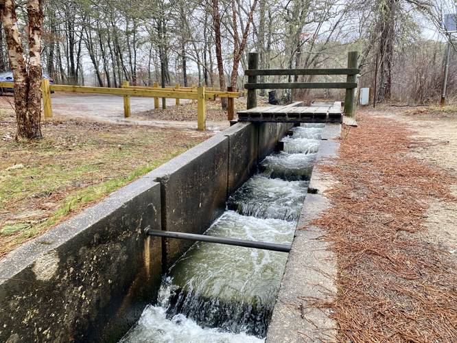
This is not a hike but rather a very short walk that packs a lot of interesting things into one place. First, the main attraction is the Herring Run - the human-made waterfall "step ladder" that the Herring use to connect from the Herring River up to the West Reservoir. This Herring Run ladder system is a very popular spot for bird-of-prey, like the Osprey and Great Blue Heron. I randomly found this spot and thought it'd be neat to check out in early April - turns out this is a great season for bird-watching Osprey and Great Blue Heron. As I pulled in, two heron flew off, but the Osprey didn't think twice about my presence. Three Osprey sit in a tree just 20-feet across from the trail while at least on Osprey circled overhead slightly. I did not see any Herring.
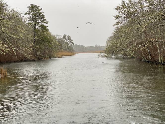
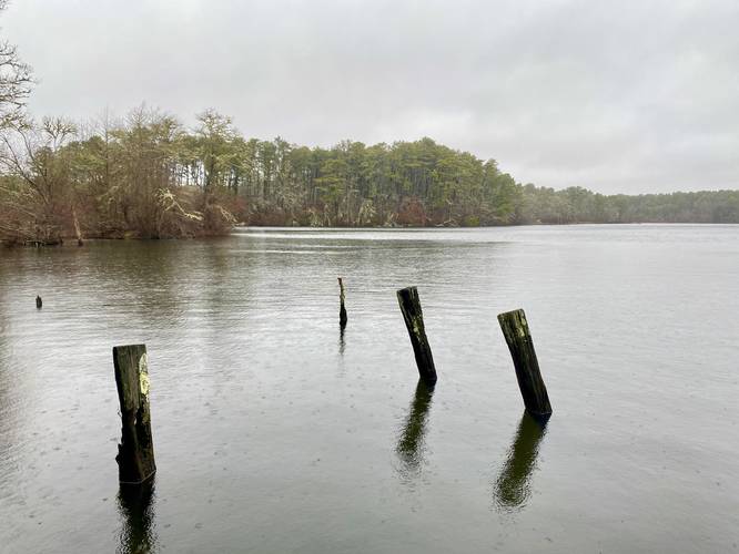
Walking further down the trail, I stopped at a nice overlook for the West Reservoir before turning back. This short walk is very scenic, but exists to protect a fragile ecosystem. Please do not take any Herring, as stated by the signs.
Waterfalls
Note that the only waterfalls here are human-made, but are still scenic especially due to the fact that Cape Cod doesn't have many waterfalls at all.
Parking
Hikers will find a small parking lot at the coordinates provided, the lot is large enough to fit less than 10 vehicles and acts as a turn-around point for the entrance road.
Pets
Dogs are allowed only if leashed and cleaned up after.
Walk Description
This is not a hike but rather a very short walk that packs a lot of interesting things into one place. First, the main attraction is the Herring Run - the human-made waterfall "step ladder" that the Herring use to connect from the Herring River up to the West Reservoir. This Herring Run ladder system is a very popular spot for bird-of-prey, like the Osprey and Great Blue Heron. I randomly found this spot and thought it'd be neat to check out in early April - turns out this is a great season for bird-watching Osprey and Great Blue Heron. As I pulled in, two heron flew off, but the Osprey didn't think twice about my presence. Three Osprey sit in a tree just 20-feet across from the trail while at least on Osprey circled overhead slightly. I did not see any Herring.
Walking further down the trail, I stopped at a nice overlook for the West Reservoir before turning back. This short walk is very scenic, but exists to protect a fragile ecosystem. Please do not take any Herring, as stated by the signs.
Waterfalls
Note that the only waterfalls here are human-made, but are still scenic especially due to the fact that Cape Cod doesn't have many waterfalls at all.
Parking
Hikers will find a small parking lot at the coordinates provided, the lot is large enough to fit less than 10 vehicles and acts as a turn-around point for the entrance road.
Pets
Dogs are allowed only if leashed and cleaned up after.