Hackers Falls, Minisink & Tri-State Overlooks Hike at Delaware Water Gap National Recreation Area near Milford, Pennsylvania is a moderate 2.7-mile loop that features the 30-foot tall Hackers Falls and stunning cliff views from the Minisink and Tri-State Overlooks.
Trails
This hike follows several named trails in a loop in the following order: Hackers Trail (yellow blazes), Buchanan Trail (red blazes and white), Cliff Trail (white blazes).
Hike Description
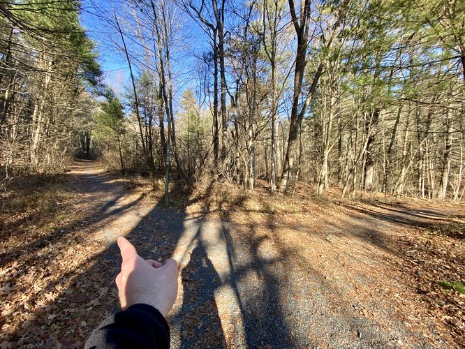
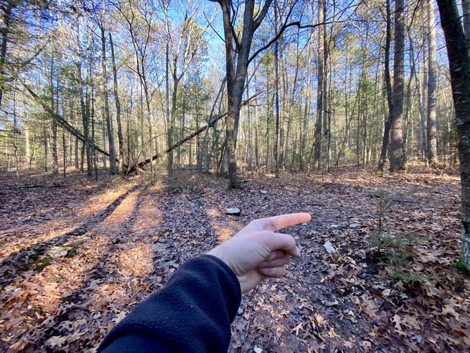
This hike begins at the main parking lot for Raymondskill Falls and heads in on the trailhead located on the north side of Raymondskill Road. Hikers will find a junction within the first few-hundred feet -- keep left to stay on the yellow-blazed Hackers Trail.
Left-Hand Turns - Mile 0.3 & 0.5
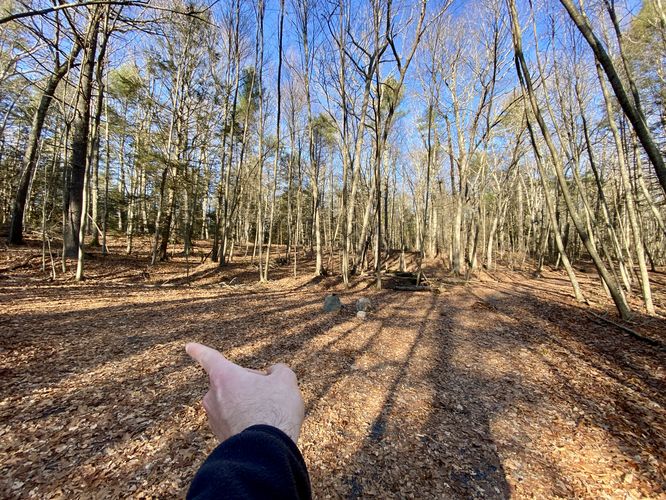
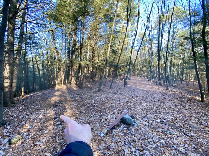
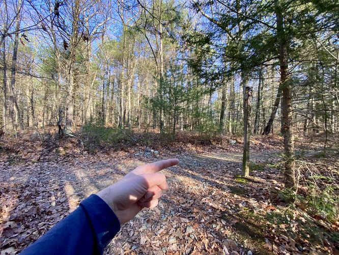
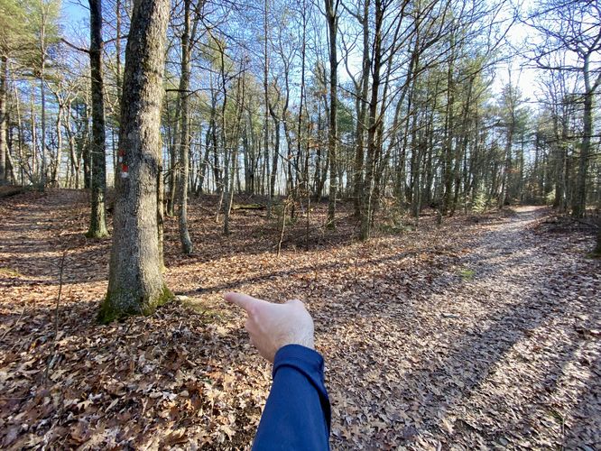
After the first turn, hikers will head uphill to reach a plateaued forest -- at mile 0.3, take a left-hand turn at the top of the hill. The trail will then bend its way around the forest floor heading north and then northeast -- keep right as it bends. At mile 0.5, however, is a left-hand turn that heads straight downhill. This turn is easy to miss -- take this left-hand turn to head down toward Hackers Falls.
Right-Hand Turn - Mile 0.6
At mile 0.6, hikers will take a right-hand turn to hike northward along the Hackers Trail to reach Hackers Falls.
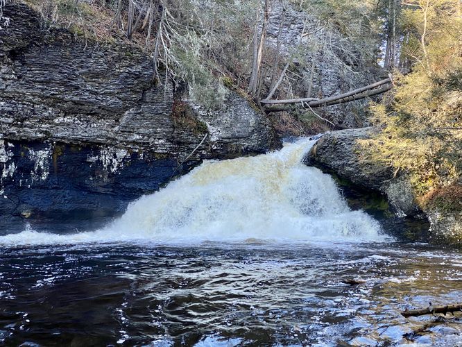
Hackers Falls (30-feet tall) - Mile 0.9
At mile 0.9, hikers will reach the ~30-foot tall waterfall known as Hackers Falls. Hackers Falls starts out, at the top, within a skinny cascade, but then quickly widens and sends water outward. This display of cascading water reminded me of a ball gown dress or a wedding dress. The base of Hackers Falls can be enjoyed from the banks of Raymondskill Creek from downstream, located ~200-feet away, so in pictures the waterfall looks smaller than it really is. Hikers can hang out here as the banks of the creek provide an open and flat area to setup a picnic, for example. After enjoying the waterfall, this hike continues the loop.
Reaching the Minisink Overlook from Hackers Falls - Mile 0.9 to 1.68
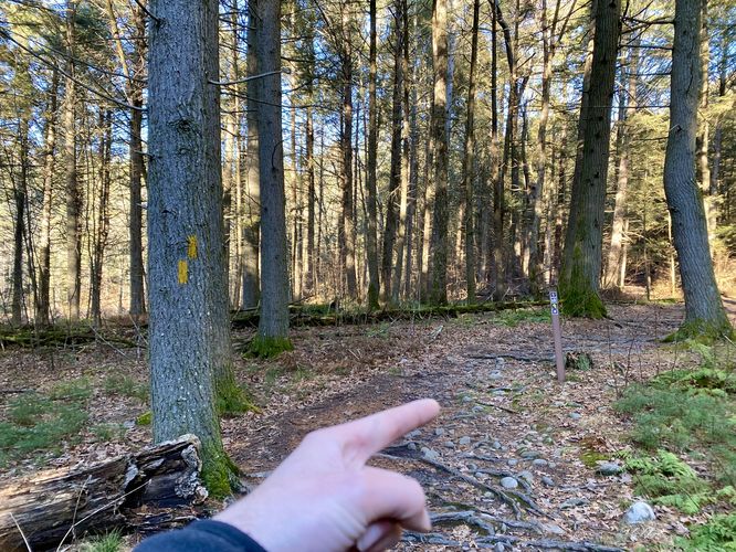
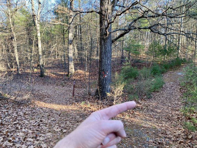
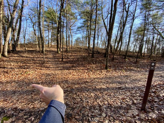
At Hackers Falls, hikers will head northward to reach a junction located around mile 1. Keep-right here. Immediately after, several-hundred feet down the trail, is another right-hand turn at mile 1.07 -- take this right-hand turn. Note that the trail just uphill from Hackers Falls can be very very wet and almost creek-like after heavy rains. Hikers will then take another right-hand turn at mile 1.3 to ope on the Buchanan Trail. The next set of turns is a bit confusing -- the trail will enter and exit a grove of White Pine trees and after exiting will hit red and white blazes. Take a right-hand turn at the red/white blazes and then take an immediate left-hand turn afterward. The left-hand turn will lead hikers to the white-blazes Cliff Trail. At the Cliff Trail take a left-hand turn -- located several-hundred feet from this junction is the Minisink Overlook of the Delaware River.
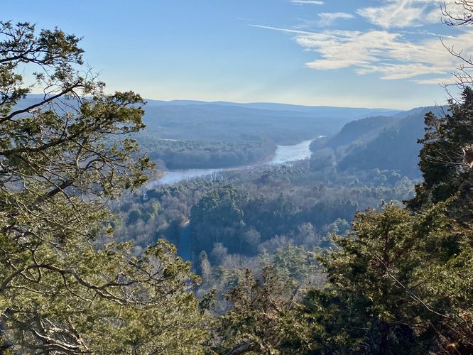
Minisink Overlook - Mile 1.68
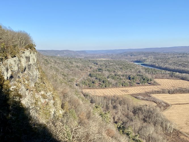
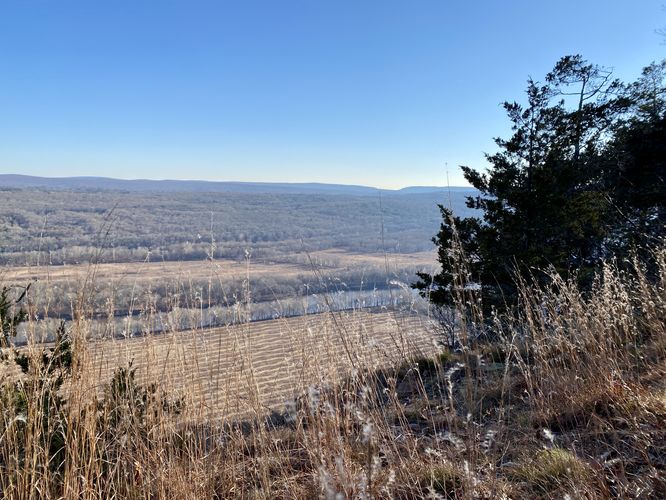
Around mile 1.68, hikers will reach the cliff's edge at the Minisink Overlook. The best view faces northward and features views of the Delaware River (Delaware Water Gap), distant hills, the Milford-Montague Toll Bridge that spans the river, and cliffs in the foreground. This view is best enjoyed from the other side of the fence, however, you must watch your step as the drop-off the cliff is hundreds of feet down.
Hike the Cliff Trail to Tri-State Overlook - Mile 1.7 to 2.16
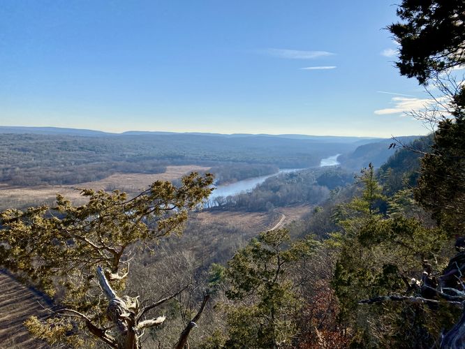
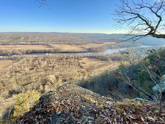
After exploring the Minisink Overlook, hikers can hop on the cliff's edge of the Cliff Trail which runs southward to reach the Tri-State Overlook. The trail provides some views along the way where you can get similar views of the Delaware River and distant hills. Hikers will reach another fenced area at mile 2.16 -- this is the Tri-State Overlook. If you wish, as shown in the GPS track, you can hike down to the cliff's edge where a rock juts out for better views of the Delaware Water Gap. The views from the Tri-State Overlook obviously include views into New York, New Jersey, and Pennsylvania.
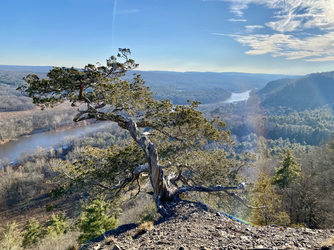
Lone Evergreen & River View - Mile 2.4
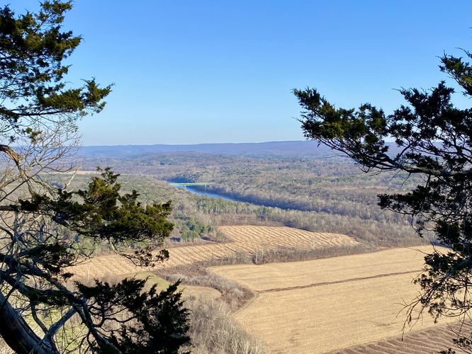
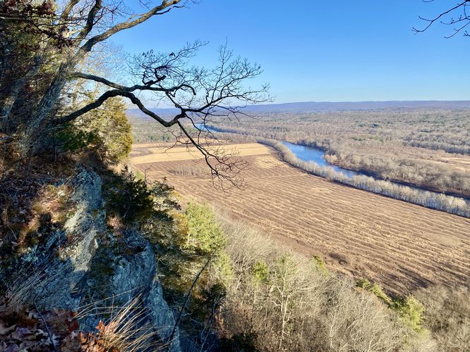
After visiting the Tri-State Overlook, hikers will head south along the Cliff Trail to reach more views of the Delaware River before heading back to parking. One of the best views along the trail is located at mile 2.4 where you'll find a lone evergreen (juniper tree?) on the slopes of the rocky hillside. The view from this spot faces south and provides the largest view of the Delaware River as it slowly passes through the Delaware Water Gap. This was my favorite view along the hike.
Hiking to Parking - Mile 2.4 to 2.7
After visiting the lone evergreen (juniper) vista, hikers will head downhill along the Cliff Trail to where it approaches Raymondskill Road. There's a trail terminus hikers can take located at the end of the Cliff Trail; however, to play it safer with regard to road hiking, this GPS track brings hikers westward to another trailhead that connects just across from the northeast corner of the parking lot. The loop is done at mile 2.7 when the hiker reaches the parking lot.
Parking
Hikers will find a medium-sized parking lot at the coordinates provided along Raymondskill Road. The lot, as of December 2023, is large enough to fit just over 1 dozen vehicles max. There's another parking lot located ~200-feet to the west which can hold a similar amount of cars.
Pets
Dogs are allowed only if leashed and must be cleaned up after.
Warnings
Steep cliffs: This hike passes by the edge of very steep and dangerous cliffs. Hike at your own risk.
Wet trails: Just north of Hackers Falls, the trails can turn into miniature creeks after heavy rainfall. It's best to wear waterproof footwear if you can.
Lack of signage: It's smart to bring a physical map or offline GPS tracker (like the MyHikes app!) with you on your hike so you don't get lost due to the lack of signage on the trails.
Trails
This hike follows several named trails in a loop in the following order: Hackers Trail (yellow blazes), Buchanan Trail (red blazes and white), Cliff Trail (white blazes).
Hike Description
This hike begins at the main parking lot for Raymondskill Falls and heads in on the trailhead located on the north side of Raymondskill Road. Hikers will find a junction within the first few-hundred feet -- keep left to stay on the yellow-blazed Hackers Trail.
Left-Hand Turns - Mile 0.3 & 0.5
After the first turn, hikers will head uphill to reach a plateaued forest -- at mile 0.3, take a left-hand turn at the top of the hill. The trail will then bend its way around the forest floor heading north and then northeast -- keep right as it bends. At mile 0.5, however, is a left-hand turn that heads straight downhill. This turn is easy to miss -- take this left-hand turn to head down toward Hackers Falls.
Right-Hand Turn - Mile 0.6
At mile 0.6, hikers will take a right-hand turn to hike northward along the Hackers Trail to reach Hackers Falls.
Hackers Falls (30-feet tall) - Mile 0.9
At mile 0.9, hikers will reach the ~30-foot tall waterfall known as Hackers Falls. Hackers Falls starts out, at the top, within a skinny cascade, but then quickly widens and sends water outward. This display of cascading water reminded me of a ball gown dress or a wedding dress. The base of Hackers Falls can be enjoyed from the banks of Raymondskill Creek from downstream, located ~200-feet away, so in pictures the waterfall looks smaller than it really is. Hikers can hang out here as the banks of the creek provide an open and flat area to setup a picnic, for example. After enjoying the waterfall, this hike continues the loop.
Reaching the Minisink Overlook from Hackers Falls - Mile 0.9 to 1.68
At Hackers Falls, hikers will head northward to reach a junction located around mile 1. Keep-right here. Immediately after, several-hundred feet down the trail, is another right-hand turn at mile 1.07 -- take this right-hand turn. Note that the trail just uphill from Hackers Falls can be very very wet and almost creek-like after heavy rains. Hikers will then take another right-hand turn at mile 1.3 to ope on the Buchanan Trail. The next set of turns is a bit confusing -- the trail will enter and exit a grove of White Pine trees and after exiting will hit red and white blazes. Take a right-hand turn at the red/white blazes and then take an immediate left-hand turn afterward. The left-hand turn will lead hikers to the white-blazes Cliff Trail. At the Cliff Trail take a left-hand turn -- located several-hundred feet from this junction is the Minisink Overlook of the Delaware River.
Minisink Overlook - Mile 1.68
Around mile 1.68, hikers will reach the cliff's edge at the Minisink Overlook. The best view faces northward and features views of the Delaware River (Delaware Water Gap), distant hills, the Milford-Montague Toll Bridge that spans the river, and cliffs in the foreground. This view is best enjoyed from the other side of the fence, however, you must watch your step as the drop-off the cliff is hundreds of feet down.
Hike the Cliff Trail to Tri-State Overlook - Mile 1.7 to 2.16
After exploring the Minisink Overlook, hikers can hop on the cliff's edge of the Cliff Trail which runs southward to reach the Tri-State Overlook. The trail provides some views along the way where you can get similar views of the Delaware River and distant hills. Hikers will reach another fenced area at mile 2.16 -- this is the Tri-State Overlook. If you wish, as shown in the GPS track, you can hike down to the cliff's edge where a rock juts out for better views of the Delaware Water Gap. The views from the Tri-State Overlook obviously include views into New York, New Jersey, and Pennsylvania.
Lone Evergreen & River View - Mile 2.4
After visiting the Tri-State Overlook, hikers will head south along the Cliff Trail to reach more views of the Delaware River before heading back to parking. One of the best views along the trail is located at mile 2.4 where you'll find a lone evergreen (juniper tree?) on the slopes of the rocky hillside. The view from this spot faces south and provides the largest view of the Delaware River as it slowly passes through the Delaware Water Gap. This was my favorite view along the hike.
Hiking to Parking - Mile 2.4 to 2.7
After visiting the lone evergreen (juniper) vista, hikers will head downhill along the Cliff Trail to where it approaches Raymondskill Road. There's a trail terminus hikers can take located at the end of the Cliff Trail; however, to play it safer with regard to road hiking, this GPS track brings hikers westward to another trailhead that connects just across from the northeast corner of the parking lot. The loop is done at mile 2.7 when the hiker reaches the parking lot.
Parking
Hikers will find a medium-sized parking lot at the coordinates provided along Raymondskill Road. The lot, as of December 2023, is large enough to fit just over 1 dozen vehicles max. There's another parking lot located ~200-feet to the west which can hold a similar amount of cars.
Pets
Dogs are allowed only if leashed and must be cleaned up after.
Warnings
Steep cliffs: This hike passes by the edge of very steep and dangerous cliffs. Hike at your own risk.
Wet trails: Just north of Hackers Falls, the trails can turn into miniature creeks after heavy rainfall. It's best to wear waterproof footwear if you can.
Lack of signage: It's smart to bring a physical map or offline GPS tracker (like the MyHikes app!) with you on your hike so you don't get lost due to the lack of signage on the trails.