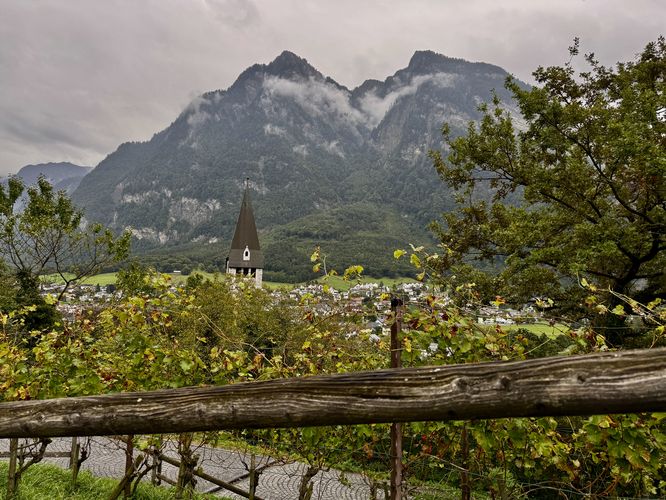
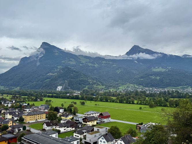
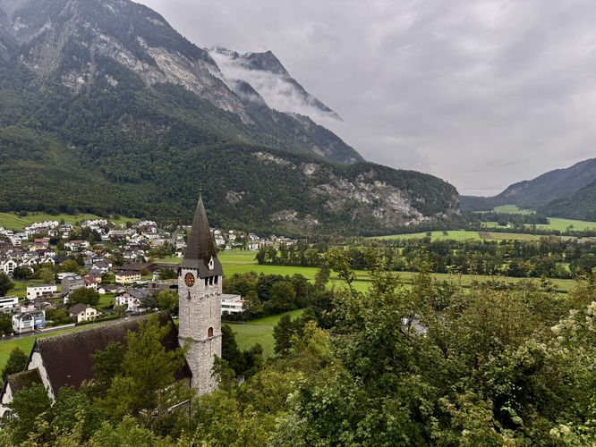
Escape the everyday and step into a fairytale with the Burg Gutenberg Trail, an unmissable walk in Liechtenstein. This scenic walk begins at the Pfarrkirche St. Nikolaus parking lot in Balzers, guiding you along a public trail that climbs high above sun-drenched vineyards and offers breathtaking, panoramic views of the Alpine Rhine Valley.
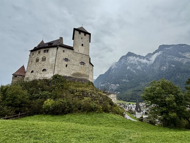
While the walk doesn't explore the castle's interior, it provides the absolute best vantage points, encircling the impressive medieval fortress before leading you directly into its historic courtyard. Once inside the gates, you’ll find the perfect spot to appreciate the castle's towering architecture and soak in even more spectacular valley vistas from the public terrace. Perfect for hikers, history enthusiasts, and anyone seeking stunning Alps views in Liechtenstein, this guide is your key to experiencing one of the country's most iconic and best-preserved castles in Europe.
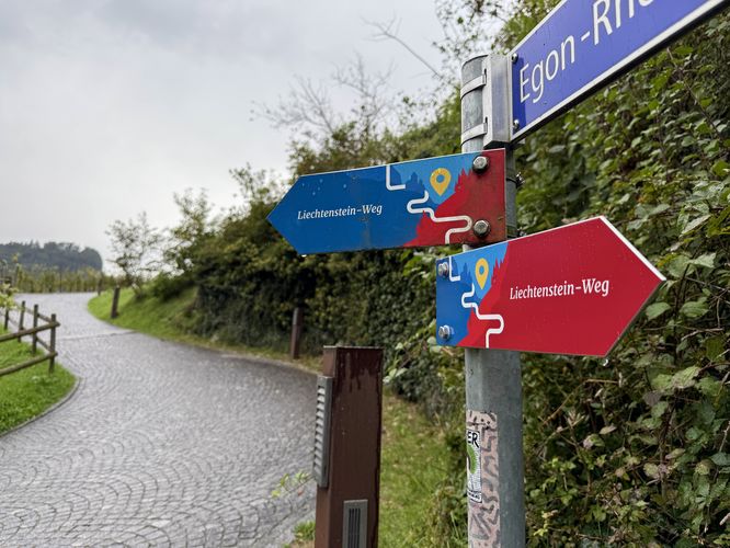
Follow the forest trail uphill along a moderate grade as it leads along a couple of switchbacks to reach a junction with the Burg Gutenberg trail and Liechtenstein-Weg. Take a right-hand turn here to head up the cobblestone path.
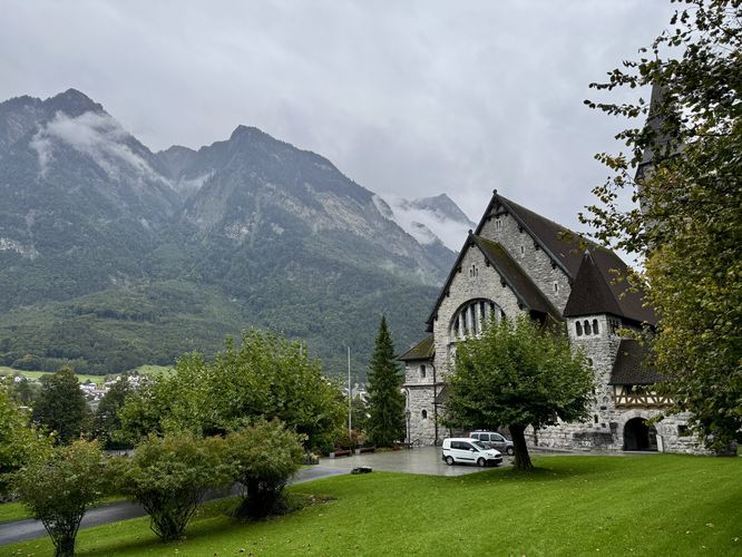
The fortress received a new lease on life in the early 20th century when it was acquired by the architect Egon Rheinberger, who undertook extensive reconstruction and restoration work between 1905 and 1935, transforming the ruins back into a magnificent, habitable castle. Following his death, the State of Liechtenstein purchased the castle in 1979. Today, Burg Gutenberg is one of the best-preserved castles in the region and is designated as a national monument. It now serves primarily as a museum and venue for cultural events, though it is not generally open for interior tours, preserving its exterior grandeur for visitors like those on this trail. You can learn more on the castle's official website.
While the walk doesn't explore the castle's interior, it provides the absolute best vantage points, encircling the impressive medieval fortress before leading you directly into its historic courtyard. Once inside the gates, you’ll find the perfect spot to appreciate the castle's towering architecture and soak in even more spectacular valley vistas from the public terrace. Perfect for hikers, history enthusiasts, and anyone seeking stunning Alps views in Liechtenstein, this guide is your key to experiencing one of the country's most iconic and best-preserved castles in Europe.
Discover the Majesty of Burg Gutenberg: Your Essential Trail Guide
This short, but moderate trail leads up to breathtaking Alps views from the grounds of Burg Gutenberg, starting just below near the church Pfarrkirche St. Nikolaus. Hikers and visitors will find a public trail located on the west side of Kirchensträssle, just south of the parking lot just before you reach the church.Follow the forest trail uphill along a moderate grade as it leads along a couple of switchbacks to reach a junction with the Burg Gutenberg trail and Liechtenstein-Weg. Take a right-hand turn here to head up the cobblestone path.
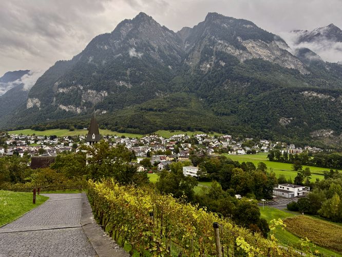
The Cobblestone Castle Trail & Vineyards
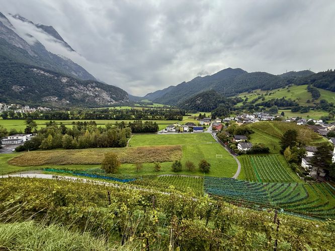
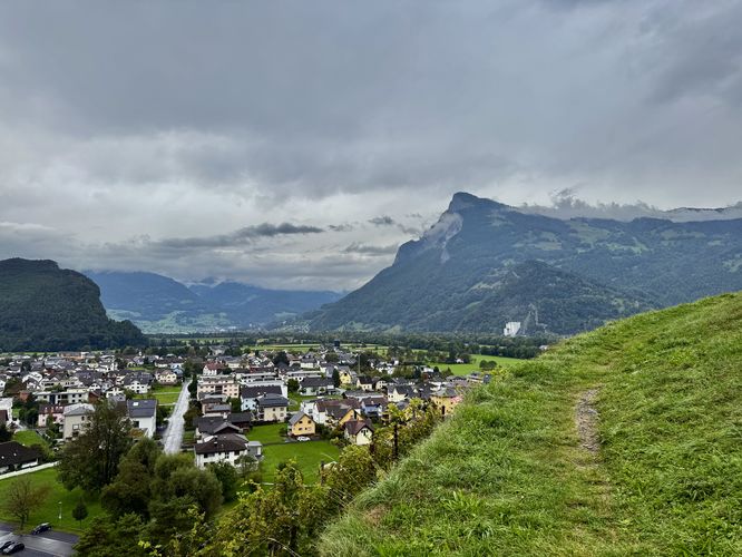
The trail to Burg Gutenberg starts to follow vineyards that sit just below the castle. Here, you'll find your first views above Balzers with a backdrop of the Alps of Liechtenstein from the vineyard. As you hike up the cobblestone trail, the towering walls of Burg Gutenberg will stand above your head to the north. This imposing view of the castle, while not the most scenic, is a fun way to picture how the castle must have felt centuries ago by potential invaders or nearby villagers. Before walking along the cobblestone path's switchbacks to reach the castle gates, this route leads along a grassy trail that runs atop the castle vineyards. This is a fun way to explore views you otherwise would have missed. Watch your step, however, because the trail leads along a 3-meter tall rock wall with the vineyard below your feet, you would not want to accidentally fall off of this short cliff. Views from this grassy path include south, west, and north-facing vistas of the Liechtenstein Alps and the Rhine Valley. These panoramic views cannot be beat, especially once you walk up the hill back toward the castle. From this short hill, visitors will find the best panoramic Alps views in Liechtenstein with the castle in view.Exploring Burg Gutenburg's Courtyard
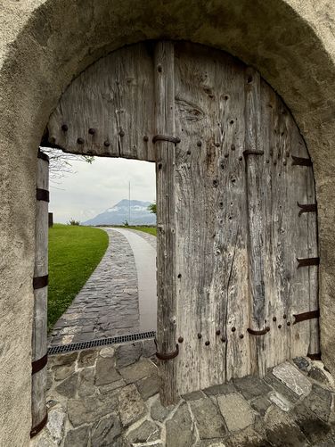
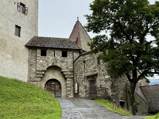
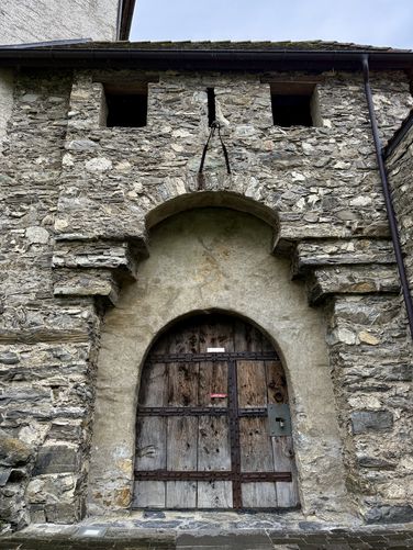
Next, the trail leads up the cobblestone path and enters the Burg Gutenberg courtyard. Passing through the castle's outer wall leads directly to historical information signs, an accessible courtyard path, historic castle ramparts, and breathtaking views of the Liechtenstein Alps. While the castle is closed, or if you simply want to enjoy the free outside area of Burg Gutenberg, this route leads you through the wide open courtyard to enjoy views and historical information about the castle.Return to Parking
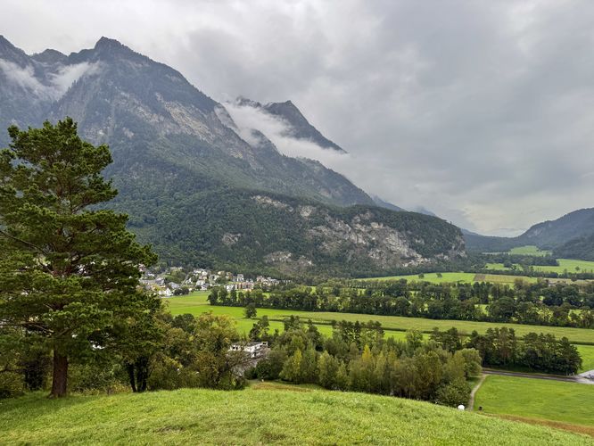
After exploring the castle's courtyard, this route leads right back to parking following the same path out. Follow the cobblestone trail as it leads past the final Alps views of the Rhine Valley, passing more vineyards, before following the Liechtenstein-Weg down to Pfarrkirche St. Nikolaus. Walk the paved road back to parking to complete this short, but moderate 1 km (0.6 mile) out-and-back walk to Burg Gutenberg.Parking & Directions: Getting to Burg Gutenberg
Hikers and visitors will find a medium sized parking lot along the south side of Fürstenstrasse in Balzer near the coordinates provided: 47.066153, 9.501853. The parking lot is large enough to fit approximately 30 vehicles as of September 2025.A Brief History of Burg Gutenberg
The history of Burg Gutenberg stretches back to the High Middle Ages, with its earliest known function being a medieval church and graveyard site. Archaeological findings suggest that the hill may have been settled even earlier. The construction of the current fortress began around the 13th century, built upon a rugged natural rock outcrop, and it served as the seat of local nobility, including the influential Lords of Frauenberg. Following the extinction of this line, the castle frequently changed hands among local aristocratic families and was acquired by the Holy Roman Empire around 1499. Although badly damaged by a fire in 1795, the ruinous castle was later purchased by the Municipality of Balzers.The fortress received a new lease on life in the early 20th century when it was acquired by the architect Egon Rheinberger, who undertook extensive reconstruction and restoration work between 1905 and 1935, transforming the ruins back into a magnificent, habitable castle. Following his death, the State of Liechtenstein purchased the castle in 1979. Today, Burg Gutenberg is one of the best-preserved castles in the region and is designated as a national monument. It now serves primarily as a museum and venue for cultural events, though it is not generally open for interior tours, preserving its exterior grandeur for visitors like those on this trail. You can learn more on the castle's official website.