The Great House Pueblo Trail at Chimney Rock National Monument near Pagosa Springs, Colorado is a moderate 0.6-mile out-and-back hike that leads to a viewpoint of the natural rock formation Chimney Rock and leads to ancient Puebloan structures atop the mesa's ridge.
Hike
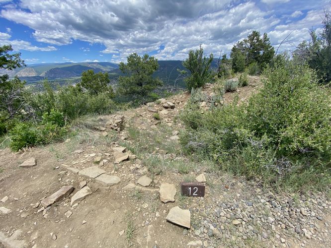
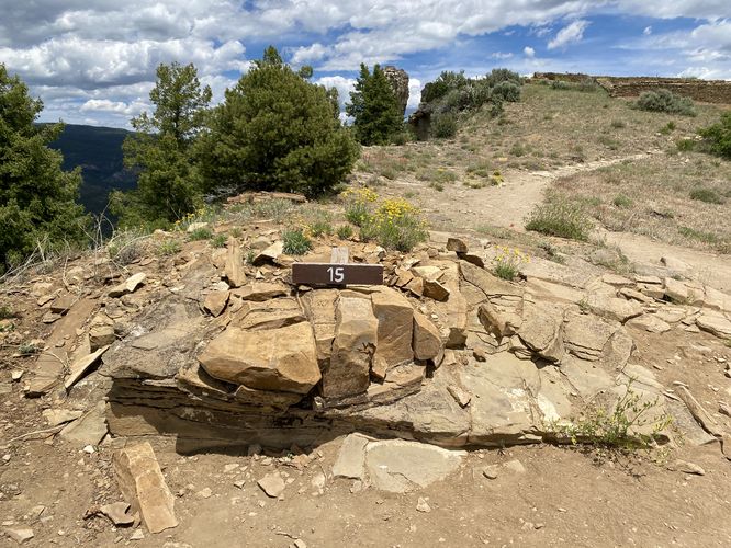
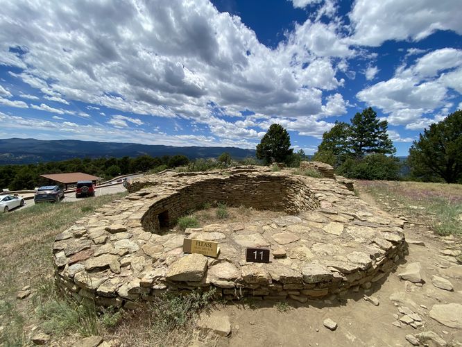
This hike begins at the main parking lot located at the very end of Chimney Rock Road within the park at the eastern-most trailhead. The Great House Pueblo Trail heads uphill along a ridge as it makes its way toward the towering Chimney Rock pinnacles. Along the way are numbered interpretive signs, where hikers can read more about the ancient structures by borrowing a self-guided tour pamphlet near the trailhead. Some of the sights along the way are an old "Guard House" that's speculated to have been used as a watch tower for the village, pithouses, and finally the Great House that sits at the top of the mesa's ridge -- located near Chimney Rock. The trail itself is rocky with larger loose stones, so you have to watch where you step, especially on the steeper grade.
Great House & Chimney Rock - Mile 0.25 to 0.3
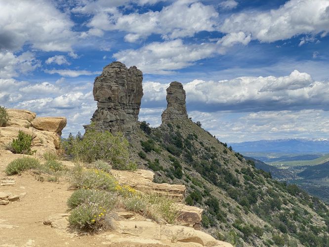
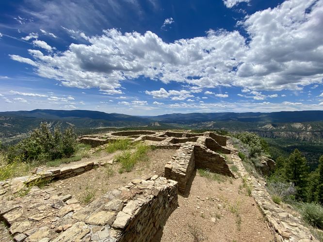
Around mile 0.25, hikers will reach the Great House, which is an ancient Puebloan village complex that sits at the top of the mesa's ridge. Here, you'll find spectacular views facing westward, around mile 0.3, which includes the Great House in the foreground. Just behind is a great view of Chimney Rock. The trail ends just a couple-hundred feet to the east of Great House where you'll find stunning views of the rock pinnacles known as Chimney Rock.
After exploring the ancient structures and the views of Chimney Rock, the hike out leads down the same, somewhat steep, trail that you hiked-in on for a short 0.6-mile hike.
Hours of Operation
Chimney Rock is open to visitors between the hours of 9AM and 4:30PM as of June 2024. The park is closed annually from ~mid-October to mid-May each year.
Parking & Fees
Hikers will find a large parking lot at the coordinates provided, located at the very end of Chimney Rock Road at the park. The lot is large enough to fit a few dozen vehicles as of June 2024. Like other national parks, there's a $25 vehicle entry fee as of June 2024. You can also use your annual National Parks Pass to enter without additional charge.
Warning
Steep cliff: This hike passes very steep and tall cliffs. It's best to stay on-trail near the ridge and cliff areas.
Sun exposure: This trail has virtually no shade, so bring plenty of water and sun protection depending on the time of day.
Elevation sickness: This trail leads hikers up to about 7,500 feet above sea level. Around the 7,000-foot mark above sea level, hikers may start to experience symptoms of elevation sickness including headache, muscle aches, shortness of breath, among other warning signs. In order to avoid elevation sickness it's recommended to ascend to higher elevations and take short walks to acclimate over the course of several days before taking a long or physically-demanding hike. At any time you feel elevation sickness kicking in, that's the time to turn back and head for lower altitude or the parking lot.
Hike
This hike begins at the main parking lot located at the very end of Chimney Rock Road within the park at the eastern-most trailhead. The Great House Pueblo Trail heads uphill along a ridge as it makes its way toward the towering Chimney Rock pinnacles. Along the way are numbered interpretive signs, where hikers can read more about the ancient structures by borrowing a self-guided tour pamphlet near the trailhead. Some of the sights along the way are an old "Guard House" that's speculated to have been used as a watch tower for the village, pithouses, and finally the Great House that sits at the top of the mesa's ridge -- located near Chimney Rock. The trail itself is rocky with larger loose stones, so you have to watch where you step, especially on the steeper grade.
Great House & Chimney Rock - Mile 0.25 to 0.3
Around mile 0.25, hikers will reach the Great House, which is an ancient Puebloan village complex that sits at the top of the mesa's ridge. Here, you'll find spectacular views facing westward, around mile 0.3, which includes the Great House in the foreground. Just behind is a great view of Chimney Rock. The trail ends just a couple-hundred feet to the east of Great House where you'll find stunning views of the rock pinnacles known as Chimney Rock.
After exploring the ancient structures and the views of Chimney Rock, the hike out leads down the same, somewhat steep, trail that you hiked-in on for a short 0.6-mile hike.
Hours of Operation
Chimney Rock is open to visitors between the hours of 9AM and 4:30PM as of June 2024. The park is closed annually from ~mid-October to mid-May each year.
Parking & Fees
Hikers will find a large parking lot at the coordinates provided, located at the very end of Chimney Rock Road at the park. The lot is large enough to fit a few dozen vehicles as of June 2024. Like other national parks, there's a $25 vehicle entry fee as of June 2024. You can also use your annual National Parks Pass to enter without additional charge.
Warning
Steep cliff: This hike passes very steep and tall cliffs. It's best to stay on-trail near the ridge and cliff areas.
Sun exposure: This trail has virtually no shade, so bring plenty of water and sun protection depending on the time of day.
Elevation sickness: This trail leads hikers up to about 7,500 feet above sea level. Around the 7,000-foot mark above sea level, hikers may start to experience symptoms of elevation sickness including headache, muscle aches, shortness of breath, among other warning signs. In order to avoid elevation sickness it's recommended to ascend to higher elevations and take short walks to acclimate over the course of several days before taking a long or physically-demanding hike. At any time you feel elevation sickness kicking in, that's the time to turn back and head for lower altitude or the parking lot.