The Grays Arch Loop Trail at Red River Gorge National Geological Area in Stanton, Kentucky is a moderate to difficult 5.4 mile trail that leads you out to Grays Arch and Hanson's Point. This loop is one of the most popular backpacking trails at Red River Gorge since it passes two of the most unique features in the area.
This recording technically brings you on three different trails: Grays Arch Trail, Rough Trail, and Pinch-Em Tight Trail.
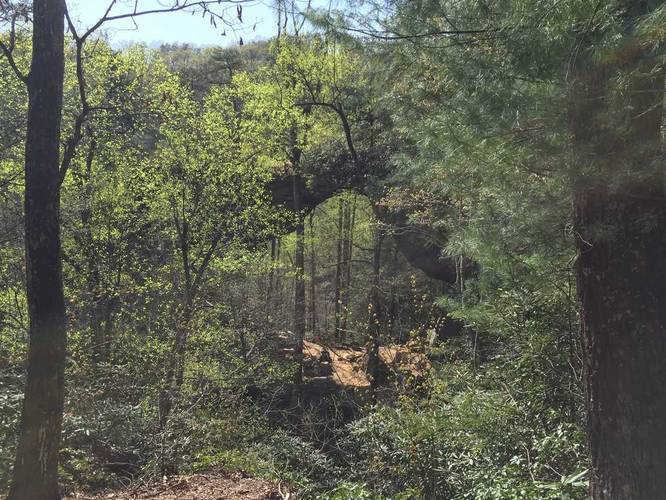
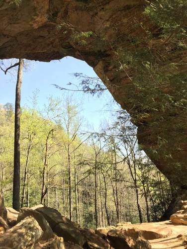
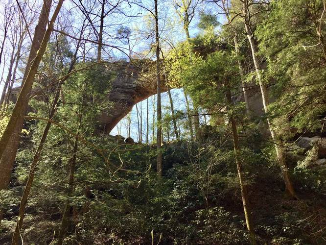
Sights/Views: Grays Arch is by far the most popular sight to see along this trail. The arch is 50-feet high and 80-feet wide and extends off the end of a cliff to form a buttress (a projecting support of stone built against a wall).
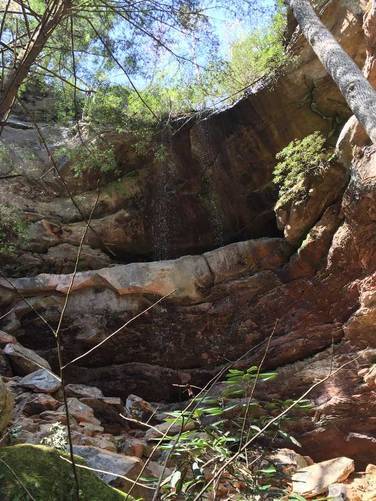
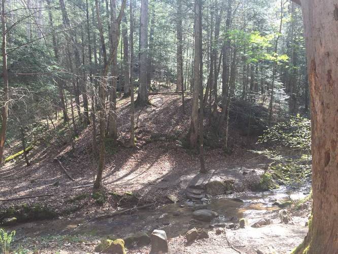
Waterfalls: There's a 50-foot tall (or maybe taller) seasonal waterfall just before the climb up to Grays Arch along the short spur trail (see notes below for more trail details). The waterfall is likely only present during the Spring and after heavier rainfalls.
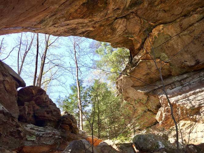
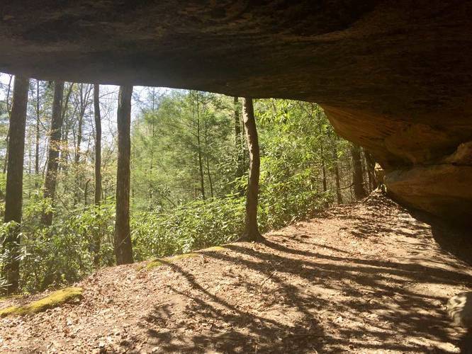
Caves/Overhangs: There are plenty of rock formations and cave-like overhangs along this hike. Most of them lie between miles 1.4 and 3.7 (see notes below for more trail details).
Parking: Parking can be found at the coordinates provided; however, you can park in the western lot off of Route 77 where the Rough Trail begins. During off-season, you'll either need to park off of Route 77 or off of Route 15 (Campton Road) and hike an additional 2 miles out-and-back due to the road being closed.
Permits: You must buy a backpacking permit from most local retailers. Gas stations are your best bet for backpacking permits and most are open late. You can buy them as 1-night or 3-night overnight passes. A 1-night pass will cost you $3.
Blazes: Follow the white diamond blazes. Along the Pinch-Em Tight Trail, follow the white diamonds and white turtle blazes (see pictures for turtle blazes).
Mileage below is based on the GPS data provided. Please use the elevation chart to see where the mile markers are. This route was tracked from 'west to east'.
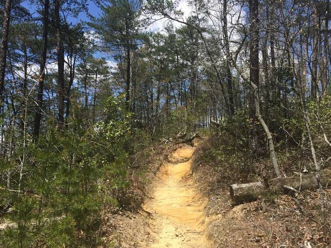
Mile 0 to 0.25: Start at the Grays Arch Trail trailhead parking lot and hike until you reach the Rough Trail at mile 0.25. Take a right-hand turn at this junction. Note: if you arrive during off-season, early Spring, or late Fall, Tunnel Ridge Road will be closed and you'll have to hike in 1 additional mile from route 15 (Campton Road), which will add a total of 2 miles to your trip.
Mile 0.25 to 1.1: Easy hiking down to Grays Arch. When you reach mile 1.1 you will have hiked down the large staircase toward the arch. Stay right on the trail to hike along the spur to Grays Arch. During the Spring, just before you reach Grays Arch, there will be a waterfall above you falling from a large cliff about 50-feet or more.
Mile 1.1 to 1.4: Hike the Grays Arch spur trail and back to the staircase. When you reach the staircase, stay right at the fork to stay along the Rough Trail.
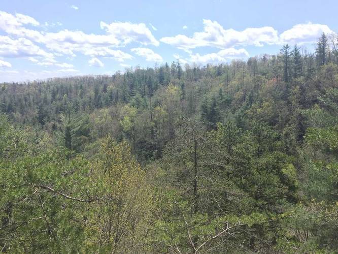
Mile 1.4 to 3.77: After visiting Grays Arch, you'll be hiking the difficult portion of the loop. You'll first head downhill, uphill, downhill again, and then back uphill to where the trailhead for Hanson's Point is. Make sure to hike Hanson's Point for an additional 1.8 miles as it'll give you the best view of Red River Gorge along this route. Along the way are plenty of campsites, rock formations, and a couple of cave-like overhangs. One section of the trail within this mileage is a rock scramble about 10-feet high. You'll need to use the nearby tree and roots to help get up or down.
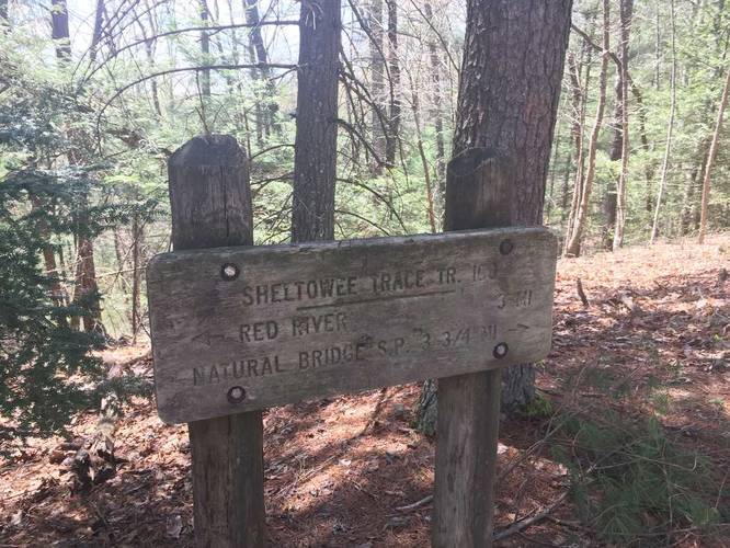
Mile 3.77 to 3.84: Continue hiking east until you reach another trail junction with the Pinch-Em Tight Trail. At this junction, take another right-hand turn to head south along Pinch-Em Tight.
Mile 3.84 to 5.4: Easy hiking along Pinch-Em Tight compared to the previous trails. There are some uphill sections, but for the most part it's relatively flat.
Dogs and backpacking are allowed on this trail.
This recording technically brings you on three different trails: Grays Arch Trail, Rough Trail, and Pinch-Em Tight Trail.
Sights/Views: Grays Arch is by far the most popular sight to see along this trail. The arch is 50-feet high and 80-feet wide and extends off the end of a cliff to form a buttress (a projecting support of stone built against a wall).
Waterfalls: There's a 50-foot tall (or maybe taller) seasonal waterfall just before the climb up to Grays Arch along the short spur trail (see notes below for more trail details). The waterfall is likely only present during the Spring and after heavier rainfalls.
Caves/Overhangs: There are plenty of rock formations and cave-like overhangs along this hike. Most of them lie between miles 1.4 and 3.7 (see notes below for more trail details).
Parking: Parking can be found at the coordinates provided; however, you can park in the western lot off of Route 77 where the Rough Trail begins. During off-season, you'll either need to park off of Route 77 or off of Route 15 (Campton Road) and hike an additional 2 miles out-and-back due to the road being closed.
Permits: You must buy a backpacking permit from most local retailers. Gas stations are your best bet for backpacking permits and most are open late. You can buy them as 1-night or 3-night overnight passes. A 1-night pass will cost you $3.
Blazes: Follow the white diamond blazes. Along the Pinch-Em Tight Trail, follow the white diamonds and white turtle blazes (see pictures for turtle blazes).
Mileage below is based on the GPS data provided. Please use the elevation chart to see where the mile markers are. This route was tracked from 'west to east'.
Mile 0 to 0.25: Start at the Grays Arch Trail trailhead parking lot and hike until you reach the Rough Trail at mile 0.25. Take a right-hand turn at this junction. Note: if you arrive during off-season, early Spring, or late Fall, Tunnel Ridge Road will be closed and you'll have to hike in 1 additional mile from route 15 (Campton Road), which will add a total of 2 miles to your trip.
Mile 0.25 to 1.1: Easy hiking down to Grays Arch. When you reach mile 1.1 you will have hiked down the large staircase toward the arch. Stay right on the trail to hike along the spur to Grays Arch. During the Spring, just before you reach Grays Arch, there will be a waterfall above you falling from a large cliff about 50-feet or more.
Mile 1.1 to 1.4: Hike the Grays Arch spur trail and back to the staircase. When you reach the staircase, stay right at the fork to stay along the Rough Trail.
Mile 1.4 to 3.77: After visiting Grays Arch, you'll be hiking the difficult portion of the loop. You'll first head downhill, uphill, downhill again, and then back uphill to where the trailhead for Hanson's Point is. Make sure to hike Hanson's Point for an additional 1.8 miles as it'll give you the best view of Red River Gorge along this route. Along the way are plenty of campsites, rock formations, and a couple of cave-like overhangs. One section of the trail within this mileage is a rock scramble about 10-feet high. You'll need to use the nearby tree and roots to help get up or down.
Mile 3.77 to 3.84: Continue hiking east until you reach another trail junction with the Pinch-Em Tight Trail. At this junction, take another right-hand turn to head south along Pinch-Em Tight.
Mile 3.84 to 5.4: Easy hiking along Pinch-Em Tight compared to the previous trails. There are some uphill sections, but for the most part it's relatively flat.
Dogs and backpacking are allowed on this trail.