Graves Landing via Skinner Hill Road Trail at Quabbin Reservoir in Petersham, Massachusetts is a moderate 3.8-mile out-and-back trail that leads from Dana Common out to the shores of Quabbin to a location named Graves Landing.
This trail begins at the northwest side of Dana Common and follows Skinner Hill Road northwest, passing more old house foundations that were once part of the town of Dana Massachusetts. Just before Whitney Hill Road is a house foundation worth exploring - featuring old stone steps and a neat walk into the basement.
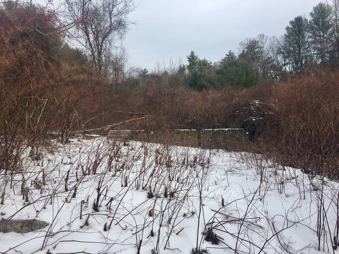
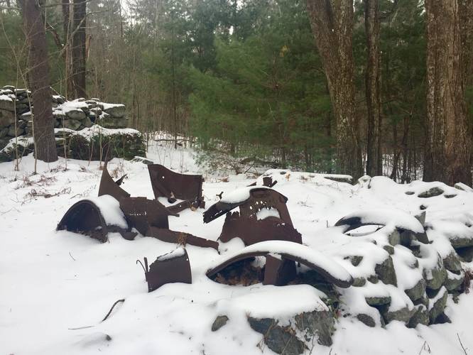
Further down the road, the road heads uphill adjacent to Skinner Hill and then eventually downhill along a large curve - this large curve in the road used to be named "Dead Man's Curve". Just beyond Dead Man's Curve is a fork in the road - here, stay right along Skinner Hill Road to make your way down to Graves Landing. Along the way is another house foundation with an old rotting car from what looks like the 1920's era or earlier.
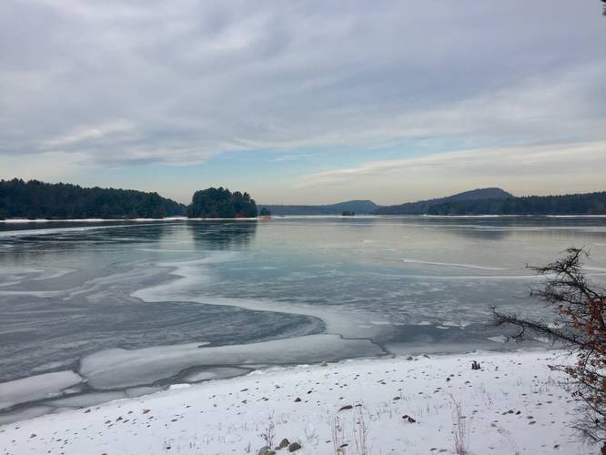
Just beyond the rotting and rusty old car is where the road heads into the water and where hikers will meet the shores of Quabbin. Before the shore is a decent-sized stone dedicated to a conservation officer - Franklin S. Graves (1910 - 1983).
Hikers can enjoy the beautiful views of Quabbin and the hills in the distance - both Rattlesnake Hill (to the right-hand side) and Soapstone Hill (just beyond Rattlesnake Hill, but to the left of Rattlesnake Hill).
The hike back to parking is moderate due to the grade of the hill heading back up Skinner Hill Road back to Dana Common.
Distance
Hikers will find this out-and-back hike to be close to 4 miles; however, you will also need to hike in to Dana Common first from Gate 40 - which is another 4 miles out-and-back. So plan for a total hike of 8-miles out-and-back.
Pets
Dogs are not allowed on any trails at Quabbin, including this one.
Parking
The parking lot for Gate 40 is located at the coordinates provided. The lot itself is large enough to accommodate about 8 cars.
History
Thanks to Hikeandgame's trip report, they mention Franklin Graves was their grandfather who was a conservation officer at Quabbin and used to launch his boat from this location.
This trail begins at the northwest side of Dana Common and follows Skinner Hill Road northwest, passing more old house foundations that were once part of the town of Dana Massachusetts. Just before Whitney Hill Road is a house foundation worth exploring - featuring old stone steps and a neat walk into the basement.
Further down the road, the road heads uphill adjacent to Skinner Hill and then eventually downhill along a large curve - this large curve in the road used to be named "Dead Man's Curve". Just beyond Dead Man's Curve is a fork in the road - here, stay right along Skinner Hill Road to make your way down to Graves Landing. Along the way is another house foundation with an old rotting car from what looks like the 1920's era or earlier.
Just beyond the rotting and rusty old car is where the road heads into the water and where hikers will meet the shores of Quabbin. Before the shore is a decent-sized stone dedicated to a conservation officer - Franklin S. Graves (1910 - 1983).
Hikers can enjoy the beautiful views of Quabbin and the hills in the distance - both Rattlesnake Hill (to the right-hand side) and Soapstone Hill (just beyond Rattlesnake Hill, but to the left of Rattlesnake Hill).
The hike back to parking is moderate due to the grade of the hill heading back up Skinner Hill Road back to Dana Common.
Distance
Hikers will find this out-and-back hike to be close to 4 miles; however, you will also need to hike in to Dana Common first from Gate 40 - which is another 4 miles out-and-back. So plan for a total hike of 8-miles out-and-back.
Pets
Dogs are not allowed on any trails at Quabbin, including this one.
Parking
The parking lot for Gate 40 is located at the coordinates provided. The lot itself is large enough to accommodate about 8 cars.
History
Thanks to Hikeandgame's trip report, they mention Franklin Graves was their grandfather who was a conservation officer at Quabbin and used to launch his boat from this location.