Dana Common via Gate 40 Trail at Quabbin Reservoir in Petersham, Massachusetts is an easy 3.9-mile out-and-back trail that leads to the old abandoned town of Dana and Dana Common. This hike features a fascinating look at an old abandoned town that once stood in what is now the Quabbin Watershed and includes old foundations of buildings like houses, a school, a church, a general store, and the old Eagle Hotel.
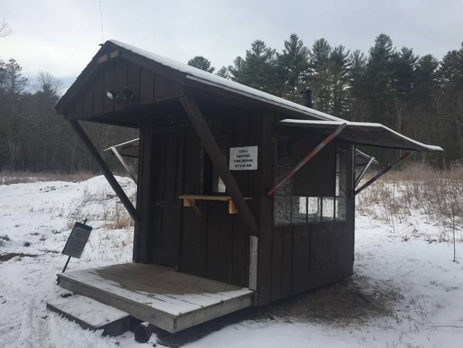
This hike begins at the parking lot at Gate 40 and follows the main, paved road, toward Dana Common. There's really not a whole lot to see along the hike in other than old stone walls, some old foundations, farming fields, and a small apple orchard. There is one small hunting shack that the DCR appears to operate for hunting season. During the colder months, when the leaves are off of the trees, hikers can get a glimpse of nearby hills through the trees as you hike along the main trail.
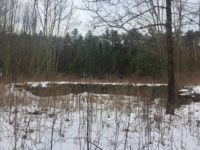
Just before reaching the old Dana Common is a fork in the road where an old Oak tree stands - this was once called Barre Road. This oak tree must have been around well before the settlers of Dana arrived and is still, somehow, still standing today. Across from this old Oak tree is a series of stone walls that connects back to the road and appears as though it could have been an old, prominent resident who lived along this stretch of road; however, this is just speculation.
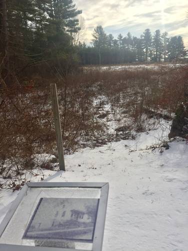
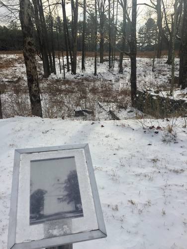
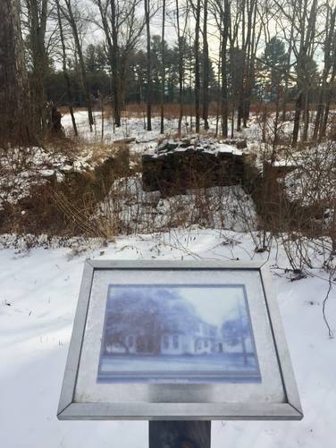
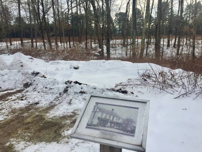
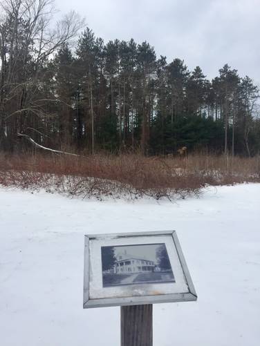
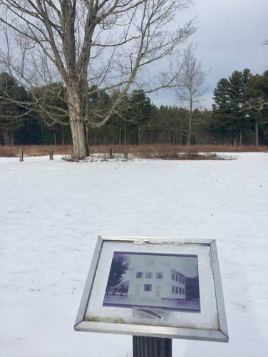
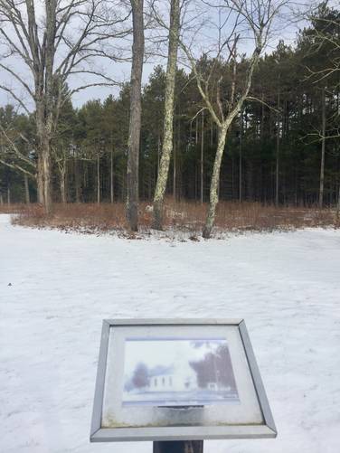
Further down from the Oak tree, just around the corner, lies Dana Common. There are pictures setup on posts around the common that show old pictures of the buildings that once stood at these locations. For a description of each building, heading in clockwise order from the southern half of the common to the north, see the "Dana Common Buildings" section below.
After visiting Dana Common, hikers can choose to head back to parking from here, for a 3.9-mile out-and-back hike. Alternatively, hikers can continue their hike out to the shores of Quabbin Reservoir at a location named Graves Landing, for a total hike back to parking of about 8-miles out-and-back. To reach Graves Landing, follow our Graves Landing via Skinner Hill Road hiking guide. The hike itself is easy since most of the road is flat, with some minor elevation changes in between.
Dana Common Buildings
The town of Dana, Massachusetts was originally built up around its small village called Dana Center, hence most of the buildings around the common are by far the oldest in this abandoned town. The buildings that surround Dana Common are listed in a clockwise order around Dana Common starting on the southern half below:
1. Marcille House - This house can be found as you first enter Dana Common and is known as the murder-suicide house. On May 21st, 1907, the owners of the house - Moses and Josephine Marcille got into an argument. Moses shot Josephine twice before shooting and killing himself. Josephine survived the shooting and lived on to move out of the house in the 1920's before the town was taken over by the state to form Quabbin.
2. Dana Congressional Church - Located directly west and next to the Marcille House, the Dana Congressional Church's old foundation can still be found today.
3. Johnson House
4. Cotton General Store - Cotton General Store also had a Post Office.
5. Eagle Hotel
6. Dana Center School - Located almost directly across the Common from the Dana Congressional Church, the Dana Center School's foundation sits behind a row of stone posts and an old tree. Both the school and town hall sat in front of what was once an old cemetery.
7. Dana Town Hall - Finally, as you make your way to the eastern end of Dana Common, located on the north end, directly across from the Marcille House, is the old Dana Town Hall foundation. Dana's town hall served as a church for many years before it was turned into a public meeting place. The building was moved onto Dana Common in 1800 by the Universalist congregation, who used it as a church until 1842 until it was turned into a town hall. The town hall was originally constructed in the nearby town of Petersham and served as a Baptist church there before being moved to Dana.
History of Dana, MA
Dana Massachusetts was established as a town in 1801, though the village was part of Hardwick and Petersham, Massachusetts before it was established as a town. The original town was made up of three smaller villages - Doubleday, North Dana, and to the south - Dana Center. Dana Center became the focal point in Dana, Massachusetts and is still accessible today and known as Dana Common. North Dana, now lying under water, once sat to the northwest of Dana Common along Skinner Hill Road.
When Quabbin Reservoir and the Quabbin Watershed was finalized, residents began moving out as the town was dis-incorporated, buildings were removed, and graves were relocated to a Quabbin cemetery in Ware, Massachusetts in preparation for the flooding of the Swift River Valley. In 1939, the Swift River was dammed and the flooding of the Swift River Valley began, but since most of Dana, Massachusetts was above the watershed line it was spared from flooding. Due to this, the remnants of Dana Common are available to explore today. North Dana, however, is now underwater.
For additional historical reading on Dana, Massachusetts, check out this great National Parks System page.
Pets
Dogs are not allowed on any trails at Quabbin, including this one.
Parking
The parking lot for Gate 40 is located at the coordinates provided. The lot itself is large enough to accommodate about 8 cars.
This hike begins at the parking lot at Gate 40 and follows the main, paved road, toward Dana Common. There's really not a whole lot to see along the hike in other than old stone walls, some old foundations, farming fields, and a small apple orchard. There is one small hunting shack that the DCR appears to operate for hunting season. During the colder months, when the leaves are off of the trees, hikers can get a glimpse of nearby hills through the trees as you hike along the main trail.
Just before reaching the old Dana Common is a fork in the road where an old Oak tree stands - this was once called Barre Road. This oak tree must have been around well before the settlers of Dana arrived and is still, somehow, still standing today. Across from this old Oak tree is a series of stone walls that connects back to the road and appears as though it could have been an old, prominent resident who lived along this stretch of road; however, this is just speculation.
Further down from the Oak tree, just around the corner, lies Dana Common. There are pictures setup on posts around the common that show old pictures of the buildings that once stood at these locations. For a description of each building, heading in clockwise order from the southern half of the common to the north, see the "Dana Common Buildings" section below.
After visiting Dana Common, hikers can choose to head back to parking from here, for a 3.9-mile out-and-back hike. Alternatively, hikers can continue their hike out to the shores of Quabbin Reservoir at a location named Graves Landing, for a total hike back to parking of about 8-miles out-and-back. To reach Graves Landing, follow our Graves Landing via Skinner Hill Road hiking guide. The hike itself is easy since most of the road is flat, with some minor elevation changes in between.
Dana Common Buildings
The town of Dana, Massachusetts was originally built up around its small village called Dana Center, hence most of the buildings around the common are by far the oldest in this abandoned town. The buildings that surround Dana Common are listed in a clockwise order around Dana Common starting on the southern half below:
1. Marcille House - This house can be found as you first enter Dana Common and is known as the murder-suicide house. On May 21st, 1907, the owners of the house - Moses and Josephine Marcille got into an argument. Moses shot Josephine twice before shooting and killing himself. Josephine survived the shooting and lived on to move out of the house in the 1920's before the town was taken over by the state to form Quabbin.
2. Dana Congressional Church - Located directly west and next to the Marcille House, the Dana Congressional Church's old foundation can still be found today.
3. Johnson House
4. Cotton General Store - Cotton General Store also had a Post Office.
5. Eagle Hotel
6. Dana Center School - Located almost directly across the Common from the Dana Congressional Church, the Dana Center School's foundation sits behind a row of stone posts and an old tree. Both the school and town hall sat in front of what was once an old cemetery.
7. Dana Town Hall - Finally, as you make your way to the eastern end of Dana Common, located on the north end, directly across from the Marcille House, is the old Dana Town Hall foundation. Dana's town hall served as a church for many years before it was turned into a public meeting place. The building was moved onto Dana Common in 1800 by the Universalist congregation, who used it as a church until 1842 until it was turned into a town hall. The town hall was originally constructed in the nearby town of Petersham and served as a Baptist church there before being moved to Dana.
History of Dana, MA
Dana Massachusetts was established as a town in 1801, though the village was part of Hardwick and Petersham, Massachusetts before it was established as a town. The original town was made up of three smaller villages - Doubleday, North Dana, and to the south - Dana Center. Dana Center became the focal point in Dana, Massachusetts and is still accessible today and known as Dana Common. North Dana, now lying under water, once sat to the northwest of Dana Common along Skinner Hill Road.
When Quabbin Reservoir and the Quabbin Watershed was finalized, residents began moving out as the town was dis-incorporated, buildings were removed, and graves were relocated to a Quabbin cemetery in Ware, Massachusetts in preparation for the flooding of the Swift River Valley. In 1939, the Swift River was dammed and the flooding of the Swift River Valley began, but since most of Dana, Massachusetts was above the watershed line it was spared from flooding. Due to this, the remnants of Dana Common are available to explore today. North Dana, however, is now underwater.
For additional historical reading on Dana, Massachusetts, check out this great National Parks System page.
Pets
Dogs are not allowed on any trails at Quabbin, including this one.
Parking
The parking lot for Gate 40 is located at the coordinates provided. The lot itself is large enough to accommodate about 8 cars.